The pidgeon hunting hut and the Mare aux Biches

A family walk in the heart of Vieux-Boucau’s communal forest. The route follows sections of the pidgeon hunting hut and Mare aux Biches nature trails before returning via the Léon-Soustons cycle path. Along the way, there are numerous benches, picnic tables and information boards describing the area. 

Details

72896732
Creation:
Last update:
Last review:
  • Walking
    Activity: Walking
  • ↔
    Distance: 5.13 mi
  • ◔
    Average duration: 2h 25 
  • ▲
    Difficulty: Easy

  • ⚐
    Back to start: Yes
  • ↗
    Ascent: + 33 ft
  • ↘
    Descent: - 33 ft

  • ▲
    Highest point: 49 ft
  • ▼
    Lowest point: 13 ft

Photos

Description of the walk

On the D652 between Vieux-Boucau and Messanges, park in the supermarket car park located at the roundabout with the Route de la Plage Sud.

(S/E) Join the tarmac track running between the supermarket car park and the industrial estate. Follow this track as it turns left. About 50 metres further on, turn right into the forest and you’ll reach a junction with the Léon–Soustons cycle path.

(1) Cross the cycle path and ride alongside Camping Lou Pignada. You’ll reach a junction with a tarmac road at elevation 7.

(2) Turn right, continue for about 300 m and you’ll reach an X-shaped junction.

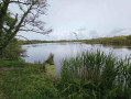
(3) Turn left towards the east. Pass by some houses at elevation 8 and turn right, heading south. Discover the magnificent Étang de S’douys. Just after the lake, turn right towards a junction with several paths.

(4) Carry on straight ahead, heading west, until you reach an X-shaped junction at elevation 6. 

(5) Carry on straight ahead. After about 120 m, you’ll reach a junction with a footbridge.

(6) Turn right, then after the footbridge, follow the various signs for the Pidgeon Hunting Hut Trail. Explore the Pidgeon Hunting Hut. Just after this, you’ll find a picnic table.

(7) Leave the ‘Pidgeon Hunting Hut Signposting’ and turn left. Continue straight on at a junction at elevation 7. Along this straight stretch, you’ll find numerous benches and picnic tables. Pass a second junction, then arrive at another T-junction at elevation 5.

(8) Turn left towards the east and walk for about 400 m before reaching an X-junction.

(9) Turn right onto the Chemin du Bayonnais. Pass by a borehole. You’ll see new signs for the Mare aux Biches Discovery Trail and arrive at a T-junction.

(10) Turn right, pass by another borehole, then turn left, then right and finally right again, following the signs for the Mare aux Biches.You’ll come to the pond. Carry on and you’ll reach an X-junction.

(11) Turn left and reach another borehole and a Y-junction. Keep left, then continue straight on at the next X-junction. Pass by the foot of the water tower (supplied by the various boreholes you’ve come across). Walk alongside Camping Les Chênes and reach the Léon-Soustons cycle path.

(12) Turn right onto this path and follow it back up to the junction you passed on the way there with the Lou Pignada campsite 

(1) Turn left and follow the route in the opposite direction to the outward journey to return to the supermarket car park (S/E). 

Waypoints

  1. S/E : mi 0 - alt. 16 ft - Supermarket car park
  2. 1 : mi 0.24 - alt. 16 ft - Junction shared with the cycle path
  3. 2 : mi 0.79 - alt. 23 ft - Junction with tarmac road – Cote 7
  4. 3 : mi 0.98 - alt. 23 ft - Crossroads
  5. 4 : mi 1.39 - alt. 23 ft - Multi-path junction – Pond
  6. 5 : mi 1.59 - alt. 20 ft - Crossroads – Marker 6
  7. 6 : mi 1.66 - alt. 20 ft - Footbridge
  8. 7 : mi 1.98 - alt. 30 ft - T-junction – Turn left
  9. 8 : mi 2.23 - alt. 16 ft - Crossroads (X-shaped) – Marker 5
  10. 9 : mi 2.52 - alt. 20 ft - Crossroads – Chemin du Bayonnais
  11. 10 : mi 2.78 - alt. 20 ft - T-junction – Turn right
  12. 11 : mi 3.22 - alt. 16 ft - Crossroads (X-shaped) – Turn left
  13. 12 : mi 3.79 - alt. 13 ft - Cycle path
  14. S/E : mi 5.13 - alt. 16 ft - Supermarket car park

Notes

For reference: the author’s time for this route was 2 hours 15 minutes (excluding breaks)

Worth a visit

Vieux-Boucau town centre and Port d’Albret Marine Lake.

Reviews and comments

4.8 / 5
Based on 2 reviews

Reliability of the description
5 / 5
Ease of following the route
5 / 5
Route interest
4.5 / 5
User 4077999

The signposting is very hard to follow; we got lost despite keeping a constant watch. It doesn’t matter, as we always manage to find our way back in the end, but it’s a bit stressful. That said, it’s a lovely walk

Machine-translated

User 2895873

Overall rating : 5 / 5

Date of your route : Nov 22, 2025
Reliability of the description : ★★★★★ Very good
Ease of following the route : ★★★★★ Very good
Route interest : ★★★★★ Very good
Very busy route : Yes

Pleasant walk through the forest, bearing in mind that at the end there is a major tarmac road.

Machine-translated

Dela
Dela

Overall rating : 4.7 / 5

Date of your route : May 18, 2025
Reliability of the description : ★★★★★ Very good
Ease of following the route : ★★★★★ Very good
Route interest : ★★★★☆ Good
Very busy route : No

We went for a walk early in the morning between 8 and 10 am, which explains why there were so few people about. The route was very pleasant under the pine trees on a carpet of pine needles. We were treated to a thunderous chorus of frogs as we walked past the pond.
The only slight downside was the end of the walk, which involved a long, somewhat tedious stretch along a tarmac road.
Thank you for all these routes and the app, which helps ensure you don’t go astray.

Machine-translated

Other walks in the area

For more walks, use our search engine .

The GPS track and description are the property of this route's author. Please do not copy them without permission.