From Vieux-Boucau to the Étang de Moïsan

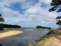
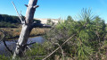
A varied and magnificent landscape characterises this circular walk starting from Vieux-Boucau-les-Bains towards the Étang de Moïsan. The route passes at the foot of the dunes, through the forest, then near the Messanges Semaphore before skirting the Étang de Moïsan and the pastures of the Landes sea cows. Finally, the return journey via the Léon–Soustons cycle path takes you back to the centre of Vieux-Boucau.

Details

48690742
Creation:
Last update:
Last review:
  • Walking
    Activity: Walking
  • ↔
    Distance: 7.08 mi
  • ◔
    Average duration: 3h 15 
  • ▲
    Difficulty: Moderate

  • ⚐
    Back to start: Yes
  • ↗
    Ascent: + 33 ft
  • ↘
    Descent: - 33 ft

  • ▲
    Highest point: 43 ft
  • ▼
    Lowest point: 7 ft

Photos

Description of the walk

Park in the large car park on the Esplanade des Arènes in Vieux-Boucau-les-Bains, near Avenue de la Liberté.

(S/E) Head north, towards the Arènes. Walk along the right-hand side of a large park with picnic tables, then come out onto the dual carriageway of the Promenade des Arènes. Turn left and walk for about 150 m. You’ll come to a pedestrian crossing.

(1) Cross the road carefully and follow Boulevard du Marensin opposite, then Chemin du Junca. You’ll reach a T-junction and the Le Vieux Port campsite.

(2) Turn sharp left, go through the barrier and follow the track signposted: ‘Access to the South Beach’, which winds through the dunes in an S-shape. You’ll reach a Y-junction and a cycle park. Optional: take a detour to the left to admire the ocean; otherwise, turn right and look out for a wide track in the sand, about 50 metres further on to the left.

(3) Follow this track, which runs alongside the dunes and narrows further on into the vegetation just after a wide sandy area. Keep the signal box in sight.

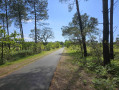
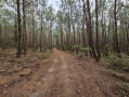
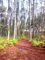
(4) At marker 10, after a short climb up the sand, follow the track which turns to the right and leads into the forest along a wide path. Then keep to the left. You’ll notice traces here and there left by Storm Klaus in 2009. At marker 3, walk at the foot of a dune, then rejoin the path. Join the tarmac road leading to the Messanges Semaphore.

(5) Turn right onto this road, then, about 120 m further on, leave it on the right, heading south-east. Keep to the left, then arrive at an X-junction.

(6) Turn onto thefirst path on the left, heading north-east, then join a tarmac road and follow it to the left. Walk for about 50 m and look out for a blue-marked path on the right.

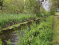
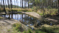
(7) Turn right onto this path, which runs alongside a stream, passes to the left of the Étang de Moïsan and runs alongside the pastures where the Landes marine cows graze (information board). Pass an observatory, then arrive at a wooden footbridge.

(8) Cross this footbridge and head off to the right, towards the north-west, following another stream. You’ll come to a wide track.

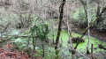
(9) Turn right onto this track, which runs alongside the Étang de Moïsan and leads to a Y-junction.

(10) Turn left, then keep left. You’ll come back to the X-junction you passed on the way there.

(6) Turn left heading south. Ignore the tracks to the left and right, then reach the boundary fence of a campsite. Turn left onto this track, which becomes a tarmac road. You’ll reach the Route des Lacs (D652).

(11) Cross it carefully and follow the path opposite which leads into the forest. Keep to the right at a Y-junction, then arrive at the Lou Pignada campsite. Take a short detour to the left and join the cycle path: Léon – Soustons.

(12) Turn right onto this cycle path, cross two roads and continue straight on until you reach the sign for ‘Centre ville Vieux-Boucau’.

(13) Leave the cycle path, turn right onto Rue de la Gare, then onto Rue de la Gendarmerie. Cross the Route des Lacs (D652) with care and continue to the end of the Grand Rue. Cross the bridge over the Courant de Messanges. Turn right, rejoin Avenue de la Liberté, then head for the car park (S/E).

Waypoints

  1. S/E : mi 0 - alt. 10 ft - Arènes car park
  2. 1 : mi 0.23 - alt. 10 ft - Pedestrian crossing on the Promenade des Arènes
  3. 2 : mi 0.81 - alt. 10 ft - Le Vieux Port Campsite
  4. 3 : mi 1.34 - alt. 13 ft - Sandy track
  5. 4 : mi 1.88 - alt. 26 ft - Difficulty rating: 10
  6. 5 : mi 2.43 - alt. 23 ft - Route du Sémaphore
  7. 6 : mi 2.69 - alt. 30 ft - X-shaped junction. Junction marking the start of the circular loop
  8. 7 : mi 2.88 - alt. 7 ft - Blue-marked trail
  9. 8 : mi 3.51 - alt. 7 ft - Footbridge
  10. 9 : mi 3.71 - alt. 10 ft - Trail
  11. 10 : mi 3.91 - alt. 10 ft - Y-junction
  12. 11 : mi 5.25 - alt. 13 ft - D652
  13. 12 : mi 5.5 - alt. 16 ft - Cycle path
  14. 13 : mi 6.61 - alt. 13 ft - Sign for “Centre Vieux-Boucau”
  15. S/E : mi 7.08 - alt. 10 ft - Arènes car park

Notes

For reference: the author’s time for this route was 2 hours 35 minutes (excluding breaks)

Reviews and comments

4.1 / 5
Based on 4 reviews

Reliability of the description
4.5 / 5
Ease of following the route
3.8 / 5
Route interest
4 / 5
dominiquerakovic
dominiquerakovic

Overall rating : 4 / 5

Date of your route : Apr 20, 2026
Reliability of the description : ★★★★★ Very good
Ease of following the route : ★★★☆☆ Average
Route interest : ★★★★☆ Good
Very busy route : No

A varied walk, taking in dunes, woodland and a pond. The path is blocked by a dune that you have to climb. Fallen trees are blocking the path. Apart from that, it’s a lovely walk.

Machine-translated

User 3495204

A lovely walk
Stunning scenery: forest and a pond 👍

Machine-translated

User 4078862

Overall rating : 3.7 / 5

Date of your route : Jan 05, 2026
Reliability of the description : ★★★★☆ Good
Ease of following the route : ★★★★☆ Good
Route interest : ★★★☆☆ Average
Very busy route : No

Easy hike, and given the weather (overcast) and temperature (11 degrees), a little-used route.

Machine-translated

M1O9M5O3
M1O9M5O3

Overall rating : 3.7 / 5

Date of your route : Feb 03, 2025
Reliability of the description : ★★★★☆ Good
Ease of following the route : ★★★☆☆ Average
Route interest : ★★★★☆ Good
Very busy route : No

Walk undertaken on Sunday 2 February 2025. Between points 3 and 4, the path was impassable for at least 200 metres on two separate occasions. We were forced to climb the sand dune – which was very high at this point – to get round the flooded section (low point). We had to do this a second time.At point 5, a landslide from the sand dune had covered the former path. There was no alternative but to climb the dune again and descend 300 metres further on to rejoin the path leading to the signal box.
The walk around Moisan Pond was also very ‘waterlogged’; we had to take our shoes off twice to get past places where the pond and the canal running alongside it had merged. As a result, it took us an hour longer than planned.
Make sure you wear wellies… or leave it until later in the season.

Machine-translated

jl1309m
jl1309m

Overall rating : 5 / 5

Date of your route : Sep 17, 2024
Reliability of the description : ★★★★★ Very good
Ease of following the route : ★★★★★ Very good
Route interest : ★★★★★ Very good
Very busy route : No

It’s best to take the beach rather than the cycle path from Vieux Boucau les Bains. At low tide it’s stunning and there are lots of surfers.
The route around Lake Moïsan is unspoilt, and you can spot a few of the Landes sea cows, which are an endangered species (51 remaining).
I extended the return route by cycling round Lake Albret, making a total of 16 km.

Machine-translated

Other walks in the area

For more walks, use our search engine .

The GPS track and description are the property of this route's author. Please do not copy them without permission.