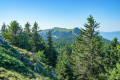
From Menthières to Le Gralet: a ridge walk through the forest

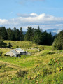
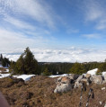
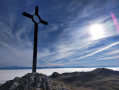
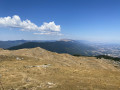
A forest walk well suited to hot weather. Wildlife quiet zone. The undergrowth is very pleasant. Quite lush vegetation. The path is well marked. However, there are few views of the valley

Details

n°13066399
Creation:
Last update:
Last review:
  • Walking
    Activity: Walking
  • ↔
    Distance: 8.71 mi
  • ◔
    Average duration: 5h 40 
  • ▲
    Difficulty: Moderate

  • ⚐
    Back to start: Yes
  • ↗
    Ascent: + 1,877 ft
  • ↘
    Descent: - 1,850 ft

  • ▲
    Highest point: 4,800 ft
  • ▼
    Lowest point: 3,698 ft

Photos

Description of the walk

Parking is available at the archery range at Col de Menthières, in the car park area.
It is also possible to park by driving about a hundred metres along the gravel track that marks the start of the route, where there is a large car park on the right.
Signposting is clear throughout the route.

(S/E) From the Col de Menthières, follow the gravel track to the bend and the large car park, then turn left heading north-east. The track then enters the forest before emerging further on at the edge of the woodland for about 150 metres.

(1) Leave the forest track and take a path that climbs to the right. This path is well-marked and the climb is fairly gradual towards Le Pelaz. Before reaching Le Pelaz, as you leave the forest, the slope becomes steeper for a relatively short stretch, but this isn’t a problem. The route continues through pastureland. Join theGR® Grand Tour du Jura trail.

(2) At Le Pelaz, turn left towards La Poutouille and Le Gralet. Continue along this path, which leads to the unstaffed La Poutouille mountain hut.

(3) Arrival at La Poutouille. The path branches off to the left. A very pleasant walk through the forest, with plenty of greenery. After a fair distance, the path joins a forest track.

(4) On reaching the forest track, turn left and follow it to Le Gralet. The refuge is manned. A good spot for a lunch break. There is a table and a bench outside, as well as large rocks to sit on.

(5) Return by retracing your steps along the same path you took on the way there, back to the car park at the shooting range (S/E).

Waypoints

  1. S/E : mi 0 - alt. 3,701 ft - Car park at the archery range. Col de Menthières
  2. 1 : mi 0.88 - alt. 4,111 ft - Start of the path
  3. 2 : mi 1.15 - alt. 4,528 ft - Le Pelaz
  4. 3 : mi 1.78 - alt. 4,744 ft - La Poutouille – Mountain Hut
  5. 4 : mi 3.41 - alt. 4,505 ft - Forest track
  6. 5 : mi 4.33 - alt. 4,708 ft - Refuge du Gralet
  7. S/E : mi 8.71 - alt. 3,698 ft - Car park at the archery range. Col de Menthières

Notes

Always be cautious and plan ahead when you're outdoors. Visorando and the author of this route cannot be held responsible for any accidents occurring on this route.

The GR® and PR® markings are the intellectual property of the Fédération Française de Randonnée Pédestre.

Reviews and comments

5 / 5
Based on 1 review

Reliability of the description
5 / 5
Ease of following the route
5 / 5
Route interest
5 / 5
Brigitte C3.
Brigitte C3.

Overall rating : 5 / 5

Date of your route : Sep 06, 2026
Reliability of the description : ★★★★★ Very good
Ease of following the route : ★★★★★ Very good
Route interest : ★★★★★ Very good
Very busy route : No

I went on this hike with a group on 6 September 2026 to escape the heat of the lowlands, and it was just the ticket!
However, I chose to return via the Malatrait track and the Col du Sac, as the route back along the ridge would have been too difficult for one of the participants, and this turned out to be a very good, less rugged alternative.
The views from the two mountain huts are magnificent!

Machine-translated

Other walks in the area

For more walks, use our search engine .

The GPS track and description are the property of this route's author. Please do not copy them without permission.