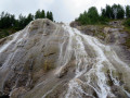
Refuge de la Femma from Tignes / Val Claret

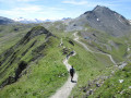
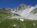
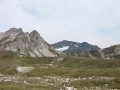
Day1 of this mini trek around Tignes – Val d’Isère, a magnificent hike in the heart of the Vanoise National Park starting from Tignes. This hike allows you to discover the wild valleys of La Leisse and La Femma. The GPX track may prove useful after the (4).

This walk is part of a multi-day hike: Boucle en Vanoise autour de Tignes/Val d'isère

Details

78941387
Creation:
Last update:
Last review:
  • Walking
    Activity: Walking
  • ↔
    Distance: 10.79 mi
  • ◔
    Average duration: 7h 50 
  • ▲
    Difficulty: Difficult

  • ⚐
    Back to start: No
  • ↗
    Ascent: + 3,337 ft
  • ↘
    Descent: - 2,546 ft

  • ▲
    Highest point: 9,331 ft
  • ▼
    Lowest point: 6,909 ft

Description of the walk

Park at Tignes Val Claret, near the Perce Neige Funicular station and the lower station of the Rollin Chairlift.

(S) Take the GR®55 trail to the left of the chairlift and you will soon reach a junction of paths.

(1) Follow the GR®55 to reach the Col de la Leisse.

(2) Continue climbing on the GR®55 to reach Lac des Nettes.

(3) The well-marked trail gradually climbs up the Leisse valley. Continue along this trail to the Refuge de la Leisse.

(4) Leave the GR®55. Descend slightly towards the Enclos des Ânes on a path visible just to the right of the one leading to the Col de la Leisse. Go round the enclosure on the right, then cross the Torrent de la Leisse.

(5) Then look out for the cairns marking the start of the climb to the Col de Pierre Blanche. This section is poorly marked and requires a good sense of direction. Reach the Col de Pierre Blanche.

(6) Follow the well-marked path downwards, south-east, to the Refuge de la Femma (E). This section presents no particular difficulty.

Waypoints

  1. S : mi 0 - alt. 6,909 ft - Tignes Val Claret
  2. 1 : mi 1.85 - alt. 8,323 ft - Crossroads
  3. 2 : mi 3.09 - alt. 9,019 ft - Col de la Leisse
  4. 3 : mi 4.19 - alt. 8,658 ft - Lac des Nettes
  5. 4 : mi 5.74 - alt. 8,159 ft - Refuge de la Leisse
  6. 5 : mi 5.94 - alt. 8,114 ft - Cairn. No markings
  7. 6 : mi 7.64 - alt. 9,321 ft - Col de Pierre Blanche (2842m)
  8. E : mi 10.79 - alt. 7,726 ft - Refuge de la Femma

Notes

Water at the Refuge de la Leisse (2).

Worth a visit

Plenty of marmots in both valleys.

Always be cautious and plan ahead when you're outdoors. Visorando and the author of this route cannot be held responsible for any accidents occurring on this route.

The GR® and PR® markings are the intellectual property of the Fédération Française de Randonnée Pédestre.

Other walks in the area

For more walks, use our search engine .

The GPS track and description are the property of this route's author. Please do not copy them without permission.