


Refine your search for walks in La Grimaudière
La Grimaudière walks
 From one bank of the Dive to the other, starting from Mazeuil
 Visorando Member
 7.49 mi
 +102 ft
 -105 ft
 3h 30
3h 30
 Moderate
 Departure from Mazeuil (Vienne)
A walk through the countryside, criss-crossing the River Dive. A wealth of heritage awaits: a Romanesque church, an old fortified dwelling, a castle, oratories, a chapel…
Along the Dive between Moncontour and Sauzeau
 8.14 mi
+66 ft
-66 ft
3h 50
Moderate
Departure from Moncontour (Vienne) (Vienne)
8.14 mi
+66 ft
-66 ft
3h 50
Moderate
Departure from Moncontour (Vienne) (Vienne)
A hike dominated by water, mostly along the various branches of the Dive river and in the shade of poplar trees.
The route was designed and marked out by the Loudunais Community of Communes and certified by the Vienne departmental committee of the FFRP (French Federation of Hiking and Rambling).
Faluns of Moulin Pochas in Amberre
5.34 mi
+66 ft
-98 ft
0h 00
 Easy
Departure from Amberre (Vienne)
Easy
Departure from Amberre (Vienne)
This walk takes you through the Moulin Pochas falun site, which was used as a sandpit, and then continues with a short stroll across the plain through the fields. The site is not really a mill in the usual sense (such as a flour mill), but rather an ancient natural geological site consisting of falunières – quarries of ancient marine deposits (clay-sand cliffs known as faluns) – dating back some 15 million years. It is a unique testament in Poitou to the era when a shallow sea (the Mer des Faluns) covered the region. The site consists of ancient shell sand quarries containing marine fossils such as shells, corals, etc.
The Gâteau Valley between Le Chillou and Lamairé
 8.12 mi
+436 ft
-459 ft
4h 05
Moderate
Departure from Le Chillou (Deux-Sèvres)
8.12 mi
+436 ft
-459 ft
4h 05
Moderate
Departure from Le Chillou (Deux-Sèvres)
This route will take you through the villages of Le Chillou and Lamairé, as well as their hamlets, linked by numerous paths winding through woods and fields.
The Châteaux of Coussay and La Tour de Ry
 8.46 mi
+253 ft
-243 ft
4h 05
Moderate
Departure from Coussay (Vienne)
8.46 mi
+253 ft
-243 ft
4h 05
Moderate
Departure from Coussay (Vienne)
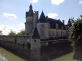
A heritage hike in the countryside and woods of Haut Poitou with two Renaissance-style castles up close and a Romanesque church.
Route designed and marked by the Vienne departmental committee of the FFRP.
Les Sentes de Fondoire
 3.32 mi
+23 ft
-23 ft
1h 35
Easy
Departure from Guesnes (Vienne)
3.32 mi
+23 ft
-23 ft
1h 35
Easy
Departure from Guesnes (Vienne)
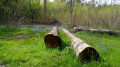
In the heart of the Scevolles Forest and starting from the Étang de Guesnes, three trails, developed and signposted by the Communauté de Communes du Loudunais, are open to the public (except during January).
The route described here is the longest of the three. It winds through the forest, allowing you to discover the diversity of its tree populations. Numerous information boards line this route, which is ideal for children or anyone with a curiosity about nature.
Berthegon circular countryside loop
 5.70 mi
+148 ft
-148 ft
2h 45
Easy
Departure from Berthegon (Vienne)
5.70 mi
+148 ft
-148 ft
2h 45
Easy
Departure from Berthegon (Vienne)
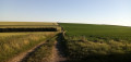
A walk mainly through fields, offering sweeping views of the countryside. There is no shortage of heritage sites, including a church, a manor house and some beautiful houses.
Berthegon Forest Circular Loop
 6.16 mi
+69 ft
-66 ft
2h 55
Easy
Departure from Berthegon (Vienne)
6.16 mi
+69 ft
-66 ft
2h 55
Easy
Departure from Berthegon (Vienne)
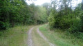
A mainly woodland walk, offering the benefit of shade from a variety of trees. It largely follows the "Sentier des Sables et des Terres Blanches", designed and signposted by the Loudunais Community of Communes.
The Abbey Farm
 5.74 mi
+46 ft
-46 ft
2h 40
Easy
Departure from Vasles (Deux-Sèvres)
5.74 mi
+46 ft
-46 ft
2h 40
Easy
Departure from Vasles (Deux-Sèvres)
This hike is a shorter version of the one offered by the Deux Sèvres hiking website, which has the same name. You will follow small roads and country lanes near the Ruisseau du Magot Natura 2000 site.
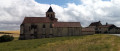
The Church of Prinçay and the Château de la Roche du Maine
 4.37 mi
+164 ft
-167 ft
2h 10
Easy
Departure from Prinçay (Vienne)
4.37 mi
+164 ft
-167 ft
2h 10
Easy
Departure from Prinçay (Vienne)
A short hike mainly through fields, discovering a beautiful Romanesque church (later remodelled) and a beautiful Renaissance castle. There are a few views of the countryside.
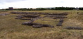
The Marais de la Palu and the Gallo-Roman site of Tours Mirandes
 6.30 mi
+213 ft
-207 ft
3h 05
Moderate
Departure from Vendeuvre-du-Poitou (Vienne)
6.30 mi
+213 ft
-207 ft
3h 05
Moderate
Departure from Vendeuvre-du-Poitou (Vienne)
After climbing a hill offering sweeping views, the route takes you through former marshes now used for market gardening. A few castles dot the route, the highlight of which is the Gallo-Roman site, whose ruins, whilst not spectacular, are moving.
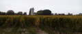
From the Pont de la Reine Blanche to the Donjon de Curçay-sur-Dive
 7.86 mi
+308 ft
-302 ft
3h 55
Moderate
Departure from Curçay-sur-Dive (Vienne)
7.86 mi
+308 ft
-302 ft
3h 55
Moderate
Departure from Curçay-sur-Dive (Vienne)
Starting from a Gallo-Roman bridge, enjoy a pleasant walk along the Canal de la Dive, a beautiful old church, a keep, a vineyard conservatory and a passage through the woods.
Most of the route was designed and marked out by the Loudunais Community of Communes and certified by the Vienne departmental committee of the FFRP (French Federation of Hiking and Rambling).
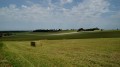
Belle Indienne Circular Loop
 6.97 mi
+190 ft
-190 ft
3h 20
Moderate
Departure from Sérigny (Vienne) (Vienne)
6.97 mi
+190 ft
-190 ft
3h 20
Moderate
Departure from Sérigny (Vienne) (Vienne)
Through fields and woods, a peaceful circular route that takes in two small castles and a beautiful dovecote.
Route designed and signposted by the Grand Châtellerault Tourist Office, and certified by the Vienne departmental committee of the FFRP.
Pressoir and Thouet valleys from Sainte-Radegonde
 12.41 mi
+817 ft
-794 ft
6h 25
12.41 mi
+817 ft
-794 ft
6h 25
 Difficult
Departure from Sainte-Radegonde (Deux-Sèvres) (Deux-Sèvres)
Difficult
Departure from Sainte-Radegonde (Deux-Sèvres) (Deux-Sèvres)
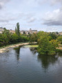
Route passing through the Vallée du Pressoir (classified as a Natura 2000 site since March 2025) then the left bank of the Thouet valley from Pommiers to Sainte-Radegonde. Pass through Saint-Jacques-de-Thouars on the left bank of the Thouet, then Saint-Jean-de-Thouars, the Cirque de Missé and return to Thouars on the right bank of the Thouet via the GR®36. The hike also offers views of the town of Thouars, with its historic monuments and rich heritage.
Left bank of the Thouet from Sainte-Radegonde to Missé
 12.03 mi
+682 ft
-663 ft
6h 10
Difficult
Departure from Sainte-Radegonde (Deux-Sèvres) (Deux-Sèvres)
12.03 mi
+682 ft
-663 ft
6h 10
Difficult
Departure from Sainte-Radegonde (Deux-Sèvres) (Deux-Sèvres)
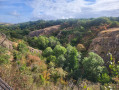
Leaving Sainte-Radegonde, you will discover the Pressoir valley, newly classified as a Natura 2000 nature reserve, then the west and south facades of Thouars, located on the promontory with the Thouet river flowing at its feet. Next, pass through Saint-Jean-de-Thouars, which overlooks the Thouet valley, the fortifications, the castle on its rocky spur, and the three large and remarkable natural meanders: Saint-Jean, Le Châtellier and Missé. Enjoy the superb valley and then enter Thouars at the foot of the castle ramparts.
The cliffs of Beauvoir
 4.16 mi
+144 ft
-144 ft
2h 00
Easy
Departure from Vouneuil-sous-Biard (Vienne)
4.16 mi
+144 ft
-144 ft
2h 00
Easy
Departure from Vouneuil-sous-Biard (Vienne)
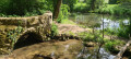
Short hike through woods and fields in the Auxance valley.
Vallée du Pressoir and Cascade de Pommiers
 5.45 mi
+200 ft
-213 ft
2h 40
Easy
Departure from Mauzé-Thouarsais (Deux-Sèvres)
5.45 mi
+200 ft
-213 ft
2h 40
Easy
Departure from Mauzé-Thouarsais (Deux-Sèvres)
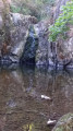
The Ruisseau du Pressoir stream flows through a narrow, deep valley marked by the Cascade de Pommiers waterfall. Some steep slopes overlooking the stream from a height of around 40 metres make this wild and picturesque valley a unique natural environment in the Thouarsais region.
Short tour of the natural environments in Migné-Auxances
3.13 mi
+98 ft
-98 ft
1h 30
Easy
Departure from Migné-Auxances (Vienne)
A nature walk between fields and the banks of the Auxance. A short, easy walk.
Route developed by the Greater Poitiers Urban Community and the Departmental Hiking Committee.
The treasures of Béruges
 3.43 mi
+272 ft
-302 ft
1h 50
Easy
Departure from Béruges (Vienne)
3.43 mi
+272 ft
-302 ft
1h 50
Easy
Departure from Béruges (Vienne)
The village, the forest, the streams... A “nature walk” organised by the Greater Poitiers Urban Community.
More walks in La Grimaudière
Select a point of interest below: