Country:
 City:
City:


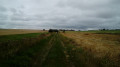
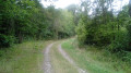
Start from the large village car park, in the centre of which stands the war memorial. Vehicle access is at the junction of the D14 and D7 roads.
No signposting
(S/E) Head east towards the town hall, leaving the war memorial on your left. Take a pedestrian exit, continue along the path and walk past the town hall. Take the first left, into Rue Sainte-Radegonde.
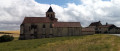
(1) Just before the church, turn into a small lane on the right. The tarmac soon gives way to a grassy path. Pass a chicane and, at the end of the path, return to the tarmac and turn right.
(2) At the end of the street (which we learn is called Rue des Grottes), turn left onto Rue des Sables. Pass Rue des Lisons on your right. At the next junction (the D70 road), continue straight ahead.
Yellow markings
Signs or arrows on small dedicated wooden signposts at junctions (no markings outside junctions). The markings are one-way, in the direction of this description.
(3) At the junction (oratory), turn right onto a small road. After the last house, the tarmac gives way to a stony track. At the junction, go straight on. Stay on the main path, which is shaded and then leads straight into a wood, ignoring any vague offshoots to the sides. You will come to an open, enclosed area (private pond some distance away).
(4) Then turn left and immediately ignore a path branching off to the left (not shown on the map). Walk alongside a poplar grove on your left and a recently cleared plot on your right. Enter the woods and, at the three-way junction that appears immediately, take the path on the left. Walk alongside a fenced-off wet area on your right and ignore a path branching off to the left.
(5) At the T-junction, turn left. At the next junction, go straight on. Keep heading north-north-east.
(6) At the T-junction, turn sharply left and immediately ignore a path on the right. Follow a wide sandy then stony path and ignore all paths on the left. Leave the woods, continue along the edge and follow a hedge on your right. Enter the woods again and follow a poplar grove on your left. You will eventually reach a crossroads.
(7) Then turn sharply right and immediately left. Walk alongside a wood on your left, then enter the wood.
(8) At the junction, turn right at the edge of the woods on your right. Enter the woods, cross the D70 road and continue straight ahead into the woods. Continue along the edge, ignore a path coming from the right and turn left onto the main path.
(9) At the hamlet of Les Étangs, follow the D7 road to the left. After about 300m, in a left-hand bend, leave the road and turn right onto a wide path. Follow this path through the undergrowth and then along a stream on the right-hand side. Make a right-left zigzag to cross the stream and immediately reach a Fork in the road.
Unmarked
(10) Follow the grassy path on the left (bearing 240) and keep to the left of the stream you have just crossed (ignore the marked path heading further to the right – bearing 260, on a path not shown on the map alongside another stream, which is shown on the map). Head towards a clump of shrubs and, at the foot of it, you’ll come out onto a farm track.
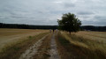
(11) Follow the track to the left and climb slightly between the fields. Descend and walk some distance to the right of the cemetery.
(12) You will come out onto the D7 and follow it to the right. After about 500 m, at a junction, continue straight on along the D7 until it meets the D14. Then turn left into the car park at the start (S/E).


 Visorando Member

 Tourist office
 Moderate