Country:
 City:
City:


Park in the car park by the town hall and village hall in Mazeuil. The entrance is rather inconspicuous:
- If coming from the north or west, at the junction with a chapel and a bus stop, head towards the church and you’ll find the entrance just before it on the left.
- If coming from the south, leave the church on your right and you’ll find the entrance shortly afterwards on the right.
Yellow markings
Markers or arrows on dedicated wooden signposts. The signposting is one-way, in the direction of this description.
(S/E) Leave the car park by continuing along the access road, passing between the village hall on the left and the town hall on the right. You will come out onto a street; follow it to the right. Walk past the foot of the church, leaving the war memorial on your right, and follow the D40 towards Vouzailles. Cross the River Dive and continue along the road for about thirty metres.
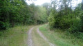
(1) At the corner of a wall, turn left onto a grassy path. The path curves in a semicircle along a vast field on the right. On the left, follow a poplar grove, then a wood and a hedge in turn, and ignore all turn-offs to the left. At the T-junction, turn right onto a path between two fields, which soon gives way to a small tarmac road.
(2) Join the D40 again near the spot where you left it and follow it to the left. Walk past La Chabotterie (a former fortified residence).
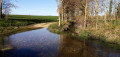
(3) After the sign marking the exit from Mazeuil and before a sign warning of wildlife, turn right onto an inconspicuous grassy path (not shown on the 1:25,000 map). Turn left then right and head slightly downhill. At the bottom, turn left and walk alongside the River Dive at some distance to your right. Continue for a long way south-south-west then south, as the river is soon obscured by vegetation. The path finally turns left (ignore an arrow indicating a right turn; this relates to the route that follows).
(4) You’ll come out onto the D40 again; follow it to the right. At the next junction (cross), turn right onto the V3 towards Les Mèes. Cross the River Dive and walk alongside the Moulin Charrais on your right. Continue for about fifty metres along the tarmac and walk alongside a hedge on your right.
(5) At the end of the hedge, turn right onto a stony track. Follow the route you took earlier on the right bank of the Dive, but this time in the opposite direction along the left bank; the river will be barely visible or not at all. When the track rejoins the tarmac (marker 96), turn left and head slightly uphill.
(6) At the T-junction, turn left. At the Fork in the road (stone cross), veer to the right. Stay on this small road and ignore two paths on the right-hand side. Note a small vineyard and a stone cross on the right.
(7) Ignore a road on the left, carry on straight ahead and enter Verger-sur-Dive. At the Stop sign, turn right towards Coussay. After house number 8, turn left and head downhill. The tarmac soon gives way to a track.
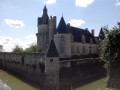
(8) At the bottom, at a junction, take a grassy path on the right, bordered by a hedge on the right-hand side. Carry on straight ahead, keeping a water tower in sight (damp patches). At the next junction, turn right. The track soon gives way to tarmac. Pass a pond on your left and head uphill. Cross a path and continue straight on until you reach a T-junction (Château de Marconnay opposite).
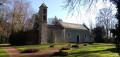
(9) Follow the road to the left and immediately turn right onto Rue du Château. Turn left at the gate to the château. At the junction, go straight on towards the Chapelle Sainte-Radegonde. Cross Rue du Cognaud on your right and continue straight on along Rue de la Source. Head downhill and note a wayside shrine on your left. Pass another wayside shrine on your right and, at the Fork in the road that appears immediately, turn right towards the chapel. You’ll reach it shortly.
(10) Continue along the small road, leaving the chapel on your right. Cross a stream and then the River Dive once more. At the next three-way junction (elevation 85), turn right onto a grassy path. At the next three-way junction, turn right. After about 250 m, look out for the start of a path on the right at the corner of a hedge.
(11) Then turn right and follow the hedge on your left. Cross the River Dive and you’ll come to a T-junction.
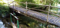
(12) Turn left here. Stay on the main path, heading east-southeast then southeast, and ignore all side paths. Further on, cross the Dive by fording or via a footbridge on the right-hand side.
(13) Join the D40, follow it to the right and cross the River Dive one last time. As you come off the bridge, turn left into Rue de la Commanderie. You will soon see the car park where you started on your right (S/E).




 The first part of the walk wasn’t great (Dive was barely visible except when we reached the road); we enjoyed the second part, with the castle and the chapel in the orchard at Dive
 Visorando Member
 Easy
Easy