Country:
 City:
City:


Park in the car park at Place de l’Église.
(S/E) Opposite the walking signposts, turn right onto Rue François Albert, which runs past the primary school. Continue along this street, passing the two junctions with Rue des Villiers on your right.
At the junction (with a ‘give way’ sign), turn right onto Rue de la Croix, which leads downhill.
(1) At the top of the hairpin bend in the road, take the road opposite which leaves Béruges and runs past the foot of the castle (Route de la Ferrandière).
Follow the first tarmac road on the right (towards Jean Moulin/Le Gué des Roches).
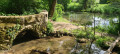
(2) Carry on to the right along the tarmac road which crosses the Boivre via two bridges. Continue straight ahead along the dirt track, passing the first two footpaths on the left.
(3) At the crossroads where the two paths meet, turn right (pink markings).
Cross the tarmac road and continue straight on along the path that descends into the forest. You are walking along an ancient Roman road.
(4) Once you reach the D40, take it to the right, cross the bridge and continue uphill to the right.
(1) At the hairpin bend, take the same road as on the way out to return to the Place de l’Église (S/E).

 Visorando Member