Berthegon circular countryside loop

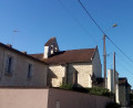
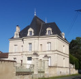
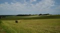
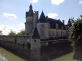
A walk mainly through fields, offering sweeping views of the countryside. There is no shortage of heritage sites, including a church, a manor house and some beautiful houses.

Details

98065259
Creation:
Last update:
Last review:
  • Walking
    Activity: Walking
  • ↔
    Distance: 5.70 mi
  • ◔
    Average duration: 2h 45 
  • ▲
    Difficulty: Easy

  • ⚐
    Back to start: Yes
  • ↗
    Ascent: + 148 ft
  • ↘
    Descent: - 148 ft

  • ▲
    Highest point: 430 ft
  • ▼
    Lowest point: 243 ft
  • ⚐ Country: France
  • ⚐ City: Berthegon (86420)
  • ⚑
    Start/End: N 46.897583° / E 0.261712°
  • ❏
    IGN map(s): Ref. 1725SB
  • Hour-by-hour weather

Photos

Description of the walk

Start from the large village car park, in the middle of which stands the war memorial. Vehicle access is at the junction of the D14 and D7 roads.

No signposting
In some places, you will find faded yellow markings: ignore these and rely on the map and the description below.

(S/E) Take the vehicle exit and follow the D14 to the right towards Loudun. Shortly afterwards, turn left onto the D7 towards Mirebeau. Pass the Berthegon exit sign.

(1) Ignore the D70 coming from the left and continue on the D7.

(2) Just before you reach a cycle path, turn right towards Chamaillard and head up a small road.

(3) Pass a detached house and continue along a track. Descend slightly and climb again between the fields. Return to the tarmac at the first houses.

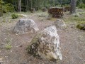
(4) At the Stop sign, turn left. Note a meadow on the left decorated with modern sculptures.

(5) At the junction shortly afterwards, follow a small road to the right (closed to vehicles over 12 tonnes) and pass by the foot of the Manoir de Vayolles. At the T-junction, turn right.

(6) At the junction immediately ahead, turn left towards Bourgneuf.

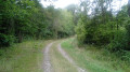
(7) At the next junction, go straight on. Go round a beautiful, isolated house on the left, continue along a grassy path and descend gently.

(8) Cross the access road to the hamlet of Ludelin and continue straight ahead along a flat grassy path. You’ll come out onto a small road (pond) and follow it to the right.

(9) At the next junction, turn right. After a shaded section, ignore a small road on the right.

(10) At the hamlet of Les Étangs, turn left onto a stony path. Soon, ignore a grassy path on the left. Walk along the edge of the woods and then into the woods.

(11) Cross the D70 and continue straight ahead on the path through the woods. Ignore a path on the left and, at the next junction, go straight on.

(12) At the next junction, turn right onto a small road. Enter Berthegon and, at the junction immediately ahead (with a wayside shrine on the left), turn right.

(13) At the Stop sign, go straight on.

(14) At the next junction (with a beautiful house opposite), turn left and walk past Berthegon church. At the end of the street, turn right and walk past the town hall. At the junction, turn left to take a pedestrian entrance to the starting car park (S/E).

Waypoints

  1. S/E : mi 0 - alt. 285 ft - Village car park – War memorial
  2. 1 : mi 0.53 - alt. 308 ft - D7 road x D70 road
  3. 2 : mi 0.74 - alt. 328 ft - Junction
  4. 3 : mi 0.91 - alt. 364 ft - Chamaillard
  5. 4 : mi 1.73 - alt. 417 ft - Junction
  6. 5 : mi 1.81 - alt. 413 ft - Crossroads - Manoir de Vayolles
  7. 6 : mi 2.08 - alt. 427 ft - Intersection - La Haute Audience
  8. 7 : mi 2.3 - alt. 420 ft - Crossroads - Bourgneuf
  9. 8 : mi 2.97 - alt. 302 ft - Crossroads - Ludelin
  10. 9 : mi 3.48 - alt. 266 ft - Road junction
  11. 10 : mi 3.89 - alt. 259 ft - Start of the path – Les Étangs
  12. 11 : mi 4.41 - alt. 253 ft - Crossing the D70
  13. 12 : mi 4.84 - alt. 276 ft - Crossroads
  14. 13 : mi 5.19 - alt. 285 ft - Crossroads
  15. 14 : mi 5.47 - alt. 272 ft - Crossroads - Église Notre-Dame (Berthegon)
  16. S/E : mi 5.7 - alt. 285 ft - Village car park – War memorial

Notes

Good walking shoes are sufficient for this route, which follows well-maintained paths and quiet country lanes.

N.B. Between (7) and (9), the route follows a grassy path. On the day of the hike, the section between (7) and (8) had been mown, but the section between (8) and (9) had not (which does not mean it is never maintained). Early in the morning, with the dew, you must be prepared to get your feet wet.

No water source has been identified along the route.

A detailed map is required (at the very least the one accompanying this description).

Hike undertaken by the author on 24 May 2026.

Worth a visit

Generally sweeping views of the countryside.

Modern sculptures just before (5).

Vayolles Manor, shortly afterwards (5).

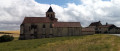
Beautiful houses and Notre-Dame Church in Berthegon, between (14) and (S/E).

Other walks in the area

For more walks, use our search engine .

The GPS track and description are the property of this route's author. Please do not copy them without permission.