The Chastelas viewpoint, starting from Saint-Pierre de Beaujeu

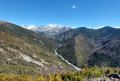
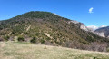
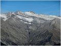
Le Chastelas is a curious karst collapse on a flattened summit. But it is also the destination of a lovely, shaded and panoramic hike, as the view from the summit is magnificent. Return via the Galèbre valley.

Details

72353132
Creation:
Last update:
Last review:
  • Walking
    Activity: Walking
  • ↔
    Distance: 6.53 mi
  • ◔
    Average duration: 4h 35 
  • ▲
    Difficulty: Moderate

  • ⚐
    Back to start: Yes
  • ↗
    Ascent: + 1,804 ft
  • ↘
    Descent: - 1,801 ft

  • ▲
    Highest point: 4,711 ft
  • ▼
    Lowest point: 3,022 ft

Photos

Description of the walk

Access from Beaujeu: the road is very winding with poor visibility; careful driving is advised. Park in the car park at the entrance to Saint-Pierre.

(S/E) Leave the car park by turning left and walk past the church. Then head right, onto the Place du Four à Pain, to take the road leading out of the village and down to the banks of the river, the Galèbre. Follow this road to the hamlet of Les Combes. 

(1) After the houses, turn right to follow the Chastelas path: marked in yellow.

(2) Cross the track and continue straight ahead until you come to another track.

(3) Follow this track to the left for a few dozen metres, then take the continuation of the path, marked in yellow, on the right. Return to the track for a few metres, then turn back onto the path on the right and head towards a three-way junction.

(4) From this point, the marked, eroded path disappears into a network of gullies. Leave it, therefore, and head straight up the path on the left, which quickly rejoins the track you left earlier. Turn right and follow it for about 150 metres. 

(5) At the cairn, head left onto another path leading to a grassy clearing, and rejoin the track one last time. 

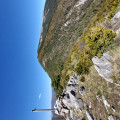
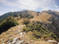
(6) Turn left for a few metres until you find the Sentier du Chastelas on the right, clearly marked in yellow. The very start is a little steep, but the rest is better marked and easier going, with wide hairpin bends. At the final bend, there’s a view towards the Barre des Tremblès and the cross, the end point of the walk. You’ll reach a flat section, perfect for relaxing and having a picnic. The path circles round the Chastelas, a karst collapse some forty metres deep, and reaches a Y-junction.

(7) Leave the ascending path. This junction, where you leave the unmarked path leading up to the Montagne de l’Ubac, isnot very visible, marked only by a small cairn. It is essential to spot and follow the yellow markings carefully all the way to the Chastelas viewpoint. 

(8) Begin the return journey along the same route, in the opposite direction, until you reach the track.

(6) Turn left. At the first hairpin bend, continue straight ahead along a secondary track leading to the Pierron farm, without going there. 

(9) Before reaching the farm, turn left onto the path signposted ‘Saint-Pierre’ (4.5 km). After a descent along the mountainside, the path joins the Galèbre track. 

(10) At the hairpin bend, turn right onto this track which runs alongside the Galèbre on your left. You’ll reach a junction. 

(11) Stay on the track you have been following so far, going straight on, and rejoin the route you took on the way up.

(2) Follow the path you took on the way up, in the opposite direction, back to the car park where you started (S/E). 

Waypoints

  1. S/E : mi 0 - alt. 3,025 ft - Car park at the entrance to Saint-Pierre
  2. 1 : mi 0.36 - alt. 3,150 ft - Les Combes
  3. 2 : mi 0.42 - alt. 3,186 ft - Crossing the track
  4. 3 : mi 0.72 - alt. 3,517 ft - Crossing the track
  5. 4 : mi 1.12 - alt. 3,770 ft - Y-junction
  6. 5 : mi 1.27 - alt. 3,868 ft - Start of the trail (cairn)
  7. 6 : mi 1.47 - alt. 4,022 ft - Start of the ascent at Chastelas
  8. 7 : mi 2.2 - alt. 4,636 ft - Y-junction
  9. 8 : mi 2.41 - alt. 4,698 ft - Chastelas viewpoint
  10. 9 : mi 3.57 - alt. 3,957 ft - Junction
  11. 10 : mi 4.34 - alt. 3,445 ft - Galèbre Trail
  12. 11 : mi 5.9 - alt. 3,261 ft - Where the tracks cross, carry on straight ahead
  13. S/E : mi 6.53 - alt. 3,025 ft - Car park at the entrance to Saint-Pierre

Notes

Bring water with you; there are no springs along the route.

Worth a visit

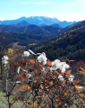
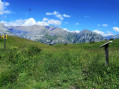
Picturesque hamlets in the Galèbre valley, green pastures and black pine forests, a hike of geological interest and, above all, superb panoramic views of the Blayeul, the Estrop, the Mourre de Simance, the Montagne de Boules, the Cheval Blanc, the Couard and the Barre des Dourbes, as well as the valley and the mountain pastures from La Javie to Labouret.

Reviews and comments

4.8 / 5
Based on 3 reviews

Reliability of the description
5 / 5
Ease of following the route
5 / 5
Route interest
4.3 / 5
pbizet
pbizet

Overall rating : 4.7 / 5

Date of your route : Jul 13, 2026
Reliability of the description : ★★★★★ Very good
Ease of following the route : ★★★★★ Very good
Route interest : ★★★★☆ Good
Very busy route : No

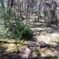
A lovely walk, with varied scenery and a beautiful view of the surrounding mountains and valleys. Most of the route is shaded, and the cool breeze blowing up the valley makes it a pleasant walk in hot weather.

Machine-translated

mstirnim
mstirnim

Overall rating : 4.7 / 5

Date of your route : Dec 08, 2025
Reliability of the description : ★★★★★ Very good
Ease of following the route : ★★★★★ Very good
Route interest : ★★★★☆ Good
Very busy route : No

A lovely, easily accessible, pleasant and varied route with beautiful views of the region's peaks.

Machine-translated

Lau Deotto
Lau Deotto

Overall rating : 5 / 5

Date of your route : Oct 22, 2025
Reliability of the description : ★★★★★ Very good
Ease of following the route : ★★★★★ Very good
Route interest : ★★★★★ Very good
Very busy route : No

Today's route followed the trail markers, signposts and cairns. No difficulty. Superb views, enhanced by the autumn colours.
The return trip along the river was a bit monotonous, but it was still a very beautiful hike.
We were the only ones on the trails, which was wonderful!
Thank you for the route.

Machine-translated

Other walks in the area

For more walks, use our search engine .

The GPS track and description are the property of this route's author. Please do not copy them without permission.