The Source de l’Alambic and the Croix d’Heyre ridge

In the centre of the commune of Prads, the village of Heyre – which is still inhabited – and its surrounding countryside offer beautiful scenery and a glimpse into the past, before the First World War, when the mountains were densely populated. Here, wheat was grown and fine lavender was distilled. What remains are meadows grazed in autumn and spring, a few beehives, a village with Romanesque roof tiles restored by its current inhabitants, and a chapel restored thanks to the Fondation du Patrimoine.

Details

n°6453302
Creation:
Last update:
Last review:
  • Walking
    Activity: Walking
  • ↔
    Distance: 1.25 mi
  • ◔
    Average duration: 0h 55 
  • ▲
    Difficulty: Easy

  • ⚐
    Back to start: Yes
  • ↗
    Ascent: + 394 ft
  • ↘
    Descent: - 394 ft

  • ▲
    Highest point: 4,016 ft
  • ▼
    Lowest point: 3,622 ft

Photos

Description of the walk

Park at the Heyre signpost if travelling by car from Prads.

(S/E) Walk down the track towards the cemetery and admire the three ancient graves.
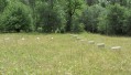
Opposite the cemetery gate, cross the esplanade and head down the small path that branches off to the right between two rows of box trees. Pass by one of the village children’s huts, then the path descends a steep slope and disappears into the meadow. Cross the meadow, keeping in the same direction, and you’ll come to a gap in a thick hedge, through which you can see the Alambic.

(1) Cross the stream and continue down the meadow in the same direction until you reach a very distinct break in the slope. Then turn left, following this break in the slope from a distance.

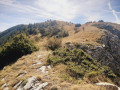
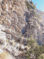
Pass through marshy areas which are full of flowers in season (daffodils), then cross the large hedge once more via another gap. Climb a steep slope to reach the bottom of the Heyre valley. Start by walking up this valley towards the cross, then, as soon as possible, turn right onto a steep slope leading up to the ridge (Photo no. 5)

(2) Follow this ridge as far as the cross (Photo no. 6), then reach the chapel (which you can visit).

(3) Above the fountain, take the track that leads back to the car park at the entrance to the village (S/E).

Waypoints

  1. S/E : mi 0 - alt. 4,016 ft - Car park: Heyre sign
  2. 1 : mi 0.45 - alt. 3,694 ft - Source de l’Alambic
  3. 2 : mi 0.83 - alt. 3,773 ft - Crête de la Croix d’Heyre
  4. 3 : mi 1.04 - alt. 3,917 ft - Chapelle Saint-Roch (Heyre)
  5. S/E : mi 1.25 - alt. 4,016 ft - Car park: Heyre sign

Notes

You may pass through areas currently being used for grazing. In this case, go round them by following the fence.

Alternatives:
You can also join this walk via thePR® trails, marked in yellow and signposted:
- 2 km, 0h45 from the wooden bridge at Blégiers (steep climb)
- 4.5 km, 1 hour 15 minutes from Prads or 4 km, 1 hour 30 minutes from La Colle (after Chavailles), the Tour du Carton trail.
Apart fromthe PR® routes, access is possible in 1 hour, 4 km, from Tercier via the track, with a gentle gradient.

Worth a visit

(S/E) Visit the villageof Heyre: the cemetery, cross, chapel, narrow streets, vaulted passages, bread oven and fountain.
Between (S/E) and (1) The path is narrow, yet this was the old route from Prads. It was necessary to conserve arable land. The meadows you will cross were once the valley’s granary.

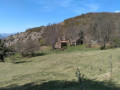
(1) L’Alambic: You will finally come across L’Alambic – the remaining vat, featuring a beautiful engraved plaque. Behind it lies the Source de l’Alambic, a rectangular stone cistern with a spillway made of hollowed-out tree trunks (Photo no. 3).

Always be cautious and plan ahead when you're outdoors. Visorando and the author of this route cannot be held responsible for any accidents occurring on this route.

The GR® and PR® markings are the intellectual property of the Fédération Française de Randonnée Pédestre.

Reviews and comments

5 / 5
Based on 1 review

Reliability of the description
5 / 5
Ease of following the route
5 / 5
Route interest
5 / 5
fanfanjac
fanfanjac

Overall rating : 5 / 5

Date of your route : Oct 30, 2026
Reliability of the description : ★★★★★ Very good
Ease of following the route : ★★★★★ Very good
Route interest : ★★★★★ Very good
Very busy route : No

We did this route: from the village of Heyre, heading up via Blegiers. A very beautiful path with magnificent views over the valley. This path is an old mule track; it winds a great deal – which is just as well, as it’s quite steep, and the gradient becomes steeper in the final third of the climb (quite steep and slippery! Take care and bring walking poles).
It emerges at the foot of the little chapel, which is magnificent (the key is on the door, as mentioned in the description); from there, you climb up to the cross, which offers a superb view of the valley and the surrounding mountains.
We continued above the village towards the path leading to Prads and the one that circles the Carton along a very wide track.
Magnificent autumn colours all along this walk in glorious sunshine!

Machine-translated

Other walks in the area

For more walks, use our search engine .

The GPS track and description are the property of this route's author. Please do not copy them without permission.