The suspended valley of Tercier and Faillefeu

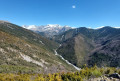
The Haute Bléone holds many surprises. It is a secluded world, with numerous valleys, the ‘roof of the world’ of Haute Provence, as described by the explorer Alexandra David-Neel and the writer Pierre Magnan.
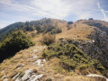
Here is a leisurely walk to explore the Tercier Valley, suspended above cliffs and a waterfall, enclosed between two high mountain ranges and the Vachières cirque. This route follows the valley floor all the way to the site of the former Faillefeu Abbey, alongside the pleasant Aune torrent.

Details

n°50597029
Creation:
Last update:
Last review:
  • Walking
    Activity: Walking
  • ↔
    Distance: 3.49 mi
  • ◔
    Average duration: 2h 00 
  • ▲
    Difficulty: Easy

  • ⚐
    Back to start: Yes
  • ↗
    Ascent: + 476 ft
  • ↘
    Descent: - 495 ft

  • ▲
    Highest point: 4,508 ft
  • ▼
    Lowest point: 4,186 ft

Photos

Description of the walk

From Prads-Haute-Bléone, follow signs for “Tercier”, admiring the sweeping view down towards Prads and L’Estrop as you go; we recommend stopping to take in the view at the viewpoint, where there is a bench to the left of the track, and park in the open-plan car park located before the village (information sign for “Chapelle Notre-Dame”). Worth seeing from the edge of this car park: a small waterfall opposite, on the other side of the valley, and a large one at the far end, below the village of Tercier.

(S/E) Follow the Faillefeu road, which goes round the village of Tercier – which you’ll pass through on the way back – and join the track from Tercier to Faillefeu

(1) Follow it down towards the bottom of the valley, ignoring the yellow markings leading uphill to the right, which you must not follow. Note, on the left-hand side below the track, the overflow from the spring, which gushes intermittently onto a bed of moss.

(2) Cross the Torrent de l’Aune, from south to north, following the track towards Faillefeu.

(3) Depending on the season, wade across the torrent again, this time from north to south. However, it is preferable to cross via the footbridges: 10 metres before the torrent’s bed, turn left onto the path that climbs towards Vachière Basse.
After 50 m, at a barely visible junction, take the path leading down to the right and cross a marshy area over tree trunks, then a small footbridge and, finally, a large footbridge.
Join the track and follow it to the top of the village of Faillefeu.

(4) The properties and the former convent are private and not open to visitors, but the area is lush and welcoming – ideal for a picnic, for example. You can also continue along the track a little further to explore the beautiful Faillefeu forest.

(4) Return along the same route you took on the way out to the village of Tercier.

(1) Turn right to walk through the village, where you can have a drink from the fountain, and then head back to the car park (S/E).

Waypoints

  1. S/E : mi 0 - alt. 4,360 ft - Car park – open space before the village of Tercier
  2. 1 : mi 0.35 - alt. 4,337 ft - Circular crossroads at the village loop
  3. 2 : mi 0.7 - alt. 4,193 ft - Torrent de l’Aune (at a place known as ‘Le Moulin’)
  4. 3 : mi 1.59 - alt. 4,429 ft - junction towards the footbridges
  5. 4 : mi 1.78 - alt. 4,498 ft - Faillefeu le Haut - Abbaye de Faillefeu
  6. S/E : mi 3.49 - alt. 4,364 ft - Car park – open space before the village of Tercier

Notes

Enjoyable all year round. In winter, suitable for snowshoeing; the trail is not cleared of snow.

Worth a visit

Explore the village of Tercier, the gateway to the valley, at your leisure. Please respect the area and the peace and quiet of the locals, who in return may be able to guide you or provide information. Head to the viewpoint at the bottom of the village, above the waterfall.

At a place called Le Moulin (2), after crossing the stream, you can follow it to the left as it winds down through the meadows (a popular spot for swimming) to just upstream of the waterfall.

From this point (4), you’ll find meadows and woodland.
From there, a traditional hiking route – the old access route to the Verdon Valley – begins; it is very difficult (steep gradients, crossing of gullies and steep sections), leading to the Col de Vachière, from where you can reach the beautiful summit of Montagne de Boules or descend into the Val d’Allos towards Beauvezer. Please take care to respect the vegetation (edelweiss) and wildlife (including ptarmigan, snow partridge, Saint-Esprit falcon and black grouse).

Reviews and comments

4.7 / 5
Based on 1 review

Reliability of the description
5 / 5
Ease of following the route
5 / 5
Route interest
4 / 5
Isabelle 1234
Isabelle 1234

Overall rating : 4.7 / 5

Date of your route : Aug 03, 2024
Reliability of the description : ★★★★★ Very good
Ease of following the route : ★★★★★ Very good
Route interest : ★★★★☆ Good
Very busy route : No

A walk to enjoy at the end of the day in summer when it’s hot. Beautiful evening light.
Easy going with lovely views at the start, then access to the river.
Very peaceful – make sure you spot the bridge at the end so you can cross over.

Machine-translated

Chercheminuit
Chercheminuit

Hello,
I download walks for my children and grandchildren; at 84 years of age, I’ve had to slow down and choose easier walks.
But I’m a keen follower of Visorando (at my own pace, which is somewhat slowed down by sciatica and the like).
Well done and best regards.
Chercheminuit.

Machine-translated

Other walks in the area

For more walks, use our search engine .

The GPS track and description are the property of this route's author. Please do not copy them without permission.