


Refine your search for walks in La Fontenelle
La Fontenelle walks


 Circular route between La Fontenelle and La Roche
 Association / Club / Walk leader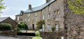
 5.36 mi
 +318 ft
 -299 ft
 2h 45
2h 45
 Easy
Easy
 Departure from La Fontenelle (Ille-et-Vilaine)
A walk along the country lanes of La Fontenelle, which presents no significant difficulty. There is a beautiful view over the Couesnon valley and the charming village of La Roche. The architecture of some of its houses is remarkable, with decorative arched windows and double-roll-top doors...
In the Villecartier State Forest
 Visorando Member
 7.05 mi
+207 ft
-203 ft
3h 25
7.05 mi
+207 ft
-203 ft
3h 25
 Moderate
Departure from Bazouges-la-Pérouse (Ille-et-Vilaine)
Moderate
Departure from Bazouges-la-Pérouse (Ille-et-Vilaine)
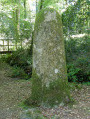
The Villecartier State Forest is now known for its leisure centre and miniature harbour. A former royal forest covering 1,000 hectares, it has been home to craftsmen since ancient times: the Auge des Sabotiers archaeological site bears witness to this. During the Roman period and then in the Middle Ages, its activities continued to evolve against a backdrop of religious influence.
This walk, which takes place entirely in the forest, invites you to discover all these places steeped in history.
Sougeal Marsh Route via La Selle and Les Landelles
 6.84 mi
+436 ft
-440 ft
3h 30
Moderate
Departure from Sougéal (Ille-et-Vilaine)
6.84 mi
+436 ft
-440 ft
3h 30
Moderate
Departure from Sougéal (Ille-et-Vilaine)
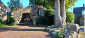
The route runs along the edge of the marsh and its vast 175-hectare wet meadows. These are classified as an “Espace Remarquable de Bretagne” (Regional Nature Reserve). The marsh is home to waterfowl all year round, but you may also come across cows and horses grazing freely there. In winter, access to the marsh is often cut off by floodwaters. The suggested route allows you to go round the marsh. However, two observation points overlooking the marsh remain accessible. The route also offers a more idyllic stretch through the woods and countryside around Sougeal. All in all, a peaceful walk to be enjoyed all year round.
The Sougeal Marsh
 8.81 mi
+459 ft
-466 ft
4h 25
Moderate
Departure from Sougéal (Ille-et-Vilaine)
8.81 mi
+459 ft
-466 ft
4h 25
Moderate
Departure from Sougéal (Ille-et-Vilaine)
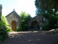
It comprises 175 hectares of extensive wet meadows and encompasses three main activities (see practical information). This route invites you to explore this environment, starting at the fish pass and then following the course of the Couesnon as closely as possible.In this regional nature reserve, only birdsong can be heard.
A circular discovery trail around the Sougeal Marsh Nature Reserve
 4.04 mi
+13 ft
-13 ft
1h 50
Easy
Departure from Sougéal (Ille-et-Vilaine)
4.04 mi
+13 ft
-13 ft
1h 50
Easy
Departure from Sougéal (Ille-et-Vilaine)
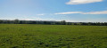
A short, easy walk around the Sougeal Marshes. Designated both a Regional Nature Reserve and a ‘Remarkable Site of Brittany’, with over 175 hectares restored, the area safeguards the bay’s ecosystem. You can spot over 360 plant species, amongst the reed beds and hedgerows. As for wildlife, there are numerous migratory birds. Depending on the season, you’ll find over 60 species of waterbirds, including grey herons and white storks.
Circular route in the Villecartier Forest via the Colonne des Chouans
 5.05 mi
+85 ft
-85 ft
2h 25
Easy
Departure from Bazouges-la-Pérouse (Ille-et-Vilaine)
5.05 mi
+85 ft
-85 ft
2h 25
Easy
Departure from Bazouges-la-Pérouse (Ille-et-Vilaine)
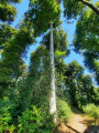
The Villecartier National Forest is known for its leisure centre, miniature harbour and hiking trails. The forest, formerly royal, covers an area of 1,000 hectares. It is dotted with monuments of varying ages that bear witness to human activity throughout its history. The proposed route allows you to discover some of them, and with a little luck, the four-legged animals that inhabit it; to do so, you must be relatively quiet.
A peaceful route taking in the monuments of the Villecartier National Forest.
 4.96 mi
+105 ft
-98 ft
2h 20
Easy
Departure from Bazouges-la-Pérouse (Ille-et-Vilaine)
4.96 mi
+105 ft
-98 ft
2h 20
Easy
Departure from Bazouges-la-Pérouse (Ille-et-Vilaine)
The Villecartier National Forest is known for its leisure centre, miniature harbour and hiking trails. The forest, formerly royal, covers an area of 1,000 hectares. It is dotted with monuments of varying ages that bear witness to human activity throughout its history. The proposed route allows you to discover some of them, and with a little luck, the four-legged animals that inhabit it. To do so, you must be relatively quiet.
Circular in the Villecartier National Forest
 7.65 mi
+102 ft
-102 ft
3h 35
Moderate
Departure from Bazouges-la-Pérouse (Ille-et-Vilaine)
7.65 mi
+102 ft
-102 ft
3h 35
Moderate
Departure from Bazouges-la-Pérouse (Ille-et-Vilaine)
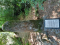
The Villecartier National Forest is known for its leisure centre, miniature harbour and hiking trails. The forest, formerly royal, covers an area of 1,000 hectares. It is dotted with monuments of varying ages that bear witness to human activity throughout its history. The proposed route allows you to discover some of these monuments and, with a little luck, the four-legged animals that inhabit the forest. To do so, you need to be relatively quiet and have a little luck.
Between Loysance and Coquillonnais
5.61 mi
+187 ft
-213 ft
2h 45
Moderate
Departure from Tremblay (Ille-et-Vilaine)
As we follow the banks of the Loysance, we enjoy the tranquillity of the Voie Verte, punctuated by a few inclines that allow us to explore the surrounding countryside, having previously walked through the Tremblay countryside along shaded paths.
From the Anaïs to the Loisance
7.37 mi
+233 ft
-246 ft
3h 35
Moderate
Departure from Tremblay (Ille-et-Vilaine)
The Greenway, the stream flowing from the Pré des Douétaux, the Loisance, the Douétel and, finally, an old railway station situated near a disused sawmill – this walk will allow walkers to appreciate the beauty of the Gallo countryside.
The path from La Ballue to Bazouges-la-Pérouse
 7.40 mi
+614 ft
-630 ft
3h 55
Moderate
Departure from Bazouges-la-Pérouse (Ille-et-Vilaine)
7.40 mi
+614 ft
-630 ft
3h 55
Moderate
Departure from Bazouges-la-Pérouse (Ille-et-Vilaine)
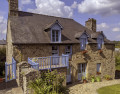
Discover the charming little town of Bazouges-la-Pérouse, then walk through the woods to reach this former residence of the Counts of Fougères, now a guest house, and finally stroll along charming streams that offer peace and serenity.
Hedgerows and moorland at Pleine-Fougères
 11.28 mi
+200 ft
-207 ft
5h 20
Moderate
Departure from Pleine-Fougères (Ille-et-Vilaine)
11.28 mi
+200 ft
-207 ft
5h 20
Moderate
Departure from Pleine-Fougères (Ille-et-Vilaine)
A landscape of hedgerows and woodlands, characterised by highly fertile soil thanks to the presence of the Ruisseaux de la Chênelais and the Petit Hermitage, as well as all the streams flowing into them, alongside woodland and heathland.
The Ruisseau des Saules in Romazy
5.43 mi
+249 ft
-259 ft
2h 45
Easy
Departure from Romazy (Ille-et-Vilaine)
A small village in the Pays de Rennes; from the heights of Romazy, you can see part of the Couesnon valley. Visitors are struck by the relaxed way of life here and appreciate its unspoilt surroundings.
The route from Saint-Georges to Chauvigné
 5.27 mi
+131 ft
-148 ft
2h 30
Easy
Departure from Chauvigné (Ille-et-Vilaine)
5.27 mi
+131 ft
-148 ft
2h 30
Easy
Departure from Chauvigné (Ille-et-Vilaine)
Lulled by the calm waters of the Ritort and the Moulinet, Chauvigné invites you to discover its hidden treasures and offers you a glimpse into its history.
The Route des Rochers in Chauvigné
7.46 mi
+102 ft
-98 ft
3h 30
Moderate
Departure from Chauvigné (Ille-et-Vilaine)
In the 1920s, Chauvigné had granite quarries next to the village of Le Fretay on the "Rochers des Renaisières" site.
The quarrying operation, which remained small-scale, focused mainly on the creation of funerary monuments.
Walkers will enjoy a stroll right in the heart of granite country: amongst meadows where the rock outcrops and traditional buildings.
Le Pas Gérault and the Oak of Liberty at the start of Sains
 7.15 mi
+177 ft
-177 ft
3h 25
Moderate
Departure from Sains (Ille-et-Vilaine)
7.15 mi
+177 ft
-177 ft
3h 25
Moderate
Departure from Sains (Ille-et-Vilaine)
A short, peaceful walk starting from Sains. The route passes through wooded areas, including a charming section at the start. There are usually many water birds at the Pas Gérault pond, especially in autumn. This walk takes you along the Oak Trail, with its many remarkable trees, including the Oak of Liberty.
Route de l'Étang du Pas Gérault starting from Sains
 5.54 mi
+112 ft
-138 ft
2h 40
Easy
Departure from Sains (Ille-et-Vilaine)
5.54 mi
+112 ft
-138 ft
2h 40
Easy
Departure from Sains (Ille-et-Vilaine)
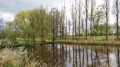
A short, peaceful walk starting from Sains. The route passes through wooded areas, including a charming section at the start. There are usually many water birds at the Étang du Pas Gérault, especially in autumn.
Around Saint-Georges-de-Gréhaigne
 5.41 mi
+256 ft
-253 ft
2h 45
Easy
Departure from Saint-Georges-de-Gréhaigne (Ille-et-Vilaine)
5.41 mi
+256 ft
-253 ft
2h 45
Easy
Departure from Saint-Georges-de-Gréhaigne (Ille-et-Vilaine)
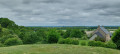
Enjoy a peaceful stroll through the polders and return via the plateau that marks the end of the old coastline. In principle, you can enjoy a breath of fresh air. The route presents only one small difficulty, namely the coast between Chanel and Haut Chanel, with a difference in altitude of 15 m to 75 m. The reward in season is cherries!
Route of Angevinière and Petite Claye starting from Sains
 7.64 mi
+318 ft
-308 ft
3h 45
Moderate
Departure from Sains (Ille-et-Vilaine)
7.64 mi
+318 ft
-308 ft
3h 45
Moderate
Departure from Sains (Ille-et-Vilaine)
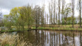
From Étang du Pas Gérault, take the paths and trails on the plateau, then on the Claye plain. The trail takes you through the somewhat wild Guyoult before following a circular route back to the plain and the lake. This area is rich in wildlife, with numerous egrets and cattle egrets, and sometimes grey herons. Game is often seen here, but it is very shy.
More walks in La Fontenelle
Select a point of interest below: