Country:
 City:
City:



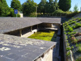
Park in the car park of the former youth hostel on Rue de Normandie, near the post office.
(S/E) Set off along Rue de Normandie on the west side.
Red and white markings forthe GR® 34 and 39
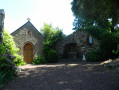
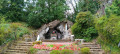
Just before the church, turn left into the first street: Rue des Riaux. As the street curves to the right, you’ll find the village washhouse on your left.
(1) Continue left onto Rue du Mont Saint-Michel (D90), then, after the roundabout, onto Rue de Rennes. At the old railway station, cross the level crossing and carry on, leaving the D89 towards Vieux-Viel on your left, and continue for 50 metres.
(2) Take the path on the right before No. 36. Continue to the right along a track, then ignore a path on the left (GR® route).
Yellow markings
(3) Carry on straight ahead and follow the bend to the right towards the railway line. Walk alongside this railway line until you reach the road.
(4) Turn right to cross the level crossing and the road (D4); immediately afterwards, continue left onto the path, which turns right after 250 m. Carry on until you reach a road.
(5) Turn left onto the small road and, after 40 m, rejoin the path on the right.
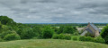
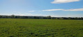
(6) When you reach a road, turn right, then immediately left, and head due north along this track to reach the hamlet of Le Pin. Along the way, there is a beautiful view of the village of Sains, two kilometres away.
(7) Turn left to cross the hamlet of Le Pin. Continue along this road.
(8) Turn right, then left to cross the Lande du Pin. Keep left at the road and cross the D387 straight ahead. After 200 metres, you’ll reach Le Goulet.
(9) Take the path on the right, then veer left and continue southwards between two fields until you reach the road. Turn left and continue to the junction.
(10) Cross the level crossing on the right and then turn left. Walk through the hamlet of Villemeloüen and follow the railway line to the road. Turn right, then left 50 metres further on towards the hamlet of Razette.
(11) Cross the D4, head towards Le Plessis and immediately turn onto the grassy path on the left. Enter the Bois de Coquerel, continue along the path and cross the Ruisseau de la Chênelaise via the footbridge. Continue along the stony path to the right until you reach the road. (Do not follow the yellow markings to the left).
(12) Turn left; you’ll briefly rejoin theGR® routes coming from the left.
Red and white markings forthe GR® 34 and 39
Pass Maison Neuve on your right and come out onto the D90. Turn left onto it and follow it for 150 m
(13) Continue to the right to cross the Ruisseau du Petit Hermitage towards Champ Lambert, a small, typical hamlet. On leaving the hamlet, turn right and, after a left-hand bend, carry on straight ahead, ignoring the path on the right signposted for theGR® routes.
Yellow markings
(14) At the crossroads, turn left onto the stony track. Pass under a high-voltage power line, then at the fork, keep right and follow the road as it bends to the right, passing near Pierre Blanche. On reaching Ville Marie, continue along the stony track for 20 m to the left, then leave the D89 by turning right towards the east.
(15) Turn left and continue northwards along the road, ignoring the right-hand bend. At the T-junction, follow the road to the left for 50 m, then take the path on the right after passing the turn-off to L’Écluse. When you reach a road, continue straight on to pass through the hamlet of Beaurepaire, admiring its traditional houses.
(16) Continue to the left and turn left after 20 m. After 250 m, turn right onto the first path which passes to the right of the sewage treatment plant. Cross Rue de la Rouérie and continue straight ahead until you reach Avenue des Prunus.
(17) Turn right. Head towards Rue de Normandie, cross the level crossing on the left and return to the car park where you started (S/E).

 Association / Club / Walk leader

 Easy
Easy  Visorando Member