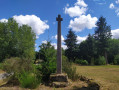
The Ruisseau des Saules in Romazy

A small village in the Pays de Rennes; from the heights of Romazy, you can see part of the Couesnon valley. Visitors are struck by the relaxed way of life here and appreciate its unspoilt surroundings.

Details

2836657
Creation:
Last update:
Last review:
  • Walking
    Activity: Walking
  • ↔
    Distance: 5.43 mi
  • ◔
    Average duration: 2h 45 
  • ▲
    Difficulty: Easy

  • ⚐
    Back to start: Yes
  • ↗
    Ascent: + 249 ft
  • ↘
    Descent: - 259 ft

  • ▲
    Highest point: 276 ft
  • ▼
    Lowest point: 121 ft
  • ⚐ Country: France
  • ⚐ City: Romazy (35490)
  • ⚑
    Start/End: N 48.375999° / W 1.497652°
  • ❏
    IGN map(s): Ref. 1217SB, 1317SB
  • Hour-by-hour weather

Description of the walk

(S/E) Place de la Mairie.

Red and white markings forthe GR®39

Turn right onto Rue Constant Bazillais and cross Rue du Mont-Saint-Michel.
Leave Romazy, passing first a small lake on your left, then a road leading to Les Courcières.
One hundred metres past this road, look out for a dirt track on the left.

(1) Take this track. After a bend to the right, continue to the left, heading north-east then east. Cross the road which leads, to the right, to La Bidois, and continue straight ahead. As you approach the Ruisseau des Saules, the path veers left, heading due north.
Follow this path which, after crossing the stream, reaches a crossroads.

(2) Turn right, heading due south, onto a path between two embankments. Ignore the GR®39, which branches off to the left.

No signposting

Carry on southwards until you reach another stream: the Ruisseau du Haut de Mont.

(3) Cross it and head left, through the woods, to reach a cluster of houses: La Montagnerie. At the first houses, turn left onto the road, then very quickly right without going as far as the Croix Robin wayside cross. Go round to the back of the farmhouse and follow the apple trees, then join the path.

Continue southwards, past the houses at Seugé and then those at La Noë Guy, and carry on to the right.
At La Moisondaie, turn left, and at the Fork in the road, turn right and walk past the electricity substation.

Red and white markings for a variant ofthe GR®39

(4) After 50 m, follow the path to the right which crosses a stream and then runs alongside it. Continue along this path, which turns westwards before leading to a farm track. Follow this track to the right.
Cross a small road and continue straight ahead. Ignore a track on the left, then another on the right. Cross the Ruisseau du Moulinet and reach the access track to La Poilevrie.

(5) Carry on to the left, heading north-west. At a Fork in the road, keep left, still heading north-west, and you’ll reach Rue de Rennes.
Follow it to the right for 20 metres, then turn left onto a path which joins Rue du Roquet. Take this street to the right; it leads to Place de la Mairie (S/E).

Waypoints

  1. S/E : mi 0 - alt. 240 ft - Place de la Mairie in Romazy
  2. 1 : mi 0.37 - alt. 259 ft - Dirt track on the left
  3. 2 : mi 1.46 - alt. 272 ft - Crossroads on the right
  4. 3 : mi 2.27 - alt. 200 ft - After the stream, turn left
  5. 4 : mi 3.29 - alt. 154 ft - Path on the right between two streams
  6. 5 : mi 4.57 - alt. 203 ft - At La Poilevrie, take the path on the left
  7. S/E : mi 5.43 - alt. 240 ft - Place de la Mairie in Romazy

Worth a visit

Near ::3: the Manoir du Moulinet: private property, not open to the public.

Always be cautious and plan ahead when you're outdoors. Visorando and the author of this route cannot be held responsible for any accidents occurring on this route.

The GR® and PR® markings are the intellectual property of the Fédération Française de Randonnée Pédestre.

Reviews and comments

3.7 / 5
Based on 4 reviews

Reliability of the description
3.8 / 5
Ease of following the route
3.8 / 5
Route interest
3.5 / 5
User 4727606

Overall rating : 4 / 5

Date of your route : Aug 08, 2026
Reliability of the description : ★★★★☆ Good
Ease of following the route : ★★★★☆ Good
Route interest : ★★★★☆ Good
Very busy route : No

A route with little tarmac, best tackled in dry weather,

Machine-translated

mery
mery

Overall rating : 3 / 5

Date of your route : Nov 14, 2022
Reliability of the description : ★★★☆☆ Average
Ease of following the route : ★★★☆☆ Average
Route interest : ★★★☆☆ Average
Very busy route : No

No. 4 to 5: Very poorly signposted – a bit disappointed

Machine-translated

dedep
dedep

Overall rating : 4 / 5

Date of your route : Jan 30, 2022
Reliability of the description : ★★★★☆ Good
Ease of following the route : ★★★★☆ Good
Route interest : ★★★★☆ Good
Very busy route : No

A lovely walk in very peaceful surroundings. Best done in fine weather

Machine-translated

Le vannier
Le vannier

Overall rating : 3.7 / 5

Date of your route : Mar 09, 2021
Reliability of the description : ★★★★☆ Good
Ease of following the route : ★★★★☆ Good
Route interest : ★★★☆☆ Average
Very busy route : No

I got lost in La Moisondale; after passing the electricity substation, I misunderstood the directions.

Machine-translated

Claude_Rennes
Claude_Rennes
• Edited:

To be saved for another time!

Machine-translated

Other walks in the area

For more walks, use our search engine .

The GPS track and description are the property of this route's author. Please do not copy them without permission.