


Refine your search for walks in La Colle
La Colle walks


 Ascent of Mont Mounier from the Aygue Blanche bridge
 Visorando Member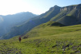
 14.36 mi
 +5,935 ft
 -5,919 ft
 2 days
 Difficult
 Departure from Péone (Alpes-Maritimes)
This two-day hike takes you up to Mont Mounier, a major and isolated peak in the Mercantour, via a circular route.
After a fairly short first stage, an early morning ascent to the summit will allow you to enjoy clearer weather and perhaps spot a few chamois and marmots.
The descent to the Pont d’Aygue Blanche will be very long (a 1,800-metre descent). Don’t hesitate to set off the day before from the Altifsurface to balance out the route.
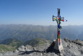
Mont Mounier as seen from the Montagne de l’Estrop
 10.63 mi
+2,703 ft
-5,919 ft
7 hrs
10.63 mi
+2,703 ft
-5,919 ft
7 hrs
 Very difficult
Departure from Péone (Alpes-Maritimes)
Very difficult
Departure from Péone (Alpes-Maritimes)
This hike forms thesecond stage of the ascent of Mont Mounier.
Starting from the Montagne de l’Estrop, you’ll climb to the Col de Crousette for a beautiful view over the valley of the same name and the Haute-Tinée. You’ll then reach the Mont Mounier ridge, which you’ll follow to the summit.
The descent takes you through the hamlet of La Colle before climbing back up towards the Tête de Charnaye, then down again towards the altisurface, and finally the final descent to the Pont d’Aygue Blanche.
Walks near La Colle
From the Aygue Blanche bridge to Montagne de l’Estrop
3.69 mi
+3,209 ft
-0 ft
4h 30
Difficult
Departure from Péone (Alpes-Maritimes)
This hike is the first stage of a two-day circular route leading to the ascent of Mont Mounier.
Starting from the Pont d’Aygue Blanche near Péone, you’ll climb gradually towards the small plateau of the Montagne de l’Estrop, where you can camp in sheltered conditions. A stage through deciduous woodland and mountain pastures at the foot of the rocky ridge of the Montagne de l’Alp.
From the Longon Refuge to Saint-Dalmas
 15.05 mi
+3,540 ft
-5,518 ft
10h 00
Difficult
Departure from Alpes-Maritimes
15.05 mi
+3,540 ft
-5,518 ft
10h 00
Difficult
Departure from Alpes-Maritimes
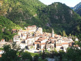
This nineteenth stage continues the long traverse of the Mercantour. From the Refuge de Longon, the path descends the Vallon du Longon diagonally across the slope to the hamlet of Rougios, before following the Fracha forest road and then taking a shortcut to the pretty Provençal village of Roure. Via a stony descent, it cuts across the hairpin bends of the M130 and M30 roads and reaches Saint-Sauveur-sur-Tinée, which it passes through before climbing up to the Chapelle Saint-Roch. Running along the hillside, it crosses the Vallon du Romarinier, passes through the hamlet of Roubinastre, crosses the Ravin de l’Esclosé and arrives at Rimplas. The GR®5 descends gently towards the small pass of Ragias and crosses the Vallon Gros, before climbing back up to the ridge on that side of the slope and then skirting the hamlet of La Bolline. From there, it climbs to the hamlet of La Roche and then ascends the ridge of the Vallon de Bramafam to reach Saint-Dalmas Valdeblore.
From Roya to the Longon Refuge
 12.21 mi
+4,321 ft
-3,081 ft
9h 25
Difficult
Departure from Saint-Étienne-de-Tinée (Alpes-Maritimes)
12.21 mi
+4,321 ft
-3,081 ft
9h 25
Difficult
Departure from Saint-Étienne-de-Tinée (Alpes-Maritimes)
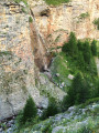
This eighteenth stage continues the traverse of the Mercantour Massif. From Roya, the GR®5 crosses the Vallon de Roya torrent, follows the Vallon de la Maïris upstream and then the Vallon de Sallevieille, before winding its way up to the Plan des Laces and then the Col de Crousette. From the pass, the path winds its way up the left-hand slope of the Vallon de la Culasse towards the Stèle Vallette, follows the ridge on the Vallon du Démant side, crosses the Baisse du Démant and descends to the Col du Refuge and then to the Col des Moulinés. It drops down to the bottom of the Vallon du Démant, crosses its torrent and, on the slope of the opposite side, meets the Vallon de la Gourgette. Above the hamlet of Vignols, it climbs beneath the ruin-like rocks of Les Chambrettes, where a colony of bearded vultures nests, and passes the small pass of Portes de Longon, then winds its way along a stream to reach the Refuge du Longon or Vacherie de Roure.
Daluis Gorges
 2.33 mi
+482 ft
-676 ft
1h 30
2.33 mi
+482 ft
-676 ft
1h 30
 Moderate
Departure from Guillaumes (Alpes-Maritimes)
Moderate
Departure from Guillaumes (Alpes-Maritimes)
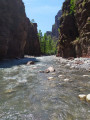
A route at the bottom of the superb Daluis Gorges! A water hike to be undertaken only in good weather, ideal in summer during hot weather. A hike accessible to children who can swim. Closed shoes are essential.
This hike crosses a protected natural site that is subject to regulations. See practical information.
Auron – Longon dairy farm
 16.41 mi
+5,928 ft
-4,970 ft
10 hrs
Very difficult
Departure from Saint-Étienne-de-Tinée (Alpes-Maritimes)
16.41 mi
+5,928 ft
-4,970 ft
10 hrs
Very difficult
Departure from Saint-Étienne-de-Tinée (Alpes-Maritimes)
A long but beautiful stage combining the austere landscape of Mont Mounier with the green mountain pastures of Longon.Look up to watch the vultures.A gentle finish at the Vacherie de Longon, surrounded by animals.
Saint-Étienne-de-Tinée - Rabuons Refuge
 4.55 mi
+4,951 ft
-423 ft
6h 25
Difficult
Departure from Saint-Étienne-de-Tinée (Alpes-Maritimes)
4.55 mi
+4,951 ft
-423 ft
6h 25
Difficult
Departure from Saint-Étienne-de-Tinée (Alpes-Maritimes)
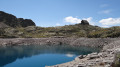
This first stage will take you to the Rabuons mountain hut, on the shores of the largest lake in the Alpes-Maritimes.The landscape is very rocky. You’ll come across plenty of Italians, as just across the border there are several mountain huts offering lovely routes via the nearby Pas de l’Ischiator.
⚠️ Allow around 4 hours for an average hiker in good physical condition to complete this walk.
Saint-Etienne-de-Tinée - Lacs de Vens - Small Pass of Tortisse
 7.52 mi
+5,942 ft
-1,342 ft
7 hrs
Very difficult
Departure from Saint-Étienne-de-Tinée (Alpes-Maritimes)
7.52 mi
+5,942 ft
-1,342 ft
7 hrs
Very difficult
Departure from Saint-Étienne-de-Tinée (Alpes-Maritimes)
First stage of a two-day hike in the Haute-Tinée.
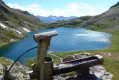
Ascent to the magnificent Lacs de Vens and the small pass of Tortisse via the Claï valley and Lac des Babarottes.
Plenty of marmots and chamois around the Lacs de Vens and below the small pass of Tortisse.