Col de Cloche and Baume Longe from Villard d’Abas

A lovely walk starting from Villard d’Abas, which begins in a light, open deciduous forest, leading to the old hamlet of Cloche, before changing sides of the mountain (once again through a beautiful larch forest) to reach Baume Longe. The descent is also through the forest, along the mountainside. It’s a bit more treacherous, so you’ll need sure-footedness!
Please note => check the route description on WP (7) before starting the descent.

Details

104704979
Creation:
Last update:
Last review:
  • Walking
    Activity: Walking
  • ↔
    Distance: 5.78 mi
  • ◔
    Average duration: 4h 50 
  • ▲
    Difficulty: Difficult

  • ⚐
    Back to start: Yes
  • ↗
    Ascent: + 2,516 ft
  • ↘
    Descent: - 2,523 ft

  • ▲
    Highest point: 6,801 ft
  • ▼
    Lowest point: 4,852 ft

Photos

Description of the walk

You can park in the car park at the departmental technical centre, just after the bridge on the D902 at the exit from Villard d’Abas, heading uphill.

(S/E) Cross the bridge then take the well-signposted path which starts on the right, at the side of the road.

(1) At the houses in Le Serre, turn right and follow the winding path through the mixed deciduous and coniferous forest up to the Pré de Cloche.

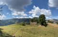
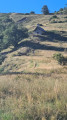
(2) Take the path on the right to visit the old hamlet of Petit Cloche, with a few ruined houses and beautiful alpine pastures.

(3) Turn back.

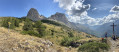
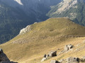
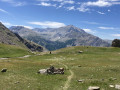
(2) Continue the route to the right towards the Col de Cloche. Pass through theold hamlet of Cloche, which is also in ruins except for the small Chapelle Saint-Médard, which has been restored, and one house that is still standing in 2026… but for how much longer? Then reach the Col de Cloche: take in the view of the Pain de Sucre, the old village and the valley.

(4) Continue to the Vallon des Pasquiers, on the other side of the mountain, on the north-facing slope.

(5) Turn left and follow the path through a pleasant larch forest, full of raspberry bushes.

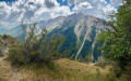
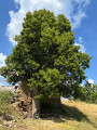
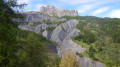
(6) Turn right to go round the mountain range to the west, along the cliff where you’ll see the remains of stone huts built against the rock face. You’ll reach Baume Longue, where a few ruins and a magnificent lime tree await you.

(7) Then head down to the left, southwards towards Villard d’Abas. Take care during this descent down the mountainside: there are a few fairly steep sections, with handrails installed at the most perilous points. Pass through the Roure, Goujan and then La Toure valleys in turn before coming out onto the D902.

(8) Follow the road to the left, walking carefully alongside it and taking great care to avoid cars and motorbikes. This will take you back to the starting car park (S/E).

Waypoints

  1. S/E : mi 0 - alt. 5,049 ft - Car park at the technical centre
  2. 1 : mi 0.21 - alt. 5,240 ft - Le Serre
  3. 2 : mi 0.87 - alt. 6,283 ft - The Petit Cloche junction
  4. 3 : mi 1.04 - alt. 6,453 ft - Le Petit Cloche
  5. 4 : mi 1.72 - alt. 6,752 ft - Col de Cloche
  6. 5 : mi 2.05 - alt. 6,752 ft - Pasquiers Ravine
  7. 6 : mi 2.76 - alt. 6,263 ft - Turn
  8. 7 : mi 2.84 - alt. 6,243 ft - Turn right
  9. 8 : mi 3.26 - alt. 5,935 ft - Baume Longe
  10. 9 : mi 5.3 - alt. 4,852 ft - D902
  11. S/E : mi 5.78 - alt. 5,052 ft - Car park at the technical centre - Bachelard (rivière)

Notes

The ascent and descent are through woodland, which is particularly pleasant during a heatwave.

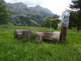
You can have a picnic at Baume Longe, near the ruins, in the shade of a magnificent lime tree where old planks serve as comfortable benches.

(7) The descent follows the mountainside. It is often steep with loose, slippery stones. Make sure you wear sturdy footwear

Worth a visit

(3) and (4) The former hamlets of Petit Cloche and Cloche.

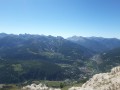
(4) Col de Cloche: view of the Pain de Sucre and the surrounding area.

Further on (6) huts beneath the cliff.

(7) Ruins of Baume Longe.

(5) And, if you visit in August, kilos of raspberries in the Ravin des Pasquiers. Yum!

Other walks in the area

For more walks, use our search engine .

The GPS track and description are the property of this route's author. Please do not copy them without permission.