OT Métabief

 Tourist office
- 6 Place Xavier Authier
- Tel:0381491381
- Website: http://www.rando-jura.com
Sign up:
Published route(s)
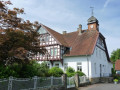
 The Mijoux Chapel
 3.19 mi
 +236 ft
 -207 ft
 1h 40
1h 40
 Easy
Easy
 Departure from Les Fourgs (Doubs)
A short route that takes you through various landscapes of the Haut Doubs whilst staying on paths or even small roads.
You’ll pass through part of the village along Rue des Fourgs. Enjoy your walk.
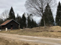
The Saracen rock
 6.25 mi
+361 ft
-361 ft
3h 10
Easy
Departure from Les Fourgs (Doubs)
6.25 mi
+361 ft
-361 ft
3h 10
Easy
Departure from Les Fourgs (Doubs)
This route takes you to the Belvédère de la Roche Sarrasine viewpoint through woodland and back along a small road to the village of Les Fourgs.