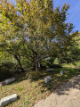
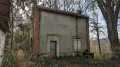
The Banquet Chapel in Mhère

This route takes you on a journey of discovery through the village of Mhère, its landscapes and its rich heritage.
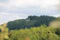
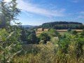
It’s an opportunity to discover the Notre-Dame du Morvan Chapel, situated at an altitude of 554 metres on top of a hill with a superb panoramic view. It overlooks the surrounding regions and the village of Mhère. One of the hills visible from here is nicknamed ‘the crocodile’.

Details

102801836
Creation:
Last update:
Last review:
  • Walking
    Activity: Walking
  • ↔
    Distance: 6.33 mi
  • ◔
    Average duration: 3h 35 
  • ▲
    Difficulty: Moderate

  • ⚐
    Back to start: Yes
  • ↗
    Ascent: + 764 ft
  • ↘
    Descent: - 751 ft

  • ▲
    Highest point: 1,801 ft
  • ▼
    Lowest point: 1,135 ft
  • ⚐ Country: France
  • ⚐
    Area: Morvan
  • ⚐ City: Mhère (58140)
  • ⚑
    Start/End: N 47.206967° / E 3.856836°
  • ❏
    IGN map(s): Ref. 2723ET, 2723SB
  • Hour-by-hour weather

Photos

Description of the walk

The route starts at the square by the church in Mhère.

(S/E) From this square, walk past the town hall and take the small road on the right which passes the school and the cemetery.

(1) At the junction, turn right, walk alongside the woods, cross the D238 and continue straight on.

(2) At the fork, take the path on the right up the hill, then, at the junction, turn left. Cross the D171, carry on straight ahead, then take the path on the right for 100 metres.

(3) Before reaching the hamlet of Jeaux, begin the climb to the left towards the Chapelle du Banquet by following the wide path on the left, which climbs first to the left, then to the right at the entrance to the woods.

(4) Ignore the two paths branching off to the right and continue your climb.

(5) Carry on straight ahead until you reach the Chapelle du Banquet (view over the Anguison valley).

(6) Retrace your steps.

(5) Turn left, ignoring the two paths on the right. You will then come to another junction.

(7) Turn left, leave the woods and carry on straight ahead, ignoring the other paths.

(8) At the T-junction, turn right, continue straight ahead on the D171 for 75 metres, then turn left.

(9) Carry on straight ahead, cross the Ruisseau de l’Étang de Chartes and return to the original fork in the path.

(2) Follow the route back in the opposite direction to return to Mhère (S/E).

Waypoints

  1. S/E : mi 0 - alt. 1,224 ft - Church Square, Mhère
  2. 1 : mi 0.38 - alt. 1,289 ft - Crossroads after the cemetery
  3. 2 : mi 0.94 - alt. 1,260 ft - Junction of the circular loop
  4. 3 : mi 1.94 - alt. 1,293 ft - T-junction before the hamlet of Jeaux
  5. 4 : mi 2.72 - alt. 1,716 ft - Straight ahead
  6. 5 : mi 3.04 - alt. 1,749 ft - Junction. Return trip to the Chapelle du Banquet
  7. 6 : mi 3.15 - alt. 1,801 ft - Chapelle du Banquet
  8. 7 : mi 3.77 - alt. 1,598 ft - Crossroads in the woods
  9. 8 : mi 4.48 - alt. 1,263 ft - T-junction before the D171
  10. 9 : mi 5.09 - alt. 1,135 ft - Étang de Chartes stream
  11. S/E : mi 6.33 - alt. 1,224 ft - Church Square, Mhère

Worth a visit

The Banquet Chapel: formerly known as ‘Banquet’ due to the lively feasts that brought the villagers together there. This site is home to a chapel erected in 1858. It was built on the initiative of André-Marie Dupin, mayor of Gâcogne, in memory of his late wife. Every year, a pilgrimage dedicated to the Virgin Mary was held there. It subsequently fell into disrepair and, in 1986, the Pro-Morvan association undertook its restoration, thereby breathing new life into this place steeped in history.

Microbrasserie du Banquet: founded in 2020 in the heart of the hamlet of Jeaux, the Microbrasserie du Banquet invites you to discover its range of craft beers, available to buy directly from the brewery. Guided tours are also organised to give you an insight into the secrets of the brewing process. To make a purchase or book a tour, please contact: 06 49 23 63 62.

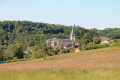
Saint-Germain Church in Mhère: nestled in the village square, this19th-century Neo-Romanesque church, built mainly of white stone, replaced an older church that once stood in the centre of the square and was partly destroyed by the Huguenots. Its carved capitals are particularly captivating when beautiful light floods the nave.

Other walks in the area

For more walks, use our search engine .

The GPS track and description are the property of this route's author. Please do not copy them without permission.