Country:
 City:


Small car park in the centre of the village of Herbelles.
(S/E) From the car park, head for the steps leading to Rue de l’Église. Follow this road straight ahead and, at the junction, turn right towards the church. You’ll reach a T-junction.
(1) Turn left onto Rue Titelouze. At the T-junction, turn right and, 50 metres further on, turn left into Rue Boquet. Follow this road until you reach a T-junction near the noisy A26.
(2) Follow the D198 to the left to reach Inghem. Cross the village, staying on the D198 heading due north, until you reach a three-way junction (Chapelle Notre-Dame de Lourdes on the left).
(3) Take the D212 on the left and, a few metres further on, take the path on the left (Phew!).
After 1.5 km, you’ll come to a small road; follow it to the left. Ignore the first path on the right.
(4) As you come out of the bend, take the track on the right (Chemin des Processions) to reach the first houses in Bientques. You’ll come to a T-junction.
(5) Turn left. When the road bends to the left, take the lovely path opposite to reach the D192. Follow it to the right until the next path branches off to the left.
(6) Follow this and, after 200 m, turn right onto the straight path. You’ll reach a wide track where you’ll find theGR®145(Via Francigena, colloquially known as the ‘Frangipane’ – but we’re foodies).
Turn left and follow it until you reach a T-junction.
(7) Turn left, then right towards Cléty d’Aval. At the entrance to the village, you’ll find a lovely pond with a picnic table. Turn left, staying on theGR®. Ignore the first path on the right and turn right onto the second lovely path, which is a bit damp in places and leads to a small road.
(8) Follow it to the left to join the D341. Cross the road (Take care!) and continue straight ahead until you reach a junction.
(9) Turn left, still followingthe GR® 145, to go round Dohem. Join the D190 near the sports ground. Follow it to the right and, at the three-way junction (Notre-Dame de la Salette Chapel), turn left to reach a crossroads.
(10) Turn left into Rue du Paradis. About 300 m further on, leave theGR® and take the path on the left. Just under a kilometre further on, you’ll reach a crossroads.
(11) Head straight ahead. (You are now on thePR® des Bonniarts but going in the opposite direction). At the three-way junction, turn left to reach the D193.
(12) Follow it to the left towards Upen d’Amont. When the D193 turns left, take the path on the right and join the D201.
(13) Do not join the road but take the path on the left to reach Upen d’Aval and Rue des Deux Upen.
(14) Follow the road to the left for about 200 m, then take the path on the right until you reach a wider track.
(15) Turn sharply left (leaving thePR® des Bonniarts) and head towards a junction.
(16) Turn right. Just before reaching the D341, take the grassy path on the right. 400 m further on, turn left (still on the grassy path) and reach the D341.
(17) Follow it to the right (with care!) for about a hundred metres, then take a path on the left. After a right-left turn, you’ll reach a junction.
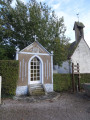
(18) Turn left. At the next junction, turn right towards Herbelles. Walk past the Chapel of Notre-Dame des Affligés and reach a T-junction.
(19) Take the street on the left. It turns right at a 90° angle before reaching a junction. Turn right to reach the car park in the centre of the village of Herbelles (S/E).

 Local authority
 Easy

 Visorando Member
 Difficult
 Very difficult