The Faing Martin circular to Les Voivres

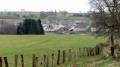
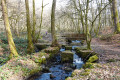
Starting from the Étang Lallemand, this route runs partly through the forest and partly across fields. You’ll be able to spot the remains of the Pont des Fées along the way and, with a bit of luck, you might even come across some of the local wildlife (roe deer and hares).

Details

n°35664300
Creation:
Last update:
Last review:
  • Walking
    Activity: Walking
  • ↔
    Distance: 2.75 mi
  • ◔
    Average duration: 1h 30 
  • ▲
    Difficulty: Easy

  • ⚐
    Back to start: Yes
  • ↗
    Ascent: + 276 ft
  • ↘
    Descent: - 299 ft

  • ▲
    Highest point: 1,289 ft
  • ▼
    Lowest point: 1,017 ft

Photos

Description of the walk

From Bains-les-Bains, take the D434 towards La Chapelle-aux-Bois, then the D4 towards Les Voivres. At the village, turn left onto Rue du Moulin, then left again at the first street. Follow this road to Étang Lallemand.

Yellow Ring signposting along the entire route

(S/E) With your back to the pond, take the road on the right for 600 metres until you reach the “La Clandestine” brewery.

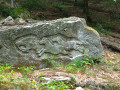
(1) Turn left onto a stony track towards Faing Martin and the old grindstone quarry, following the Red Disc and Yellow Ring markings. Continue through the forest.

(2) At the crossroads, turn right to cut across the fields. 250 m further on, turn left, skirting the edge of the forest, and continue to follow the Yellow Ring markings, heading straight ahead until you reach the forest entrance.

(3) Stay on this stony path.

(4) Turn left when you can no longer go straight on. Then ignore every junction and follow the stony path uphill to the building. At the junction by the building, head straight on towards the Pont des Fées.

(5) “Admire the remains of the Gallo-Roman structure”, and follow this same path for over 1 km to make a wide circular route to the left and reach the Étang Lallemand (S/E).

Waypoints

  1. S/E : mi 0 - alt. 1,102 ft - Lallemand Pond
  2. 1 : mi 0.37 - alt. 1,129 ft - Brasserie
  3. 2 : mi 0.64 - alt. 1,201 ft - Junction
  4. 3 : mi 1.51 - alt. 1,106 ft - Entering the woods
  5. 4 : mi 1.66 - alt. 1,030 ft - Turn left at the fork.
  6. 5 : mi 1.91 - alt. 1,093 ft - The Pont des Fées
  7. S/E : mi 2.75 - alt. 1,102 ft - Lallemand Pond

Notes

Thank you to the Club Vosgien for organising this walk and for the work carried out by its teams throughout the year to mark out and maintain these paths.

Worth a visit

  • (5) The Pont des Fées: dating from the 4th century, we are not certain that it was ever completed, let alone used. Indeed, the Roman Empire was already experiencing significant unrest along its borders, with incursions by ‘barbarian’ peoples such as the ‘Franks’ and the ‘Huns’. In this context (which was only set to worsen), funding engineering works was certainly not a priority unless it served a military purpose.

The construction of the bridge was undoubtedly driven more by economic than strategic considerations, given its proximity to the spa town of Bains-les-Bains and the Roman road.

Reviews and comments

4 / 5
Based on 2 reviews

Reliability of the description
4 / 5
Ease of following the route
4.5 / 5
Route interest
3.5 / 5
randokarine
randokarine

Overall rating : 4 / 5

Date of your route : Nov 13, 2025
Reliability of the description : ★★★★☆ Good
Ease of following the route : ★★★★★ Very good
Route interest : ★★★☆☆ Average
Very busy route : No

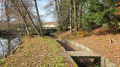
Yellow ring markings. A pleasant walk along wide dirt tracks and forest paths. Lallemand Pond is idyllic. You can walk around it, with some sections on wooden walkways (which can be slippery). But be careful depending on the time of year: in mid-November, when this walk took place, some areas around the Ru de Migaille stream were flooded with around ten centimetres of water and almost impossible to avoid. You're guaranteed to get your feet wet.
After point 1, the description takes you into the forest, but after point 2, there is no longer a path across the Maufroi field, which is entirely cultivated. Conclusion: at point 1, continue straight ahead on the wide stony path. Before turning left, you can make a short return trip of about a hundred metres to the orientation table at altitude point 406.
One last note: between point 5 and the finish, there is a sign indicating a short detour of about ten minutes (red round markings) to see the remains of the Forge Quénot (not shown on this map). However, the path is not maintained and fallen trees are almost impossible to cross or go around. Unfortunately, we had to turn back.
For a break, there is a shelter with a long bench seating about ten people at La Colosse (after point 4).

Machine-translated

Pat photos
Pat photos

Overall rating : 4 / 5

Date of your route : Jan 27, 2025
Reliability of the description : ★★★★☆ Good
Ease of following the route : ★★★★☆ Good
Route interest : ★★★★☆ Good
Very busy route : No

Hello,
I’ll have to do this walk again because I went the wrong way and had a bit of a struggle, but it’s my own fault.

Machine-translated

Other walks in the area

For more walks, use our search engine .

The GPS track and description are the property of this route's author. Please do not copy them without permission.