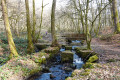
Route past Les Chicottes in Harsault

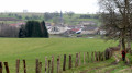
A hilly rural and woodland route within the Harsault municipal area.

Details

35987730
Creation:
Last update:
Last review:
  • Walking
    Activity: Walking
  • ↔
    Distance: 6.59 mi
  • ◔
    Average duration: 3h 25 
  • ▲
    Difficulty: Moderate

  • ⚐
    Back to start: Yes
  • ↗
    Ascent: + 407 ft
  • ↘
    Descent: - 420 ft

  • ▲
    Highest point: 1,276 ft
  • ▼
    Lowest point: 955 ft
  • ⚐ Country: France
  • ⚐ City: Harsault (88240)
  • ⚑
    Start/End: N 48.057883° / E 6.239238°
  • ❏
    IGN map(s): Ref. 3418O, 3419O
  • Hour-by-hour weather

Description of the walk

From La Vôge-les-Bains, take the D164 towards Darney. Turn right after five kilometres onto the D40 and continue to the Harsault town hall.

Red Disc signposting along the entire route

(S/E) With your back to the town hall, head to the right and join Rue du Centre, then turn right again. Carry on straight for 500 m, ignoring a path on the right and then another on the left, and turn right, following the Red Disc markings onto Chemin du Pont Canin. Cross a stream.

(1) When you reach the stony track, turn right twice so that you are walking alongside the forest. You will then enter the forest; continue straight on along the path, ignoring the various paths branching off to the left and right on either side. Cross the fields as you leave the forest to reach the end of the track.

(2) Turn left onto the stony track. Then follow the track alongside the woodland until you reach the junction.

(3) Turn left and carry on straight ahead. Veer slightly to the right, staying on the track as it descends gently. When you reach a junction with three paths, take the one on the far right and continue along the flat section, then head down through the fields to rejoin the woodland, keeping straight on at every junction.

(4) In the forest, take the path on the right and head downhill until you reach the road. Carry straight on and, at the ‘Give Way’ sign, turn left to cross the Canal de l’Est. You may spot an industrial site along the Canal des Vosges, reminiscent of the textile industry. Here, the bridge you cross is a swing bridge, allowing boats to pass through the canal.

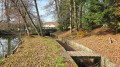
(5) Turn immediately right onto the cycle path and follow the river to the lock.

(6) Turn right twice to head up towards the forest. Take the path on the left at the fork. At the junction of the paths, carry on straight ahead; then, at the next junction, head up to the right until you reach the crossroads.

(7) Turn right. Carry on straight ahead and, when you reach the road – which goes slightly uphill and then downhill – carry on straight ahead at the ‘Give Way’ sign.

(8) Turn right to enter the village of Harsault, then turn left and go straight on twice to reach the end of the cul-de-sac. Turn left three times to return to the starting point (S/E).


Waypoints

  1. S/E : mi 0 - alt. 1,191 ft - Harsault Town Hall Square
  2. 1 : mi 0.5 - alt. 1,152 ft - Gravel path - Cailloux (ruisseau) - Affluent du Canal de l'Est
  3. 2 : mi 1.35 - alt. 1,175 ft - Turn left across the fields
  4. 3 : mi 1.88 - alt. 1,201 ft - Three-Way Junction
  5. 4 : mi 2.94 - alt. 1,142 ft - Forest
  6. 5 : mi 3.5 - alt. 958 ft - Rotating bridge - Côney (rivière)
  7. 6 : mi 4.18 - alt. 958 ft - Lock 24 - Canal de l'Est
  8. 7 : mi 5.1 - alt. 1,237 ft - Three-way junction
  9. 8 : mi 6 - alt. 1,217 ft - Give way to the right
  10. S/E : mi 6.59 - alt. 1,191 ft - Harsault Town Hall Square

Notes

Thank you to the Club Vosgien and the walking section of the MJC in Bains-les-Bains for organising this walk and for the work carried out by their teams throughout the year to signpost and maintain these paths.

Reviews and comments

4.7 / 5
Based on 2 reviews

Reliability of the description
5 / 5
Ease of following the route
5 / 5
Route interest
4 / 5
mondemeilleur88
mondemeilleur88

Overall rating : 4.7 / 5

Date of your route : Aug 05, 2025
Reliability of the description : ★★★★★ Very good
Ease of following the route : ★★★★★ Very good
Route interest : ★★★★☆ Good
Very busy route : No

A pleasant, very bucolic and relaxing route, with varied terrain and landscapes. Some maintenance is needed on the forest trails, which have overgrown vegetation and ruts. The village of Harsault is isolated and this area seems very quiet

Machine-translated

jeannebertha
jeannebertha

Overall rating : 4.7 / 5

Date of your route : Jul 24, 2023
Reliability of the description : ★★★★★ Very good
Ease of following the route : ★★★★★ Very good
Route interest : ★★★★☆ Good
Very busy route : No

An easy walk: pleasant stretches through the forest and along the canal (where you can have a picnic), but also long, straight sections that aren’t particularly interesting… Best avoided during hot weather

Machine-translated

Other walks in the area

For more walks, use our search engine .

The GPS track and description are the property of this route's author. Please do not copy them without permission.