


Refine your search for walks in La Bollène-Vésubie
La Bollène-Vésubie walks


 The Lantosque elephant via the Crête des Martourins
 Visorando Member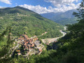
 8.77 mi
 +3,399 ft
 -3,428 ft
 7h 00
7h 00
 Difficult
 Departure from Lantosque (Alpes-Maritimes)
A pleasant hike thanks to its diversity. Wooded areas with different species of trees, beautiful views, ancient trails including the Crête des Martourins, and a finale in this little aquatic paradise where the elephant is located, a swimming spot once known mainly to the people of Lantosquois and its surroundings.
Tres Crous from Belvédère
 8.46 mi
+3,780 ft
-3,776 ft
7h 10
8.46 mi
+3,780 ft
-3,776 ft
7h 10
 Very difficult
Departure from Belvédère (Alpes-Maritimes)
Very difficult
Departure from Belvédère (Alpes-Maritimes)
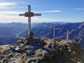
A challenging hike to reach the Tres Crous viewpoint, characterised by its three crosses and the panoramic view of the Vésubie valley stretching all the way to the sea.
The summit of Castel Vieil from Roquebillière
 6.38 mi
+2,785 ft
-2,759 ft
5h 20
Difficult
Departure from Roquebillière (Alpes-Maritimes)
6.38 mi
+2,785 ft
-2,759 ft
5h 20
Difficult
Departure from Roquebillière (Alpes-Maritimes)
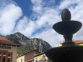
A very beautiful hike offering stunning views of the Vésubie Valley. The imposing Villette ridge overlooks the return trail. The route between points (8) and (9) bears witness to an ancestral agricultural past.
The giant fir trees of Maïris and the barns of Suorcas
 5.89 mi
+1,437 ft
-1,421 ft
3h 55
5.89 mi
+1,437 ft
-1,421 ft
3h 55
 Moderate
Departure from La Bollène-Vésubie (Alpes-Maritimes)
Moderate
Departure from La Bollène-Vésubie (Alpes-Maritimes)
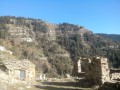
In the heart of the magnificent Turini Forest (3,500 hectares), the pass of the same name (1,674 metres) marks the climatic boundary between the Mediterranean hinterland of Nice and the mountainous "high country".
Olive groves give way to fir, beech and larch forests, which are ablaze with colour in autumn.
Throughout this loop, you will enjoy superb views of the entire region, including the Mounier, the Cime du Diable and the Vallon de la Maïris.
From Saint-Colomban to Peïra-Cava via the Maïris Forest
 Association / Club / Walk leader
 9.23 mi
+3,241 ft
-3,232 ft
7h 05
Difficult
Departure from Lantosque (Alpes-Maritimes)
9.23 mi
+3,241 ft
-3,232 ft
7h 05
Difficult
Departure from Lantosque (Alpes-Maritimes)
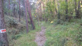
This beautiful walk takes us through the Saint-Colomban valley, the starting point of the walk. It can be reached from Lantosque by turning right onto a winding road for 5 km. Its hamlets – Gorblaou on the way out and Camari on the way back – have retained an undeniable charm (small colourful houses, orange lilies surrounding the fountain in Camari). The climb to the Peïra-Cava resort through the Maïris Forest allows us to encounter various species of trees: pines, chestnut trees, beech trees, firs and larches. Upon reaching the summit of Peïra-Cava, between Vésubie and Bévéra, we are treated to a panoramic view of the woodlands of the three surrounding villages: Lantosque, Moulinet and Lucéram.
Forest walk starting from the Col de Turini
 3.75 mi
+676 ft
-676 ft
2h 20
3.75 mi
+676 ft
-676 ft
2h 20
 Easy
Departure from La Bollène-Vésubie (Alpes-Maritimes)
Easy
Departure from La Bollène-Vésubie (Alpes-Maritimes)
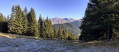
A short circular forest offering views of the mountains towards the Mediterranean, as well as the peaks of the Mercantour.
From the Calmette ridge to the barns at Suorcas, a circular route.
 9.43 mi
+2,543 ft
-2,516 ft
6h 35
Moderate
Departure from La Bollène-Vésubie (Alpes-Maritimes)
9.43 mi
+2,543 ft
-2,516 ft
6h 35
Moderate
Departure from La Bollène-Vésubie (Alpes-Maritimes)
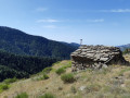
If you enjoy walks in the forest, this one is for you. This route, which runs mainly through a forest of larch, pine and spruce trees, starts at the legendary Col de Turini and takes you, via the Calmette ridge and then the Baisse de Patronel, to the Granges de Suorcas. The return journey is via the Piste de Tardei.
Col de Turini circular
4.66 mi
+1,201 ft
-1,207 ft
3h 10
Moderate
Departure from Moulinet (Alpes-Maritimes)
From the Col de Turini, the trail climbs steadily towards the Cime de la Calmette, alternating between forest and open areas. The ascent is via a wide, safe path to the summit, which offers a beautiful view of the valley. The crossing to the Baisse de Patronel follows a pleasant path. The return journey, along a balcony path, becomes more challenging in places, with a few narrow passages requiring caution. A varied, bright and panoramic route, ideal for hikers accustomed to mountain terrain. Time: approximately 4 hours.
 Crête de l'Arpiha from Camp d'Argent
 5.46 mi
+1,142 ft
-1,129 ft
4 hrs
Moderate
Departure from La Bollène-Vésubie (Alpes-Maritimes)
5.46 mi
+1,142 ft
-1,129 ft
4 hrs
Moderate
Departure from La Bollène-Vésubie (Alpes-Maritimes)
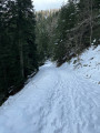
A lovely, easy forest hike. Some beautiful views of the surrounding peaks.
The fortifications of the Authion massif
 8.75 mi
+1,959 ft
-1,929 ft
5h 45
Moderate
Departure from La Bollène-Vésubie (Alpes-Maritimes)
8.75 mi
+1,959 ft
-1,929 ft
5h 45
Moderate
Departure from La Bollène-Vésubie (Alpes-Maritimes)
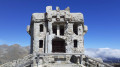
In April 1945, the entire Authion massif was the scene of fighting that led to the liberation of the Alpes-Maritimes. This route passes through the main fortifications of the Alpes-Maritimes fortified sector (SFAM). Apart from its historical significance, this circular route offers magnificent panoramic views of the high peaks of the Mercantour to the north and the Mediterranean to the south.
La Baisse de Camp d'Argent – Sospel
 13.53 mi
+1,670 ft
-6,289 ft
10 hrs
Very difficult
Departure from La Bollène-Vésubie (Alpes-Maritimes)
13.53 mi
+1,670 ft
-6,289 ft
10 hrs
Very difficult
Departure from La Bollène-Vésubie (Alpes-Maritimes)
The sixth stage ofthe GR®52, where the landscapes change dramatically. Due to its length and significant descent of nearly 2,000 metres, the stage is very difficult. The descent to Sospel, which makes up two-thirds of the route, puts a real strain on the knees and ankles. Please note, it gets very hot in summer on this section.
Circular walk around the Vallon and the Baisse de Peïra Cava
8.44 mi
+3,235 ft
-3,212 ft
6h 40
Difficult
Departure from Lantosque (Alpes-Maritimes)
We were charmed by this pleasant walk because of its shaded nature.
Indeed, the path winds its way mostly under the shelter of the trees, allowing you to enjoy the pleasant woodland setting. The view is rarely unobstructed, but the route offers a rich variety of flora and geological features.
The path is very even and gradually ascending: except on the return leg, where the climb is concentrated in a series of short hairpin bends, though these are shaded, making the effort quite manageable. The walk is well worth the detour
The four fortified structures of Authion
 4.86 mi
+1,467 ft
-1,463 ft
3h 30
Moderate
Departure from La Bollène-Vésubie (Alpes-Maritimes)
4.86 mi
+1,467 ft
-1,463 ft
3h 30
Moderate
Departure from La Bollène-Vésubie (Alpes-Maritimes)
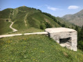
This area with its four fortifications located at high altitude was the scene of fierce fighting, both in 1793 when the French invaded the County of Nice, and in April 1945, during one of the last battles between the German army and the Allies. These stone and cement structures, bearing multiple cannon and gunshot marks, bear witness to the violence of these final confrontations.
The forts of Authion
 4.18 mi
+1,102 ft
-1,070 ft
2h 55
Easy
Departure from La Bollène-Vésubie (Alpes-Maritimes)
4.18 mi
+1,102 ft
-1,070 ft
2h 55
Easy
Departure from La Bollène-Vésubie (Alpes-Maritimes)
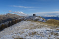
Located on the borders of the Vésubie, Bévéra and Roya valleys, Authion is the southernmost peak in the Alps above 2,000 metres.
Hiking its three peaks (Pointe des Trois Communes, Forca and Mille Fourches) offers magnificent panoramic views between the Mediterranean Sea and the Mercantour massif.
It is also an opportunity to discover its ancient military forts, which guarded the French-Italian border from the end of the19th century until the end of the Second World War.
More walks in La Bollène-Vésubie
Select a point of interest below: