Country:
 City:
City:


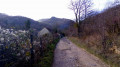
Car park in the hamlet of Maillot, at the junction of the Chemin de Maillot and Chemin des Mercureaux. Yellow Trail markings. Some sections are unmarked.
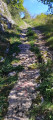
(S/E) Head up the Chemin de Maillot (mountain bike route 114). The road becomes a gravel track. Shortly after the hairpin bend, at the sign reading ‘No entry except for local residents’, climb up the path on the right, where the markings disappear. At a ruined hut, it veers sharply to the right and quickly becomes a path climbing up the wooded hillside. At the top, look out for a small track branching off to the right towards the nearby Mercureaux viewpoint.
(1) Continue the climb along this well-defined track, which leads to marker post No. 61 at a crossroads of paths. Turn left, leaving the signposting behind, onto the path that follows the ridge. There are a few trees marked with white paint. Go round a rocky outcrop on the left, then climb up it, descending on the other side of the ridge. You’ll pass a small stone marker and reach a fork in the path (hidden by a dead tree); continue to the left.
(2) You’ll soon reach an old dry-stone wall and a fork in the path (marked ‘Trail 7’ in the opposite direction to your walk). Carry on to the left and stay on the ridge, ignoring the paths leading down to the right. After walking alongside a low wall, at its end, step over the scree to make your way carefully to the viewpoint. Continue the descent to reach a stony track, which you’ll follow uphill to the right (Route 9) as far as the hunting lodge.
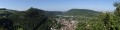
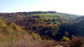
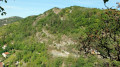
(3) Carry on to the left across the pasture to the viewpoint overlooking the Doubs valley. There’s a bench here for a break.
(4) Carry on straight ahead along the edge of the trees lining the cliffs and, after about fifteen metres, you’ll come across a small, inconspicuous path on your left which continues to follow the cliffs and leads you to the Baume Martin (a ‘baume’, derived from the Gaulish word ‘balma’, is a rock shelter). Return to the pasture and head off to the left; at the corner of the pine copse, turn left for a 50-metre round trip to a viewpoint overlooking Planoise. Return to the corner of the pine copse and then to the bench.
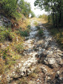
(4) Carefully make your way down along the ledges; the path may be slippery. Shortly after leaving the ledges, you’ll come to a fork. Head down to the right, following the signposts. You’ll reach the Chemin du Sert and its ancient Celtic track with ruts carved into the rock. Head left up the tarmac Maillot road for about 300 metres and, at the corner by a gate, turn right down the path that passes in front of the Bout du Monde waterfall, which is more visible when the leaves have fallen. After the waterfall, at the fork, carry on straight ahead and turn left into Rue de la Cascade. Immediately after the footbridge, take a quick detour down the small cobbled lane opposite on the right to have a look at the old washhouse. Retrace your steps and carry on straight ahead.
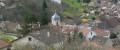
(5) At the next fork, head straight up the dead-end lane. Push open the gate and, after about thirty metres, veer diagonally to the right, then follow the stream to reach the end of a pretty little valley where the Pisseur will delight you with its two waterfalls. Stop at the first one. A path leads to the second one, but be careful: whilst the climb may seem easy, the return journey looks rather perilous to me! Head back towards the gate and climb straight up the meadow, veering slightly to the left. Don’t stray into the pasture – the path is on communal land, but the meadow is private. At the edge of the wood, there is an opening in the wire fence. Follow the path. Don’t miss, higher up, a narrow track on the right leading down to the stream, where you can see the gorge’s exit as a waterfall. Continue the climb carefully along the steep path: the stones, which are always damp, are slippery! The track veers to the left and joins a signposted path; head down to the right. About fifty metres further down, don’t miss a small, barely visible path to the left, just a few metres long, which leads to the viewpoint overlooking the old village of Beure. But be extremely careful – the viewpoint is not secured! Return to the path and continue your descent. You’ll rejoin the Chemin de Maillot, which you follow to the right for 200 metres to reach the car park. (S/E)
 The route includes ledge paths and unsecured viewing points. Despite the short distance, the walk is challenging and requires sure-footedness. Take care with children along the ledges. The paths are rocky and slippery in places. Sturdy footwear is essential and the use of walking poles is recommended.


 Visorando Member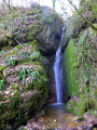
 Easy
Easy