Country:
 City:
City:


There is a small car park on the right, halfway up the dead-end road from Côte Blanche to Beure. The route is marked with red-and-white and yellow-and-blue markings, but most of the route will be unmarked.
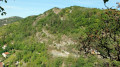
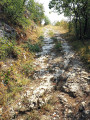
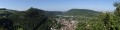
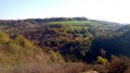
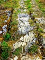
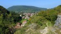
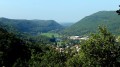
(S/E) Walk up the street, which becomes a path that climbs steeply up the hillside to the right of the water tower. Note the ruts left in the rock by our ancestors’ carts with iron-rimmed wheels. At the first fork, take the left-hand path. At the top, there are beautiful, though unsecured, views over the Doubs valley and, a little further on, from a clear spot, over the hills of Arguel and Fontain.
(1): Shortly after a forest sign no. 20, at the crossroads of paths, head down to the left, passing through a shady fir forest, then a lovely wooded valley. Continue straight ahead along this path, keeping the ledges on your left in sight at all times. On reaching a plateau, the path veers slightly to the right to join, at a fir forest, a straight ridge path. Head down to the left until you reach its end, which forms a small rocky outcrop.
(2) Caution! Retrace your steps for about seventy paces and turn left (at a right angle) onto a path that becomes faintly visible at the foot of a tree stump. Another landmark may help: on your way back from the small rocky outcrop, you’ll pass a forest signpost no. 24; the stump is about fifteen paces further on.
You’ll pass to the left of a hunter’s lookout post. The path descends into a superb valley with slender trees, ending in a beautiful gap between the rocks. Do not go down there under any circumstances, but climb back up the other side, carefully skirting the rocky ledges on your left.
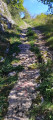
You’ll reach a viewpoint overlooking the valley through the trees. With a little more care, you’ll soon find your way back onto more well-trodden paths. With your back to the valley, you must not head towards the second gap on your left. You should spot a straight track that climbs gently up the wooded hillside. It starts between signposts 26 and 27 and, further up, two red loggers’ markings. The track becomes more distinct as you climb, then turns into a lovely path.
(3) You’ll reach a stony, signposted path (phew!) which you should take to the left. When the path splits into three, simply continue along the stony path on the right, following the signposts. Soon, you’ll come to another post (no. 61); head down to the right despite the crosses to reach the viewpoint.
(4) 200 metres further down – about a 5-minute walk – look out for a small clearing in the trees on the left and a path leading to the viewpoint over the Mercureaux Valley, the Arguel valley and its jagged rocks. There’s a bench here for a short break. Continue your descent towards the hamlet of Maillot. You’ll come to a lovely stony track which you follow uphill to the right.
Further up, for the more adventurous, when the path levels out onto a plateau, just before a fir forest, look out for an unassuming track on the right which will become a ridge path leading to a viewpoint over the Mercureaux Valley through the trees. Do not go any further than a small dry-stone wall; step over the scree to carefully reach the unsecured viewpoint, then turn back.
For those who prefer an easier route, carry on straight ahead along the stony path to the hunting lodge. Turn left into the pasture and head towards the ledge.
(5) You’ll reach a lovely viewpoint with a bench overlooking the Doubs valley. Head back down carefully along the path that runs along the ledges. The view is magnificent, but take care – the stony path is close to the edge. A little further down, at the fork, take the sharp right-hand bend. Further down still, you’ll join a wider track – the ancient Roman road with its ruts carved into the stone. Head down to the right until you reach the tarmac road known as the Chemin de Maillot. Head back up to the left for three hundred metres.
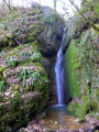
(6) Head down to the right along the path that starts between the metal gate and the crash barrier. You’ll pass the Bout du Monde waterfall, which unfortunately isn’t always visible at certain times of year – a few trees need pruning. At the bottom, go straight on, ignoring the footbridge on the left. You then head up Rue de la Waterfall and, after walking alongside a wall, turn left, passing the wayside cross and the Tree of Liberation. Immediately turn right up Rue de la Côte Blanche to return to the car park (S/E).
 Do not attempt this route during the wet season. The paths are rocky and slippery in places. The route includes ledge paths and unsecured viewpoints. Sturdy footwear is essential and the use of walking poles is recommended.
 Visorando Member
 Easy
Easy