Country:
 City:
City:



Small car park on the right, halfway up the dead-end road from Côte Blanche to Beure. Marked with yellow-red, yellow-blue and ‘Trail’ signs, but a large part of the route will be unmarked.
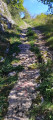
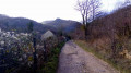
(S/E) Walk up the street, which soon turns into a path climbing steeply up the hillside, to the right of the water tower. Along the way, look out for the ruts left in the rock by our ancestors’ carts with iron-rimmed wheels. You’ll reach a junction of paths.
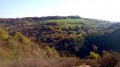
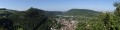
(1) Pass the first path on your right. Climb a good twenty steps further and continue up the path on the left which winds its way up the hillside. At the top, several unsecured viewing points offer views over the Doubs valley. A little further on, a clearing provides a panoramic view of the hills of Arguel and Fontain. Shortly after a forest sign marked No. 20, you’ll reach a crossroads. Head down to the far right to return to the junction you passed on the way up.
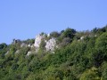
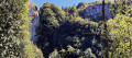
(1) Then turn left onto the path that climbs very steeply up the hillside. You’ll pass above a pile of stone gathered from fields, a remnant of the terraced farming of our Besançon hills. Ignore a small track on your left, staying on this almost straight and very steep path. At the top, near the rocks, the path splits. Head left for a few metres to catch a glimpse of the Baume Martin.
(2) Carefully continue along the path that passes above the small cave for an unsecured viewpoint over the Doubs valley, the Côte de Planoise and the new town of Planoise. Then turn right onto the path that emerges from the copse. Continue straight on for fifty metres as you leave the copse, taking the meadow path on the right which leads to a bench and a viewpoint over the valley.
Set off again, descending carefully along the path that runs along the ledges. The view is magnificent, but take care: the stony path is close to the edge. Continue along this steep but well-defined path until you reach a fork.
Take a sharp right-hand bend. Further down, you’ll join a wider track, the ancient Roman road with its ruts carved into the stone. Head down to the right until you reach the tarmac road known as the Chemin de Maillot. There’s a bench here for a short break. Then head back up to the left for three hundred metres.
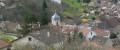
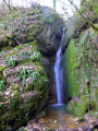
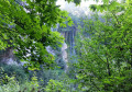
(3) Head down to the right along the path that starts between the metal barrier and the crash barrier. You’ll pass the Bout du Monde waterfall, which unfortunately isn’t always visible at certain times of year; a few trees could do with pruning. At the bottom, cross the footbridge to the left, passing the Château de Metz (Rue de la Waterfall). Turn right at the next junction (Rue de la Pisseure). At number 20 bis, continue a few more metres to the right to find the narrow lane leading to the old washhouse.
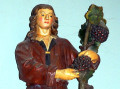
(4) Retrace your steps and continue to the right until the next junction, then turn right again. You may feel as though you’re entering the private grounds of a house, but you’ll spot a small gravel path on your right. Turn round for a view of the rocks at the Cascade du Bout du Monde. After the footbridge, you’ll reach Rue de la Cascade; turn left, passing the Lucien Roy Museum. Cross the road and walk down Rue de la République to the church. Pay a visit to Saint-Vernier (on the right inside the church) in memory of our Comté winegrowers.
(5) Walk round the church to the left, reach a flight of steps which you climb on the right, then rejoin Rue de Besançon. Cross it at the pedestrian crossing and walk back up the street to find another flight of steps leading to the foot of the car park. (S/E)
 Visorando Member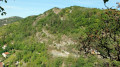
 Easy
Easy