The Mercureaux Valley

Fans of alpine races who chant the Sambre et Meuse song as they run, move along. If, on the other hand, you like to make long speeches to one of our good old Montbéliard cows encountered along the way and find them very witty, if you like to trudge along our Cambrousard trails, then enjoy the charm of this peaceful walk along the Mercureaux stream where, it is said, a temple dedicated to the god Mercury stood in ancient times.

Details

65207
Creation:
Last update:
Last review:
  • Walking
    Activity: Walking
  • ↔
    Distance: 5.25 mi
  • ◔
    Average duration: 2h 55 
  • ▲
    Difficulty: Easy

  • ⚐
    Back to start: Yes
  • ↗
    Ascent: + 548 ft
  • ↘
    Descent: - 541 ft

  • ▲
    Highest point: 1,506 ft
  • ▼
    Lowest point: 1,010 ft
  • ⚐ Country: France
  • ⚐ City: Fontain (25660)
  • ⚑
    Start/End: N 47.20102° / E 6.024426°
  • ❏
    IGN map(s): Ref. 3323ET
  • Hour-by-hour weather

Photos

Description of the walk

(S/E) Fontain cemetery car park. Follow the Grands Prés route, yellow-blue markings. Pass in front of the war memorial with the church on your right, then turn immediately left, going around the cemetery, to reach Rue du Mouthier and then Impasse du Prays, the first fork on the left. Nice view of the church.

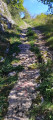
(1) 800 metres from the start, turn right onto a small path hidden between two houses, just at the route sign and before the electrical transformer. This path climbs perpendicularly. At the last house, take the path on the right which joins a small tarmac road via a staircase.

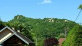
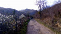
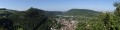
(2) Turn right onto this road, which leads to the Vallée des Mercureaux, and continue along it, ignoring the stony path on the left at the edge of the copse, which descends towards Maillot. Take the time to turn around and enjoy the lovely view of the jagged Arguel mountains and the beautiful Arguel hill. If you have good eyesight and a little luck, you may even spot some chamois grazing in the pastures below. Try to imagine the old medieval castle on this jagged ridge.

(3) Along the way, nature beckons us with the Petit and Grand Treuchot hills. The road joins another, less well-maintained road, so turn left down into the Val des Mercureaux. You will pass under the four-lane road, which has somewhat spoiled the virginity of this valley.

(4) When you come within sight of the farms at Chapelle des Buis, turn left onto a recently gravelled path. By the time you pass through, it may have been tarmacked. You will walk alongside the Mercureaux stream.

(5) The road turns into a forest path and you will ford the stream and enter a small, shady gorge. Take care when the path begins to descend, as the stones are slippery underfoot.

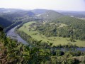
(6) You arrive at the hamlet of Maillot with a lovely view of the Arguel rocks. A yellow-blue marker on an electricity pole invites you to turn left at the first small bridge on Rue Euvrard. The path becomes stony as it enters the forest and, after a few bends, we find ourselves back on the small tarmac road that descends from Fontain. Along the way, there are views of the old village of Beure and the Arguel valley.

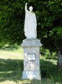
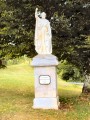
(7) Go up to the right to the roundabout, ignoring the steps we came down. Say hello to old Saint-Pierre, who has sadly lost his shepherd's crook, then turn your back on him and head for Impasse Prays opposite the pedestrian crossing. You will soon find the signs and the car park.

(8) Alternatively, about 50 metres from the transformer, after a house, you will find a small passage on the right and can walk diagonally down the field. When I passed by, a municipal employee had mowed a small path there. Otherwise, return by the road, going around the cemetery again, which you can take the time to visit to discover old graves (S/E).

Waypoints

  1. S/E : mi 0 - alt. 1,444 ft - Fontain cemetery car park
  2. 1 : mi 0.26 - alt. 1,473 ft - Electrical transformer
  3. 2 : mi 0.38 - alt. 1,434 ft - Vallée des Mercureaux
  4. 3 : mi 1.17 - alt. 1,430 ft - Vallée des Mercureaux
  5. 4 : mi 2.06 - alt. 1,237 ft - Chapelle des Buis
  6. 5 : mi 2.74 - alt. 1,138 ft - Forest path
  7. 6 : mi 3.48 - alt. 1,010 ft - Maillot
  8. 7 : mi 4.53 - alt. 1,391 ft - Les Vanches
  9. 8 : mi 5.09 - alt. 1,467 ft - Cemetery
  10. S/E : mi 5.25 - alt. 1,444 ft - Fontain cemetery car park

Reviews and comments

4.2 / 5
Based on 8 reviews

Reliability of the description
4 / 5
Ease of following the route
4.1 / 5
Route interest
4.4 / 5
CK25
CK25

Overall rating : 4 / 5

Date of your route : Apr 13, 2021
Reliability of the description : ★★★★☆ Good
Ease of following the route : ★★★★☆ Good
Route interest : ★★★★☆ Good
Very busy route : Yes

very pleasant

Machine-translated

Ecrid
Ecrid
• Edited:

Overall rating : 4.7 / 5

Date of your route : May 26, 2020
Reliability of the description : ★★★★★ Very good
Ease of following the route : ★★★★★ Very good
Route interest : ★★★★☆ Good
Very busy route : No

A pleasant, easy hike. Alternates between pastureland and woodland. The second part, after passing near the motorway , is the most attractive.

Machine-translated

elisabeth1957
elisabeth1957

Overall rating : 4 / 5

Date of your route : Feb 16, 2019
Reliability of the description : ★★★★☆ Good
Ease of following the route : ★★★★☆ Good
Route interest : ★★★★☆ Good

Lack of signposting in the first section up to point 4.
A somewhat hesitant start. For us, there was far too much road to point 4.
That said... a nice little hike to stretch your legs. The second part is very pleasant along the stream in the woods.
Nice view of Beurre and Besançon.
Worth doing...

Machine-translated

jp25
jp25

Overall rating : 4.3 / 5

Date of your route : Mar 11, 2018
Reliability of the description : ★★★★☆ Good
Ease of following the route : ★★★★☆ Good
Route interest : ★★★★★ Very good

A pleasant walk to enjoy with the family, even with young children.

Machine-translated

fadette
fadette

Overall rating : 5 / 5

Date of your route : Apr 18, 2016
Reliability of the description : ★★★★★ Very good
Ease of following the route : ★★★★★ Very good
Route interest : ★★★★★ Very good

I have become a big fan of Visorando. It's a beautiful walk and not difficult. We had to turn back after a while and start again from scratch. The path is not very visible and starts just after the cemetery. Make sure you have the church behind you and this path is right at the start of the walk. That was the only mistake we made. The rest was perfect.

Machine-translated

fadette
fadette

Overall rating : 4.7 / 5

Date of your route : Apr 03, 2016
Reliability of the description : ★★★★☆ Good
Ease of following the route : ★★★★★ Very good
Route interest : ★★★★★ Very good

Perfect information sheet. We had no difficulty finding our way around.

Machine-translated

Hubert C.
Hubert C.

Overall rating : 4 / 5

Date of your route : Aug 28, 2014
Reliability of the description : ★★★★☆ Good
Ease of following the route : ★★★★☆ Good
Route interest : ★★★★☆ Good

The route is well detailed and matches the map. However, for convenience, I chose to start from the roundabout at the entrance to the village when coming from Arguel. I plan to do it again in the opposite direction.
Thank you.
Hub

Machine-translated

tonnoguh
tonnoguh

When suggesting these short walks, for safety reasons, I prefer to start them from a car park whenever possible.

Machine-translated

Isabelle57
Isabelle57

As a resident of the Mercureaux Valley, just above the farm mentioned in the itinerary, I think the walk could start outside the village centre to avoid confusion in the village streets (for example, starting at the roundabout where the famous statue of St Peter stands). In my opinion, the description is very complimentary...It's true that, as I often walk along the paved section of the route, I no longer think to observe all the details mentioned by Annidoux. I think the walk takes about 2½ hours, not 15 minutes as mentioned by a member of the forum. On my next walk along a large part of this route, I will try to "rediscover" the "interesting" points mentioned by the author of the walk. Isabelle

Machine-translated

POULIN Gérard
POULIN Gérard ★

Thank you, Claude, for your responsiveness and this correction. This forum is really useful for all of us, hikers and authors alike. The site is greatly enhanced by all of you. Well done!

Machine-translated

tonnoguh
tonnoguh
• Edited:

Annidoux's comment is correct, there was an inaccuracy at the start: you have to pass in front of the monument with the church on your right. I will correct this. The small path is not easy to find, but the landmarks given seem sufficient to me: 800 metres from the start, take a small path on the right, slightly hidden between two houses, just at the route sign and before the electrical transformer. As for the rest, I think there is always something to be found in the village's winding streets, here a pretty view of a bell tower, there a fountain, etc. In any case, thank you for Gérard's friendly and moderating support.
Best regards to you all.
Claude

Machine-translated

POULIN Gérard
POULIN Gérard ★

Hello Annidoux,
thank you for your comment on this hike. This route seems to me to be well described with precise landmarks, and yet you lost your way on this hike. The author will no doubt give us their point of view.

Machine-translated

annidoux
annidoux

Overall rating : 2.7 / 5

Date of your route : Jul 14, 2014
Reliability of the description : ★★☆☆☆ Disappointing
Ease of following the route : ★★☆☆☆ Disappointing
Route interest : ★★★★☆ Good

The route looked interesting, but the description turned out to be insufficient: which way should you walk past the war memorial? Apparently with your back to the church (we realised this after making a pointless detour ). You then have to take a path that is very difficult to see, which we missed...

When we realised, we were further away, so we decided to follow another route... We didn't understand the point of the twists and turns in the village before starting the actual hike... which looked interesting, so with a little more description, we'll definitely give it another try.

Machine-translated

Other walks in the area

For more walks, use our search engine .

The GPS track and description are the property of this route's author. Please do not copy them without permission.