From Les Canaux to Le Grand Serré

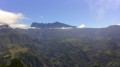
This walk takes you to Les Canaux in Le Grand Serré, a village you pass through on your way to Les Makes, offering beautiful panoramic views of this part of the island. There are several information boards along the first part of the route, providing details about the plant species you’ll encounter. There are no particular difficulties on this walk apart from the descent at Ravine Montplaisir, which is technically challenging and can be slippery depending on conditions.

Details

n°197858
Creation:
Last update:
Last review:
  • Walking
    Activity: Walking
  • ↔
    Distance: 2.70 mi
  • ◔
    Average duration: 2h 15 
  • ▲
    Difficulty: Average

  • ⚐
    Back to start: Yes
  • ↗
    Ascent: + 1,138 ft
  • ↘
    Descent: - 1,129 ft

  • ▲
    Highest point: 2,372 ft
  • ▼
    Lowest point: 1,686 ft

Photos

Description of the walk

Access: From Saint-Louis, take the road leading to Les Makes, passing the Lycée Antoine Roussin and the Parc du Gol. Pass the park and continue to the end of the road. From there, turn right towards La Rivière (signposted). Then take the second road on the left towards Les Canaux (signposted). Drive up to the village, pass the church and park in the next car park on the left.

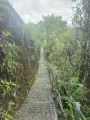
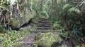
(S/E) The footpath starts opposite the car park. There is an information board to the right of the footpath. Several other information boards will be found along the route. The path runs alongside the rampart and a drainage channel. Some sections have been carved out of the rock. After 10 minutes on level ground, the path descends into the Montplaisir Ravine, which you’ll need to climb back up for about ten metres. Watch your step – it’s slippery!

The path continues on the other side of the ravine and climbs towards the Route des Makes. Then ignore the two inconspicuous paths on the left which lead to drainage channels. After a 5- to 10-minute climb, the path runs alongside the sugarcane fields before descending to the road.

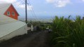
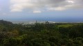
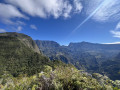
A footbridge has been built on the roadside, along with a viewpoint at the end of the footbridge. From here, you can see the Chaîne de la Plaine du Bois de Nèfles and the Pente Tunnel bandstand. You can even make out the rest of the route.

(1) Then turn right towards Le Grand-Serré. Walk uphill to the football pitch.

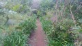
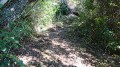
(2) Once past the pitch, turn right onto the inconspicuous path running alongside it. The path, which is slippery and steep, leads in 10 minutes to the Ravine Montplaisir, which you’ll need to cross. A short 10-minute climb is required before reaching the Canaux picnic area.

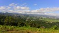
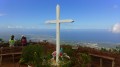
(3) At this area, keep to the right at every junction until you reach the exit, then cross the area. After this, the wide, slippery path passes in front of the Pente Tunnel kiosk. From there, you’ll be treated to a view of the coast and the Grand-Serré. Don’t hesitate to bring something to pick guavas with, as this section is teeming with them when they’re in season! (May–June).

(4) Further on, it is possible to take the steep shortcut.
Ten minutes after the kiosk, the path leads to a reservoir. Follow the concrete road to its end.

(5) Carry on straight ahead to the car park (S/E).

Waypoints

  1. S/E : mi 0 - alt. 1,722 ft - Car park
  2. 1 : mi 0.7 - alt. 1,988 ft - Turn right towards the Grand Serré
  3. 2 : mi 1.2 - alt. 2,326 ft - Turn right after the football pitch
  4. 3 : mi 1.63 - alt. 2,283 ft - Picnic area
  5. 4 : mi 2.11 - alt. 2,083 ft - Shortcut
  6. 5 : mi 2.63 - alt. 1,788 ft - Carry on straight ahead towards the car park
  7. S/E : mi 2.7 - alt. 1,722 ft - Car park

Notes

Bring something to pick guavas with when they’re in season (May–June).
Shelter is available at the picnic area.
The Pente Tunnel kiosk at the end of the trail.
The path may be slippery depending on weather conditions: please wear suitable footwear.

Worth a visit

Viewpoint from the Pente Tunnel kiosk
Picnics can be enjoyed at the designated picnic area or at the Pente Tunnel kiosk.
For the more adventurous, there’s the option of taking a detour via Le Trou and the Forêt trail (allow an extra 2 hours).

Reviews and comments

4.3 / 5
Based on 2 reviews

Reliability of the description
4.5 / 5
Ease of following the route
4 / 5
Route interest
4.5 / 5
Kricri
Kricri

Overall rating : 4.7 / 5

Date of your route : Jan 06, 2025
Reliability of the description : ★★★★★ Very good
Ease of following the route : ★★★★☆ Good
Route interest : ★★★★★ Very good
Very busy route : No

A very pleasant, shaded route. The route diverges slightly before point 3, but if you follow the best-maintained path, you’ll find your way back on track – though this is after point 3.
There are two ravines to descend and climb back up.

Machine-translated

Jacques ARCC
Jacques ARCC
• Edited:

Overall rating : 4 / 5

Date of your route : Dec 07, 2024
Reliability of the description : ★★★★☆ Good
Ease of following the route : ★★★★☆ Good
Route interest : ★★★★☆ Good
Very busy route : No

A walk on Saturday 7 December 2024 with a group of 15 people.
A short walk with no difficulties whatsoever, despite some steep climbs in the first section. Magnificent scenery, often in the shade.
Not to be undertaken in damp or rainy weather. Walking poles recommended.

Machine-translated

Other walks in the area

For more walks, use our search engine .

The GPS track and description are the property of this route's author. Please do not copy them without permission.