The Estéron, the Clue de la Clave, Gilette, Chemin de Reculon

This is a superb hike, varied, picturesque and panoramic, with the added bonus of passing through a beautiful village. What's more, it is not too difficult and therefore accessible to most hikers with a little training. It should be added that this route is very often shaded and therefore pleasant in hot weather. The markings and signposts are sufficient to prevent you from getting lost.

Details

19695474
Creation:
Last update:
Last review:
  • Walking
    Activity: Walking
  • ↔
    Distance: 7.05 mi
  • ◔
    Average duration: 4h 45 
  • ▲
    Difficulty: Moderate

  • ⚐
    Back to start: Yes
  • ↗
    Ascent: + 1,683 ft
  • ↘
    Descent: - 1,667 ft

  • ▲
    Highest point: 1,880 ft
  • ▼
    Lowest point: 397 ft

Photos

Description of the walk

Parking is available at a few spots near marker 16, on the M2209 near the Pont de l'Estéron bridge on the west side.

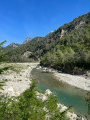
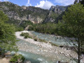
(S/E) The hike starts on a small private road that is only accessible to residents and is closed by a barrier. This road, which is very quiet, runs alongside the Estéron and already offers some beautiful views. Follow this road straight ahead for about 3 km.

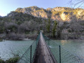
(1) A footbridge allows you to cross the Estéron on the right in a fun way. Continue on the path that extends from it.

(2) At the end of this bucolic residential area, the discovery trail begins, climbing towards Gilette through magnificent pine trees.
At marker 5, continue straight ahead. The track joins a tarmac road.

(3) Turn right and climb back up towards the village.

(4) When you reach the car park, take the stairs to continue climbing up to the village.

(5) At the end of the stairs, turn left (towards the east), cross a street and follow the markings along a road (see also: During the hike or nearby). Leave the road at the bend before marker 18.

(6) At marker 18, head towards the Reculon path, which is still very well marked.
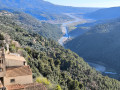
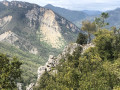
This section takes you to the highest point of the hike, with magnificent views to the east and south.
You will arrive in a small residential area of Gilette.

(7) At this intersection, take the street on the right to reach the M19 100 metres further on. Turn right onto the M19 and proceed cautiously for 150 metres.

(8) At marker 8a, leave the M19 to the left and follow a downhill tarmac road.

(9) At marker 8, turn left at the hairpin bend and continue along this road, which descends even more steeply.

(10) At this point, there is a three-way junction: on the left is the track with yellow markings, and on the right is the track without markings. Take the latter.

(11) At this intersection, leave the main track and take the path on the left, which descends to the Estéron after joining an old road that is closed to cars.

(12) At the end of the path, take this old road on the right. Reach and cross the bridge over the Esteron to return to the car park (S/E). Opportunity for a final photo.


Waypoints

  1. S/E : mi 0 - alt. 400 ft - Car park - Pont de l'Estéron
  2. 1 : mi 1.79 - alt. 453 ft - Footbridge over the - Estéron (rivière)
  3. 2 : mi 2.33 - alt. 502 ft - Start of the climb to Gilette
  4. 3 : mi 3.25 - alt. 1,325 ft - Track/road intersection
  5. 4 : mi 3.45 - alt. 1,467 ft - Staircase leading up
  6. 5 : mi 3.5 - alt. 1,526 ft - End of the staircase
  7. 6 : mi 3.96 - alt. 1,772 ft - Marker 18, track on the right
  8. 7 : mi 5.2 - alt. 1,342 ft - Marker 18a, road on the right
  9. 8 : mi 5.41 - alt. 1,273 ft - Marker 8a, road on the left
  10. 9 : mi 5.64 - alt. 1,217 ft - Marker 8, left at the hairpin bend
  11. 10 : mi 6.17 - alt. 1,027 ft - On the right
  12. 11 : mi 6.46 - alt. 840 ft - Path on the left
  13. 12 : mi 6.8 - alt. 417 ft - Road on the right
  14. S/E : mi 7.05 - alt. 413 ft - Car park - Pont de l'Estéron

Notes

The village along the route provides access to water sources.

Worth a visit

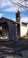
In the centre of the village of Gilette, you can visit the simple but well-maintained church. On leaving the church, turn left and continue up a steep climb that leads to the eastern exit of the village. The markings are easy to follow.

Ruins of Gilette Castle, which can be approached but not visited due to the risk of falling rocks.

Reviews and comments

4.2 / 5
Based on 8 reviews

Reliability of the description
3.9 / 5
Ease of following the route
4.3 / 5
Route interest
4.5 / 5
Aleksey
Aleksey

Overall rating : 4.3 / 5

Date of your route : Dec 27, 2025
Reliability of the description : ★★★★☆ Good
Ease of following the route : ★★★★★ Very good
Route interest : ★★★★☆ Good
Very busy route : No

A beautiful, easy route with excellent views of the river.

Machine-translated

Mcollines
Mcollines

Overall rating : 4.3 / 5

Date of your route : May 02, 2025
Reliability of the description : ★★★★☆ Good
Ease of following the route : ★★★★☆ Good
Route interest : ★★★★★ Very good
Very busy route : No

First of all, thank you to everyone who takes the time to write detailed descriptions of their hikes. We always find useful information and ideas in them. This is a beautiful, well-shaded hike, which meant we could do it without any problems on a hot day. It should be noted that the trail was officially closed between points 2 and 3, but we were able to pass without any problems. However, we did see that there had been rock falls.

Machine-translated

Dominique Torre
Dominique Torre

Overall rating : 4.7 / 5

Date of your route : Jan 19, 2025
Reliability of the description : ★★★★☆ Good
Ease of following the route : ★★★★★ Very good
Route interest : ★★★★★ Very good
Very busy route : Yes

A magnificent route, in my opinion, and not difficult. However, it should be noted that the path between La Clave and Gilette has been officially closed since December 2020 due to fallen trees and rocks. This was undoubtedly caused by Storm Alex on 2 October 2020. However, the trail (one of the most beautiful in the region) is clean and well maintained, with no branches left, but the boulders will be there for a long time to come. They do not hinder walking at all. Of course, you should not walk there in the days following a storm. I had no problems with landowners because I did not follow the original trail and after point 9 I followed the path that passes through the abandoned property. The trail is fine. Thank you for Visorando because the vegetation is dense and the trail is narrow but clean. At point 11, I would have had trouble finding the path without the system. Basically, you have to go from point 9 to 11 using the other paths. Either the track or the abandoned St Pierre castle.

Machine-translated

Guy Opio
Guy Opio

Overall rating : 3.7 / 5

Date of your route : Jan 17, 2024
Reliability of the description : ★★★☆☆ Average
Ease of following the route : ★★★☆☆ Average
Route interest : ★★★★★ Very good
Very busy route : No

The landscapes are magnificent... but:

  • Access to the village of Gilette after the hamlet of Clave has been prohibited by prefectural order since April 2023 due to landslides... not cool!
  • On the way back, access to the path leading to the Estéron bridge is prohibited by the owners of an equestrian centre who are particularly angry with hikers and claim to have informed Visorando several times... They directed us to another path that crosses another abandoned property but ends with a closed gate that we had to climb over... Not cool either!
  • We had to walk back to the Esteron bridge for 2 km along a busy motorway... Not cool either!

As things stand, we do not recommend this hike, despite the magnificent scenery and the beautiful village of Gilette.

Machine-translated

molivieri
molivieri

Overall rating : 3.3 / 5

Date of your route : Mar 05, 2023
Reliability of the description : ★★★☆☆ Average
Ease of following the route : ★★★☆☆ Average
Route interest : ★★★★☆ Good
Very busy route : No

The first part of the route is very beautiful, particularly the paved path leading from the hamlet of La Clave to the village of Gilette.
However, towards the end, when you reach the small winding path that leads to the Esteron bridge, there are no signs to help you find it.
We were initially turned away by the owners of a riding centre, and it was only when we entered private property, where there is a beautiful abandoned mansion, that we were able to identify it.
Nevertheless, it is a very beautiful route that allows you to visit the beautiful village of Gilette, among other things.
M O

Machine-translated

asoa
asoa

Overall rating : 4.3 / 5

Date of your route : Jan 30, 2023
Reliability of the description : ★★★★☆ Good
Ease of following the route : ★★★★☆ Good
Route interest : ★★★★★ Very good
Very busy route : No

A pleasant hike that takes you to the beautiful village of Gilette.
Be careful at the start: once you have crossed the Esteron bridge, the left turn for the climb is not signposted, but with the route marked out, there's no problem!
Thank you very much.

Machine-translated

Patrice de Nice
Patrice de Nice

Overall rating : 4.7 / 5

Date of your route : Jan 01, 2023
Reliability of the description : ★★★★★ Very good
Ease of following the route : ★★★★★ Very good
Route interest : ★★★★☆ Good
Very busy route : No

Nice hike, but still a lot of paved paths. The path is a bit rough at the beginning, but you can easily step over the rocks. Given the rockfalls, I think this hike should be avoided if it rains heavily.

Machine-translated

Daniel Fornili
Daniel Fornili

We decided not to go on this hike after reading an article in Nice Matin the day before, which said that a huge rock weighing several hundred tonnes was in danger of falling near Gilette. Since then, it seems that it has been "secured". We may do this hike in September.
Best regards,
Daniel FORNILI- Nice

Machine-translated

montagne06
montagne06

Overall rating : 4.3 / 5

Date of your route : Jun 17, 2022
Reliability of the description : ★★★★☆ Good
Ease of following the route : ★★★★★ Very good
Route interest : ★★★★☆ Good
Very busy route : No

For safety reasons, the route has been shortened (the upper part above the village of Reculon has been closed to us due to rockfalls) and we descended directly to the Saint Roch chapel and continued towards the banks of the Estéron. We recommend parking in the village of Gilette so you can stop for a snack in the shade by the river.
It is a very beautiful route and the climb is easy, with steps dating back to Roman times and plenty of shaded areas.
In short, a very beautiful route.
We covered 10.30 km with a 320 m elevation gain.
Highly recommended.

Machine-translated

Other walks in the area

For more walks, use our search engine .

The GPS track and description are the property of this route's author. Please do not copy them without permission.