Boucle de Saint-Martin-du-Var à la Roquette-sur-Var

Starting from Saint-Martin-du-Var, this short walk along the slopes of La Roquette-sur-Var will take you to this picturesque hilltop village offering views over the Var plain.
The return path runs alongside the Vésubie Canal for a few metres.

Details

4384600
Creation:
Last update:
Last review:
  • Walking
    Activity: Walking
  • ↔
    Distance: 2.42 mi
  • ◔
    Average duration: 1h 55 
  • ▲
    Difficulty: Moderate

  • ⚐
    Back to start: Yes
  • ↗
    Ascent: + 906 ft
  • ↘
    Descent: - 906 ft

  • ▲
    Highest point: 1,257 ft
  • ▼
    Lowest point: 351 ft

Photos

Description of the walk

Access to the start point.
By car: central car park in the village of Saint-Martin-du-Var.
Or via the “Train des Pignes” operated by Chemins de fer de Provence.

(S/E) From the square, take Rue du Four, heading north. Climb the steps to reach Route de l’Adrech. Continue to the right until you reach the cemetery.

Follow the yellow markings to the village

(1) At this point, take the cemented track on the left and walk for about 200 m.

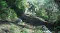
(2) At this junction between the footpath and the track, turn left onto the wooded uphill path. After a series of very tight bends, you’ll reach Route de Levens and marker 888.

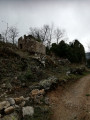
(3) Crossroads. Cross the road carefully and take the path opposite that climbs up to La Roquette-sur-Var. The viewpoint, known as the Belvédère du Pourtalet, is equipped with information boards. Walk through the village via Rue de la Libération, Rue du Château, Rue du Portail and finally Rue de l’Escoulière, heading east, which leads to the crossroads at the end of the village where four tarmac roads meet.

(4) At the roundabout, take the road towards “Saint-Martin-du-Var – Nice” on the right for 200m, until you reach an electricity pylon.

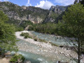
(5) At this point, turn left; the path starts at a 180° angle. At the Vésubie canal, in a grassy area, keep to the right, then veer left below the canal. The path resumes at the sign reading “Private property – No entry – Danger”. Enter this wooded area. Following Storm Alex, the path is damaged in places. At the large puddingstone rock, continue straight ahead. The path then follows the stream bed. At the bottom of the valley, keep to the fence on your left at all times to reach the track used on the way out , which leads to the cemetery.

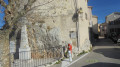
(1) At this point, turn left and head down towards the village of Saint-Martin-du-Var below. Enter the village via Rue Sidéri. At the end of this street, turn right and pass under a building to see the fully restored St-Roch church, with its striking cobalt-blue façade, ( S/E).


Waypoints

  1. S/E : mi 0 - alt. 351 ft - The main square in the village of Saint-Martin-du-Var.
  2. 1 : mi 0.22 - alt. 440 ft - Crossroads
  3. 2 : mi 0.38 - alt. 515 ft - Trail-track junction
  4. 3 : mi 0.76 - alt. 1,037 ft - Route de Levens - Start of the trail
  5. 4 : mi 1.2 - alt. 1,142 ft - Four-way junction
  6. 5 : mi 1.28 - alt. 1,112 ft - The trail starts on the left, towards the - Canal de la Vésubie
  7. S/E : mi 2.42 - alt. 351 ft - Central square in the village of Saint-Martin-du-Var

Notes

Avoid this hike in wet weather, as the return path is slippery.
Following Storm Alex, the path is damaged in places.

Drinking water available at the Roquette-sur-Var viewpoint.

Do not walk along the banks of the Vésubie Canal.

Worth a visit

La Roquette-sur-Var:
- Viewpoint over the Var plain equipped with information boards.
- 15th-century Saint-Pierre Church with Baroque décor (open on Sundays).
- Restored narrow streets and wash house.

Reviews and comments

3.5 / 5
Based on 9 reviews

Reliability of the description
3.5 / 5
Ease of following the route
3.6 / 5
Route interest
3.4 / 5
bernard bb
bernard bb

Thank you, User 27744048, for your review.
I will go and clean up the area around the trail shortly.
However, Storm Alex did cause some damage to the route.
Best regards, Rando B.

Machine-translated

User 27744048

Overall rating : 3.3 / 5

Date of your route : Sep 30, 2025
Reliability of the description : ★★★☆☆ Average
Ease of following the route : ★★★☆☆ Average
Route interest : ★★★★☆ Good
Very busy route : No

We encountered difficulties on the descent and had to cut through brambles to find the marked path. However, thanks to the app, we managed to find it!

Machine-translated

bernard bb
bernard bb

Hello SteelDusk

"Avoid," you say?

yet one of the latest reviews says, "The route is very pleasant and surprisingly diverse. Climb through an olive grove, discover beautiful historical heritage (baroque church and canal) and abundant birdlife.
The only downside is that the path back below the canal is narrow and very uneven.

I plan to do this route again, as Storm Alex has left its mark
Best regards, B.

Machine-translated

SteelDusk
SteelDusk

Overall rating : 4 / 5

Date of your route : Sep 24, 2025
Reliability of the description : Not used / Not applicable
Ease of following the route : Not used / Not applicable
Route interest : ★★★★☆ Good
Very busy route : No

Impossible to finish the hike, the GPS track doesn't follow the trail on the way up, so you learn not to trust it, then on the way down the trail disappears, I had to cut through the forest to find my way back, which wasn't easy
To be avoided.

Machine-translated

bernard bb
bernard bb

Thank you, Frédéric Rando, for this information
The return path has been damaged by the storms.
The heritage you mention is interesting
Best regards, Rando, B.

Machine-translated

Frédéric rando
Frédéric rando

Overall rating : 4 / 5

Date of your route : Jan 27, 2025
Reliability of the description : ★★★★☆ Good
Ease of following the route : ★★★★☆ Good
Route interest : ★★★★☆ Good
Very busy route : No

The route is very pleasant and surprisingly varied. It takes you uphill through an olive grove, where you can admire some lovely historical sites (a Baroque church and a canal) and spot plenty of birdlife.
The only downside: the return path below the canal is narrow and in very poor condition. You need to follow temporary fluorescent pink markings from marker number 4 and not be afraid to squeeze through the undergrowth.

Machine-translated

bernard bb
bernard bb

Thank you, Vannina, for suggesting this alternative
Best wishes, Rando B.

Machine-translated

Vannina
Vannina

Overall rating : 5 / 5

Date of your route : Feb 06, 2022
Reliability of the description : ★★★★★ Very good
Ease of following the route : ★★★★★ Very good
Route interest : ★★★★★ Very good
Very busy route : No

Once you’ve passed through the village, you can also head back up the road with two hairpin bends and join the Raiet track at the Chemin du Coulet

Machine-translated

bernard bb
bernard bb

Thank you for your feedback.
The terrain has deteriorated due to the bad weather. I’ve just reclassified it as ‘average’
Best regards, B.

Machine-translated

Eric VANAERDE
Eric VANAERDE

Overall rating : 2.7 / 5

Date of your route : Sep 29, 2021
Reliability of the description : ★★★☆☆ Average
Ease of following the route : ★★★☆☆ Average
Route interest : ★★☆☆☆ Disappointing
Very busy route : No

A disappointing walk, apart from the beautiful view at La Roquette. The ascent is steep but manageable; the descent is very steep, bordering on dangerous and impassable if the ground is slippery, for example after a downpour. The walk should be classified as moderate rather than easy. The distance is 5.2 km, not 3.5 km. An average walker should allow at least 2½ hours.
When passing the Vésubie Canal, don’t hesitate to take the path despite the ‘private property, no entry, danger’ signs; finally, the stream crossing at the end of the descent is not mentioned in the description.

Machine-translated

bernard bb
bernard bb

Thank you for your constructive feedback; I’ll go and re-trace the route again at the end of the summer,
Best regards, Bernard

Machine-translated

grislin Frédéric
grislin Frédéric

Overall rating : 2.3 / 5

Date of your route : Jun 20, 2021
Reliability of the description : ★★☆☆☆ Disappointing
Ease of following the route : ★★★☆☆ Average
Route interest : ★★☆☆☆ Disappointing
Very busy route : No

A very poor hike; no markings on the way down
The descent is very difficult with children
Very beautiful scenery on the way up
Thanks to the app for helping us follow a path on the descent
Poorly maintained trail

Machine-translated

bernard bb
bernard bb

Actually, the start does climb "a bit"
Happy hiking, B.

Machine-translated

Jean Luc Fernandez
Jean Luc Fernandez

Overall rating : 4.7 / 5

Date of your route : Mar 29, 2021
Reliability of the description : ★★★★★ Very good
Ease of following the route : ★★★★★ Very good
Route interest : ★★★★☆ Good
Very busy route : No

A hike that gets off to a flying start! Stunning views of the Var valley and the mountains

Machine-translated

bernard bb
bernard bb

Glad to hear you enjoyed the first part.
As for the return journey, sorry, Storm Alex has been through here,
and damaged the path.

Best wishes from the hiking group, warm regards, Bernard

Machine-translated

Other walks in the area

For more walks, use our search engine .

The GPS track and description are the property of this route's author. Please do not copy them without permission.