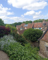
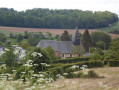
Halescourt Valley in Saint-Arnoult

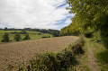
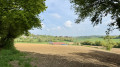
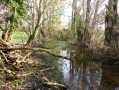
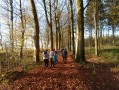
A short walk through the rolling Normandy countryside of the Oise, along the edge of woods and fields

Details

3189945
Creation:
Last update:
Last review:
  • Walking
    Activity: Walking
  • ↔
    Distance: 3.69 mi
  • ◔
    Average duration: 1h 50 
  • ▲
    Difficulty: Easy

  • ⚐
    Back to start: Yes
  • ↗
    Ascent: + 108 ft
  • ↘
    Descent: - 105 ft

  • ▲
    Highest point: 666 ft
  • ▼
    Lowest point: 561 ft

Description of the walk

Park in the car park by the Town Hall. Alternatively, there is another car park available at the entrance to the village, towards Feuquières.

(S/E) With your back to the Town Hall, at the wayside cross by the roundabout, turn right onto Rue de Moliens.

(1) Ignore the path on the left – which you’ll take on the way back – and carry on straight ahead to the wayside cross at the village exit.

(2) Take the path on the left, walk alongside the cemetery and carry on straight ahead (the Chemin Blanc).
until you reach the tarmac road at a bend.

(3) Cross the road carefully and carry on straight ahead, taking the path that leads downhill. Follow it until you reach the edge of the Monceaux woods. At the junction, take the path on the left and carry on straight ahead until you reach the tarmac road.

(4) Cross the road and take the path opposite for about 700 metres until you reach the cross at Place de Colagnie des Fenêts (a hamlet in the commune of Saint-Arnoult).

(5) Take the path on the left. Follow it straight on until you reach Rue de Moliens.

(1) Follow this street to the right to reach the village centre, about 300 m away (S/E).

Waypoints

  1. S/E : mi 0 - alt. 561 ft - Town Hall car park
  2. 1 : mi 0.21 - alt. 614 ft - Junction of the circular loop
  3. 2 : mi 0.39 - alt. 636 ft - Calvary, on the left
  4. 3 : mi 1.31 - alt. 643 ft - Road junction
  5. 4 : mi 1.83 - alt. 666 ft - Crossing the road
  6. 5 : mi 2.33 - alt. 666 ft - Calvary, on the left
  7. S/E : mi 3.69 - alt. 561 ft - Town Hall car park

Notes

Nothing in particular.

Worth a visit

Halfway along the road to Moliens, in the village, you’ll find the sign for the Picardie Verte Community of Communes (CCPV) walk: through the woods of Monceaux and the hamlets of Saint-Arnoult (distance 10 km), starting either from Saint-Arnoult or from the small square with a picnic area on the road between Monceaux l’Abbaye and Marcoquet.

Reviews and comments

4.2 / 5
Based on 3 reviews

Reliability of the description
4.7 / 5
Ease of following the route
4.3 / 5
Route interest
3.7 / 5
_apolline_
_apolline_

Overall rating : 4.3 / 5

Date of your route : May 04, 2025
Reliability of the description : ★★★★★ Very good
Ease of following the route : ★★★★☆ Good
Route interest : ★★★★☆ Good
Very busy route : No

A nice little walk

Machine-translated

Ducati60
Ducati60

Overall rating : 4 / 5

Date of your route : Apr 22, 2024
Reliability of the description : ★★★★☆ Good
Ease of following the route : ★★★★☆ Good
Route interest : ★★★★☆ Good
Very busy route : Yes

All clear

Machine-translated

Azimut71
Azimut71

Overall rating : 4.3 / 5

Date of your route : Sep 11, 2021
Reliability of the description : ★★★★★ Very good
Ease of following the route : ★★★★★ Very good
Route interest : ★★★☆☆ Average
Very busy route : No

A route through fields and woods. There is very little change in altitude, except at the start.

Machine-translated

Other walks in the area

For more walks, use our search engine .

The GPS track and description are the property of this route's author. Please do not copy them without permission.