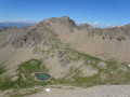
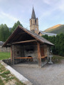
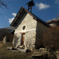
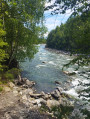
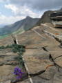
The Aupillon and the Rocher des Cailles as seen from Les Hières

A long circular route taking in the Aupillon via its southern slope, the two lakes of the Aupillon and the Rocher des Cailles.

Details

3661119
Creation:
Last update:
Last review:
  • Walking
    Activity: Walking
  • ↔
    Distance: 7.18 mi
  • ◔
    Average duration: 6h 15 
  • ▲
    Difficulty: Difficult

  • ⚐
    Back to start: Yes
  • ↗
    Ascent: + 3,383 ft
  • ↘
    Descent: - 3,379 ft

  • ▲
    Highest point: 9,498 ft
  • ▼
    Lowest point: 6,713 ft

Photos

Description of the walk

At Les Thuiles, take the small tarmac road towards Les Prats. Pass through Les Prats and continue along the main track to its end. Please note: 6 km of track. Small car park at the end of the track, before Les Hières.

(S/E) Follow the signposted path towards Lac de l’Aupillon.

(1) At La Jaumasse, take the signposted path on the left towards La Pisse and Lac de l’Aupillon.
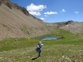
Pass La Pisse, cross the Rioclar ravine and climb the winding path below Les Aiguilles. At La Bonne Fontaine, turn right and follow the upper Rioclar valley. Join the other ascent route coming from the right and reach the lower Lac de l’Aupillon.

(2) Go round the lake on the left and, at its western end, look for the path – which is more or less clearly marked at the start and more or less signposted – that climbs northwards towards l’Aupillon. You’ll reach a fork marked by a cairn.

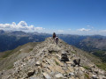
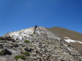
(3) Leave the path on your right that descends eastwards – you’ll take this on the way back – and head decisively left. Follow the path as it climbs through scree. At around 2870 m, join the summit ridge and follow it to the summit of the Aupillon. Caution: the final section of the ascent is exposed and requires sure-footedness. You will need to use your hands on the rocks.

(4) Retrace your steps. At around 2,870 m, take care to leave the main ridge to the left, as it descends towards the Col de l’Eissalete.

(3) At the fork marked by a cairn, take the left-hand path this time, where you will find a few markers.

(5) Pass by the upper Aupillon lake and continue straight ahead along the path to reach the Col de l’Aupillon.

(6) Turn right and follow the ridge. Pass the Tête de Cougourde and climb the ridge to the summit of the Rocher des Cailles.

(7) Descend along the opposite ridge. Pass close to the Brec de l’Aupénas, then veer right before the pass at 2,615 m to pass by the small Lama Rasinière lake, which is often dry.
Continue the descent off-trail through the grassy valley heading north-west, more or less following the valley floor.

(8) At around 2520 m, look out for the cairns marking the path from Lac de l’Aupillon and take this path to the left. Follow this path down the long, steep and slippery slope into the Jaumasse until you rejoin the ascent route.

(1) Follow it to the left until you reach the car park (S/E).

Waypoints

  1. S/E : mi 0 - alt. 6,713 ft - Les Hières
  2. 1 : mi 0.79 - alt. 7,018 ft - La Jaumasse
  3. 2 : mi 2.35 - alt. 8,340 ft - Lower Lake of the Aupillon
  4. 3 : mi 2.69 - alt. 8,665 ft - Aupillon path junction
  5. 4 : mi 3.16 - alt. 9,498 ft - L’Aupillon
  6. 5 : mi 3.84 - alt. 8,625 ft - Upper Lake of the Aupillon
  7. 6 : mi 4.13 - alt. 8,845 ft - Col de l’Aupillon
  8. 7 : mi 4.62 - alt. 9,219 ft - Rocher des Cailles
  9. 8 : mi 5.53 - alt. 8,264 ft - Junction with the Lac de l’Aupillon path
  10. S/E : mi 7.19 - alt. 6,716 ft - Les Hières

Worth a visit

(4) At the summit of the Aupillon, you’ll be treated to a sweeping panorama of the mountains surrounding the resort of Les Orres and Lake Sainte-Marguerite down to the left.

Reviews and comments

4 / 5
Based on 5 reviews

Reliability of the description
3.8 / 5
Ease of following the route
3.8 / 5
Route interest
4.3 / 5
User 26336084
• Edited:

Overall rating : 3 / 5

Date of your route : Jun 23, 2026
Reliability of the description : ★★★☆☆ Average
Ease of following the route : ★★★☆☆ Average
Route interest : Not used / Not applicable
Very busy route : No

I didn’t park at the end of the 6km track you have to drive along
I set off from the last farm that was signposted
‘Parking Lac du Parpaillon’, which meant
meant the route was longer. I arrived at a GR sign for Meolans-Révél and the Refuge de la Pare, but I couldn’t find the path. After several attempts, I returned via the same route, which was very pleasant through the forest

Dangerous road leading to the start point; no one around
Signposting and signage need reviewing
Disappointing

Machine-translated

ed04
ed04

Overall rating : 4.7 / 5

Date of your route : Oct 21, 2024
Reliability of the description : ★★★★★ Very good
Ease of following the route : ★★★★☆ Good
Route interest : ★★★★★ Very good
Very busy route : No

An extraordinary hike: beech forests, waterfalls, mountain pastures, lakes, peaks and viewpoints.
The ridge route to the summit of the Aupillon is only suitable for those with mountain-walking experience
Major drawback: the 6 km track leading to Les Hières is difficult to navigate, very muddy after rain, and only suitable for those with a 4x4 or a vehicle with high ground clearance

Machine-translated

domimusicos
domimusicos

Overall rating : 4.3 / 5

Date of your route : Aug 26, 2024
Reliability of the description : ★★★★☆ Good
Ease of following the route : ★★★★☆ Good
Route interest : ★★★★★ Very good
Very busy route : Yes

A very beautiful route up to the first Aupillon lake. The climb up the ridge to the summit of the Aupillon is difficult and not recommended for those prone to vertigo.
The return journey offers lovely views over the Ubaye Valley and Barcelonnette. The descent back to the starting point is quite a long one.

Machine-translated

JMZAHN
JMZAHN

Overall rating : 3 / 5

Date of your route : Jul 17, 2022
Reliability of the description : ★★★☆☆ Average
Ease of following the route : ★★★★☆ Good
Route interest : ★★☆☆☆ Disappointing
Very busy route : No

Hello,

I would like to point out that this walk, as described, is becoming very difficult to complete.
The tarmac road ends near Les Prats and the track that continues from the small road quickly becomes impassable.
Furthermore, parking options around Les Prats are very limited.
We tried driving up part of this track yesterday, but we had to turn back quite quickly, as only a 4x4 can reasonably make it up to Hières, and even a little further (as we discovered yesterday).
So, if you have to add about ten kilometres there and back on a track that’s uninteresting and very ‘dusty’ in this sort of heatwave, as we’re experiencing at the moment, this hike is virtually impossible to complete in its entirety, as it exceeds 20 kilometres and 1,300 metres of elevation gain.
We climbed to the summit of the Aupillon, but we had to abandon the rest of the route described, via the Rocher des Cailles, in order to be back at the car by around 5.30 pm.
So, I think it would be useful to provide these details about this walk, as the near-impossibility of getting close to Les Hières in a passenger car completely changes the nature of this walk, which would otherwise be absolutely lovely.
It’s a real shame, but you have to be able to adapt, and there are factors beyond our control.
However, it’s good to have the most accurate information possible so that we can choose our routes, on which we hope to enjoy ourselves as much as possible.
Jean-Marie.

Machine-translated

ktibri
ktibri

Overall rating : 4.3 / 5

Date of your route : Jun 30, 2022
Reliability of the description : ★★★★☆ Good
Ease of following the route : ★★★★☆ Good
Route interest : ★★★★★ Very good
Very busy route : No

A lovely walk!
It was a bit chilly to start with, but we reached the Aupillon lakes, where, unfortunately, the water level is dropping, dropping.
A superb dry-stone shepherd’s hut.
Everyone was very happy with the day

Machine-translated

Other walks in the area

For more walks, use our search engine .

The GPS track and description are the property of this route's author. Please do not copy them without permission.