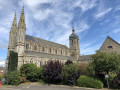
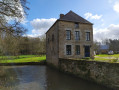
Landscapes and colours in the Monthault region

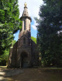
The Monthault Rock is a place where two faiths coexist: come and discover some Celtic legends which, thanks to the presence of distinctive rocks, have endured through the centuries, with the Chapel of Notre-Dame – the final stop on a Way of the Cross through the woods – as its neighbour.

Details

3725478
Creation:
Last update:
Last review:
  • Walking
    Activity: Walking
  • ↔
    Distance: 4.74 mi
  • ◔
    Average duration: 2h 30 
  • ▲
    Difficulty: Easy

  • ⚐
    Back to start: Yes
  • ↗
    Ascent: + 371 ft
  • ↘
    Descent: - 387 ft

  • ▲
    Highest point: 636 ft
  • ▼
    Lowest point: 427 ft
  • ⚐ Country: France
  • ⚐ City: Monthault (35420)
  • ⚑
    Start/End: N 48.511356° / W 1.181386°
  • ❏
    IGN map(s): Ref. 1316E
  • Hour-by-hour weather

Photos

Description of the walk

Car park between the Town Hall and the Church.
The entire route is signposted in yellow.

(S/E) From the car park, keep the Town Hall on your right and head north-west towards the Rocher de Monthault.
As you leave the village, take the grassy path on the left. Carry on straight ahead, ignoring the first turn-off on the right. Continue until you reach the entrance to the hamlet known as Le Rocher.

(1) Cross the road and continue along the dirt track opposite on the right. The track becomes a small road leading to the hamlet of La Maltière.
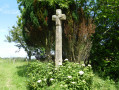
After the hamlet, turn right and follow the path uphill. Cross the road, keeping slightly to the left as you go, following the Stations of the Cross. You’ll arrive opposite the chapel.

(2) In front of the chapel, turn left to see the ‘stones of legend’ and follow a sunken track which ends at the edge of the woods and leads to a small road.

(3) Turn right and follow the road for about 200 metres. Turn right and, as soon as you enter the woodland, keep left. As you approach the road, take a sharp right-hand bend. Do not take the footbridge on your left (unless you’re taking a shortcut directly to (6)) and, immediately after the hut, take a hairpin bend to the right then a hairpin bend to the left in front of a rest area with granite benches. Walk up to the road.

(4) Turn right, then after the left-hand bend, continue along the path on the right which goes round the houses.

(5) Caution: Incorrect signposting – do not continue straight on but take the sunken path on the left. This leads to the access road to Le Rocher. Follow it to the left for 20 metres and then take the path on the left. Cross the road and continue straight ahead.

(6) On your left, you’ll see the footbridge from earlier, which spans the Vallée Humide du Bois Ainaux. Turn right and reach the village track. Follow it to the right for a few metres.

(7) Cross over and continue along the path on the left. Cross the departmental road and carry on along the path across the field. At Le Noyer, cross a local road and head slightly to the left straight ahead. Follow the path as it bends to the right and you’ll come out onto a road.

(8) Turn right and follow the road to the village of Monthault and the town hall car park (S/E).

Waypoints

  1. S/E : mi 0 - alt. 525 ft - Car park between the church and the town hall
  2. 1 : mi 0.26 - alt. 505 ft - Dirt track to the right
  3. 2 : mi 1.35 - alt. 633 ft - Notre-Dame Chapel
  4. 3 : mi 1.91 - alt. 427 ft - Road on the right
  5. 4 : mi 2.3 - alt. 459 ft - Road on the right
  6. 5 : mi 2.56 - alt. 512 ft - Sunken path on the left
  7. 6 : mi 3.29 - alt. 436 ft - Vallée Humide du Bois Ainaux
  8. 7 : mi 3.43 - alt. 476 ft - Path to the left
  9. 8 : mi 4.22 - alt. 446 ft - Road on the right
  10. S/E : mi 4.74 - alt. 525 ft - Car park between the church and the town hall

Notes

Worth a visit

The legendary stones:
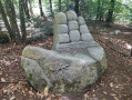
The first one you come across bears the marks of Satan’s claws; tired of carrying stones for the construction of Mont Saint-Michel, he left this one behind.
A contemporary work of art, dating from 2006, carved from granite and situated nearby, does indeed depict the claws of the Devil, as if to recall this legend. (photo)

Another is known as the ‘Stone of Offerings’ because it features hollows with natural drainage channels where the Celts sacrificed small animals to their deities.

For the history and description of the Chapel of Notre-Dame de la Délivrance:
Chapel

Reviews and comments

4.6 / 5
Based on 4 reviews

Reliability of the description
4.5 / 5
Ease of following the route
4.3 / 5
Route interest
5 / 5
roquier
roquier

Overall rating : 5 / 5

Date of your route : May 02, 2025
Reliability of the description : ★★★★★ Very good
Ease of following the route : ★★★★★ Very good
Route interest : ★★★★★ Very good
Very busy route : No

A wonderful walk, especially around the hill, with its legends, scenery, historical interest, and flora and fauna.
Thank you for this discovery

Machine-translated

rando alain
rando alain

Overall rating : 4.7 / 5

Date of your route : Jun 24, 2024
Reliability of the description : ★★★★★ Very good
Ease of following the route : ★★★★☆ Good
Route interest : ★★★★★ Very good
Very busy route : Yes

A pleasant walk with the chance to discover the local flora and fauna
area

Machine-translated

VieilPat
VieilPat

Overall rating : 4.3 / 5

Date of your route : Jul 29, 2023
Reliability of the description : ★★★★☆ Good
Ease of following the route : ★★★★☆ Good
Route interest : ★★★★★ Very good
Very busy route : No

This was our second time on the route.
As we were showing the site to visiting family, we went straight to the chapel car park, which shortens the route and allows us to visit the interesting sites.
A lovely walk, mostly in the shade.
If you do the full route, there is a car park option at the Monthault village hall, with toilets, a picnic area and games for children, and a beautiful sculpture.

Machine-translated

perceneige
perceneige

Overall rating : 4.3 / 5

Date of your route : Jul 11, 2021
Reliability of the description : ★★★★☆ Good
Ease of following the route : ★★★★☆ Good
Route interest : ★★★★★ Very good
Very busy route : Yes

pleasant, cool weather.

Machine-translated

Other walks in the area

For more walks, use our search engine .

The GPS track and description are the property of this route's author. Please do not copy them without permission.