Country:
 City:
City:


Park at the Carrefour de Chênedet, on the D177 road between Fougères and Landéan. To avoid having to cross this busy road on foot, park in the car park on the left-hand side when coming from Fougères.
Red Circle markings
At various points along the route, you’ll find signposts for the ‘Circuit de la Pierre Enfouie’. Markings and signposting are in both directions.
For the most part, you’ll be following paths that do not appear on the IGN base map.
(S/E) From the car park, take the path heading north, between the Route Forestière de la Villebœuf (on your left, signposted) and the D177 (on your right). Immediately, at the picnic table, take the path on the right (the one on the left will be the return route). The path runs a short distance alongside the D177 before veering sharply away to the left.
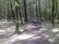
At a junction with a wider path, continue straight ahead. The path winds through the woodland: follow the markings carefully. Further on, ignore a wider path on your left and veer to the right. When you reach forest plots nos. 15 and 14, veer to the left and you’ll come out onto a wide path. Zigzag right and then left, then head downhill to cross the Clairdouet stream via a small wooden bridge and head back up the opposite side.
(1) At the junction immediately after, turn left. Just before reaching a small tarmac road (Route Forestière de Clairdouet), turn right onto a path through the woodland. Cross a path running at right angles and follow this track, which runs parallel for a while to the Route de Clairdouet on your left, before veering off towards the D177. You’ll arrive at Les Celliers de Landéan and continue to the information sign.
(2) From Les Celliers, there are two options:
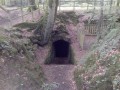
- Signposted route (the one shown on the map) – Retrace your steps and, when you reach a ventilation shaft (with a wire mesh cover), turn right to join the small tarmac road at the forest gate.
- Unmarked route – Facing the information board, continue along the path to the left and, after a few metres, turn left onto the small tarmac road until you reach the forest gate.
In both cases, continue along the tarmac road past the forest gate (south-west). After about a hundred metres, turn onto the first path on the right, at the corner of forest plot no. 11. Walk through ferns and young conifers, cross two streams, and continue through deciduous woodland. Turn right and reach the edge of the forest (meadow opposite).
(3) Turn left and walk first amongst the ferns, then past a meadow on your right, and finally through a deciduous woodland. At a fork, take the right-hand path to cross the Clairdouet stream once more (the steep path on the left leads back to the road of the same name). At a fork in the road, take the left-hand path (a half-faded Red Circle on a tree situated between the two paths). At the junction immediately after (yellow mountain-bike marker on the right), continue straight ahead. Head south-west, ignoring any tracks or paths running perpendicular to it. The path veers slightly to the left (south-south-west), crosses a stream and stays close to the small tarmac road (on your right) until you reach the Carrefour des Serfilières.
(4) At the picnic table just before the junction, turn left (do not enter the junction). Cross the Route de Clairdouet and continue straight ahead along the path (signposted). Head south-east, with the Route de Villebœuf in the distance on your right. At a junction with a track (entrance to a leisure centre visible on the road to the right), continue straight ahead along the path. Turn left and, further on, turn right to return to the starting point (S/E).



 Visorando Member

 Moderate