


Refine your search for walks in Airon (rivière) - Affluent de la Sélune
Airon (rivière) - Affluent de la Sélune walks


 Along the Airon from Landivy
 Visorando Member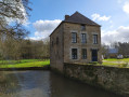
 11.43 mi
 +466 ft
 -489 ft
 5h 40
5h 40
 Moderate
 Departure from Landivy (Mayenne)
With one foot in Normandy and one in Brittany, this trail offers some truly stunning views. After taking in the panoramic scenery, you’ll wind your way through the shaded paths along the Futaie Valley.
From Pontmain to Pont Dom Guérin
3.14 mi
+141 ft
-151 ft
1h 35
 Easy
Departure from Pontmain (Mayenne)
Easy
Departure from Pontmain (Mayenne)
This route takes you into the Parc des Oblats and its arboretum, then along a shaded path by the water’s edge leading to Mausson Castle, which is privately owned but can be admired from the outside. Pontmain is an important place of pilgrimage to Our Lady of Pontmain, who appeared to several children on 17 January 1871.