Îlet à Cordes via the Burel and Reposoir trails

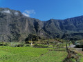
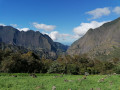
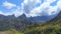
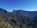
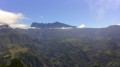
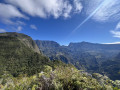
The Cirque de Cilaos is brimming with remarkable hikes. Among them is the route from the Pavillon to Îlet à Cordes via the Burel and Reposoir paths. This breathtaking hike offers stunning views of the Cirque de Cilaos. Whilst it is certainly less well-known than the route linking Îlet à Cordes to Cilaos, it is by no means lacking in appeal. You can even stop for a swim at Les Trois Bras.
This walk passes through challenging but safe terrain.

Details

12555097
Creation:
Last update:
Last review:
  • Walking
    Activity: Walking
  • ↔
    Distance: 6.91 mi
  • ◔
    Average duration: 5h 40 
  • ▲
    Difficulty: Difficult

  • ⚐
    Back to start: Yes
  • ↗
    Ascent: + 2,848 ft
  • ↘
    Descent: - 2,844 ft

  • ▲
    Highest point: 3,494 ft
  • ▼
    Lowest point: 1,404 ft

Photos

Description of the walk

Access: head towards Cilaos via the N5. Follow the road to the “Burrel” bus stop

(S/E) From the Burrel bus stop, take the path which starts on the left at the bend in the road. The path is narrow from the outset, with some sections already vertiginous. It quickly crosses sections of unstable scree: take care not to slip on this ground. Soon, the first clearings offer views of the Dimitile and the southern part of the Cirque de Cilaos.

(1) You’ll reach the Parc à Tortues. This is a former inhabited islet. After this relaxing stretch, the path quickly follows a series of narrow and vertiginous sections with an impressive sheer drop over the Bras de Cilaos. Some sections are fitted with cables, but you still need to take particular care.

(2) You’ll reach the ford on the Grand Bras de Cilaos. Directly opposite is the Parc à Dennemont. Cross the river just above a small waterfall and its pool. Be careful, however: here, you’ll often have to wade through the water. Then rejoin the path on the opposite bank, which runs alongside the river. The vegetation is rather dry, and the first views look north towards the Cirque de Cilaos.

(3) When you reach Trois Bras, ignore the path on the right leading to the Plateforme and head left to fords the Bras de Saint-Paul. This is where the challenging sections begin: you’ll need to climb 600 metres in altitude to reach the Îlet à Cordes.

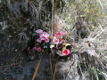
(4) A short climb begins at the ford, followed by a long flat stretch: this is the Îlet du Bois de Nèfles, largely covered in chocas. You’ll soon be able to enjoy a view of the Cirque de Cilaos and the remaining ascent. Here too, you’ll need to watch out for scree slopes, some of which are secured with cables. You climb gradually, and before long the Bras de Saint-Paul seems far below. The views gradually open up, taking in the Îlet à Pères and the southern part of the Cirque de Cilaos. The path is very rocky, quite exposed and climbs in tight hairpin bends. Some sections are narrow and vertiginous. Reaching a wayside shrine marks the halfway point of the ascent.

(5) Shortly after the wayside shrine, ignore a faint path that branches off to the right and stay on the main path. The second part of this walk is easier going and offers memorable views of the cirque. It is, however, much more exposed.

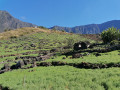
(6) Allow at least an hour’s climb from Les Trois Bras to reach the Îlet à Cordes. The final few metres take you through the lentil fields for which the Cirque de Cilaos is famous. Enjoy a well-deserved break in these fields and return to the starting point via the same route (S/E).


Waypoints

  1. S/E : mi 0 - alt. 1,755 ft - Cilaos Road
  2. 1 : mi 0.48 - alt. 1,745 ft - Turtle Park
  3. 2 : mi 1.01 - alt. 1,414 ft - Pond, waterfall on the - Bras de Cilaos (rivière) - La Réunion -
  4. 3 : mi 1.67 - alt. 1,512 ft - Trois Bras, ford
  5. 4 : mi 1.79 - alt. 1,663 ft - Ilet Bois de Nèfles
  6. 5 : mi 2.68 - alt. 2,799 ft - A poorly marked path
  7. 6 : mi 3.45 - alt. 3,481 ft - Ilet à Cordes
  8. S/E : mi 6.91 - alt. 1,755 ft - Cilaos Road

Notes

This walk is strongly advised against if you suffer from vertigo.
Take sun cream and a hat with you.
This hike is not recommended after a spell of rain (as you’ll need to cross rivers and navigate landslide-prone areas)
The elevation gain is slightly overestimated: allow for around 700 m rather than 1282.

Worth a visit

Places to see:
- The Gué waterfall and its pool (2)
- Îlet à Cordes and its lentil fields (6)

Reviews and comments

4.5 / 5
Based on 2 reviews

Reliability of the description
5 / 5
Ease of following the route
3.5 / 5
Route interest
5 / 5
martin yves
martin yves
• Edited:

Overall rating : 4.7 / 5

Date of your route : Jan 05, 2024
Reliability of the description : ★★★★★ Very good
Ease of following the route : ★★★★☆ Good
Route interest : ★★★★★ Very good
Very busy route : No

A very pleasant walk, but do take care
There is a significant elevation gain on the Reposoir trail and right up to the finish at Îlet à Cordes.
Expect several river crossings, which can be very ‘wet’ depending on the season; caution is advised when crossing these, depending on the current.
Otherwise, a lovely, well-signposted walk with superb views – though you do have to work for them!

Machine-translated

Daniel Cadet
Daniel Cadet

A magnificent walk, enjoyed in fine weather, with views across the entire surrounding mountain range.

Machine-translated

Daniel Cadet
Daniel Cadet

Overall rating : 4.3 / 5

Date of your route : Sep 25, 2023
Reliability of the description : ★★★★★ Very good
Ease of following the route : ★★★☆☆ Average
Route interest : ★★★★★ Very good
Very busy route : Yes

Once you reach the river, which you need to cross, the path becomes less defined. Look out for the arrow painted on a rock, although the ford is easier further upstream.

Machine-translated

Other walks in the area

For more walks, use our search engine .

The GPS track and description are the property of this route's author. Please do not copy them without permission.