Jacky Inard Trail

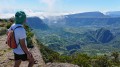
A walk along the Crête du Dimitile with magnificent views over Cilaos and the Plaine des Cafres.

Details

n°57500
Creation:
Last update:
Last review:
  • Walking
    Activity: Walking
  • ↔
    Distance: 6.98 mi
  • ◔
    Average duration: 5h 25 
  • ▲
    Difficulty: Difficult

  • ⚐
    Back to start: No
  • ↗
    Ascent: + 2,536 ft
  • ↘
    Descent: - 3,743 ft

  • ▲
    Highest point: 7,657 ft
  • ▼
    Lowest point: 4,544 ft
  • ⚐ Country: France
  • ⚐ City: L'Entre-Deux (97414)
  • ⚑
    Start: S 21.186705° / E 55.489601°
  • ⚑
    End: S 21.131034° / E 55.495631°
  • Hour-by-hour weather

Photos

Description of the walk

The day begins at La Chapelle, which can be reached via the footpath or by 4x4 along the track starting from the top of the Chemin du Dimitile (car park).

(S) Follow the 4x4 track uphill. Turn right to reach the first designated viewpoint, which offers a panoramic view of the Cilaos cirque.

(1) Continue along the track to the second viewpoint.

(2) Leave the track and take the path leading uphill to the left: this is the start of the Jacky Inard trail. A series of climbs and gentle slopes then follow until you reach a crossroads.

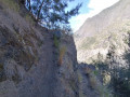
(3) Leave the Gîte Emile path on your right and carry on straight ahead. The climb continues until you reach the first ladder: thrills guaranteed.
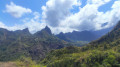
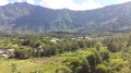
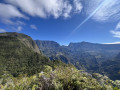
Magnificent views over the south of Réunion: to the left, the Cirque de Cilaos; to the right, the Plaine des Cafres stretching all the way to the volcano if the sky is clear.
The climb continues towards the summit of Entre-Deux, with a succession of ladders and rocky sections.

(4) From the summit, the descent via Coteau Maigre takes us to Coteau Kervéguen, where we join theGR®-R2.

(5) Follow it to the left towards the Piton des Neiges.

(6) Further on, at the signpost, leave theGR®-R2 and take the path on the left towards Mare à Joseph. A long and steep descent then begins, leading us to the Route de Bras Sec (D241) and the car park (E).
Waypoints

  1. S : mi 0 - alt. 5,755 ft - Chapel at the top of the Chemin du Dimitile - La Chapelle du Dimitile
  2. 1 : mi 0.34 - alt. 5,863 ft - 1st viewpoint
  3. 2 : mi 0.53 - alt. 5,922 ft - 2nd viewpoint
  4. 3 : mi 1.56 - alt. 6,594 ft - Straight ahead
  5. 4 : mi 3.94 - alt. 7,635 ft - L’Entre-Deux
  6. 5 : mi 4.64 - alt. 7,073 ft - Kervéguen hillside
  7. 6 : mi 5.2 - alt. 7,228 ft - Leave the GR-R2, turning left
  8. E : mi 6.98 - alt. 4,544 ft - Car park on Route de Bras Sec (D241)

Notes

Not suitable for those with a fear of heights: ridge sections with sheer drops, ladders and sections requiring climbing in places.
No refreshments available along the route: make sure you have enough water for the day.
The route is exposed to the elements all day: bring sun protection, a windbreaker and warm clothing in case of a breeze.
Strongly discouraged in wet weather or on damp ground, as the ‘tricky’ sections then become genuinely dangerous due to slippery conditions.

Worth a visit

Magnificent views over the Cirque de Cilaos and the Plaine des Cafres all the way to the volcano.
Spectacular.
Certainly one of the most beautiful hikes Réunion has to offer.

Always be cautious and plan ahead when you're outdoors. Visorando and the author of this route cannot be held responsible for any accidents occurring on this route.

The GR® and PR® markings are the intellectual property of the Fédération Française de Randonnée Pédestre.

Reviews and comments

5 / 5
Based on 1 review

Reliability of the description
Not used
Ease of following the route
Non utilisé
Route interest
5 / 5
Orando974
Orando974 ★

Overall rating : 5 / 5

Date of your route : Aug 10, 2020
Reliability of the description : Not used / Not applicable
Ease of following the route : Not used / Not applicable
Route interest : ★★★★★ Very good
Very busy route : Yes

I went on a hike last weekend, just to the summit of Entre-Deux and back. A magnificent and unforgettable hike with breathtaking views and some remarkable sections. A truly beautiful route that still fills me with wonder just thinking about it. An absolute must-do on the island. It’s a lovely way to round off 21 years of hiking on Réunion.

Machine-translated

Other walks in the area

For more walks, use our search engine .

The GPS track and description are the property of this route's author. Please do not copy them without permission.