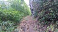
Alternative route to the previously suggested walk from Camp Montplaisir to La Fenêtre via Les Fleurs Jaunes, taking the concrete forest track, as the forest was subject to logging operations until mid-September 2026 and the path has been rendered unusable for the time being as it has been ravaged by loggers.
From Saint-Louis, head towards Les Makes, then towards La Fenêtre. Park at the Plateau de Montplaisir picnic area.
(S/E) Continue uphill along Forest Road 11 to Les Makes, heading south-east then north-west after a hairpin bend. Reach Camp de Montplaisir, pass Makes Aventure and arrive at a junction.
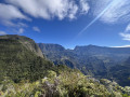
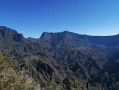
(1) Carry on to the right along the winding forest track until you reach the car park: there’s a lovely panoramic view of the Cirque de Cilaos.
(2) Follow the path near the transmission masts to reach La Fenêtre.
(3) Take the Bras Patates path, heading down to the right.
(4) At the end of the path, continue to the right. After about 300 metres, ignore the track branching off to the left and follow the path to the right, which leads to the picnic area (S/E).
Waypoints
S/E : mi 0 - alt. 4,101 ft - Montplaisir picnic car park
1 : mi 0.8 - alt. 4,390 ft - Junction with a forest track
2 : mi 2.95 - alt. 5,210 ft - Car park – Cilaos Cirque viewpoint
3 : mi 3.26 - alt. 4,511 ft - La Fenêtre
4 : mi 4.19 - alt. 3,986 ft - Junction, turn right
S/E : mi 4.59 - alt. 4,094 ft - Montplaisir picnic car park
Notes
Set off early in the morning to enjoy the best views! Kiosks and shelters are available at the starting point (S/E), with picnic facilities.
Follow the instructions for the other walk already published; this is a variation on that route.
Worth a visit
You can take a detour via Piton Cabris, or even via Camp 2000 for the more adventurous. To do this, continue along Forest Road 58 via La Scierie and Les Hauts des Makes, and return via Piton du Petit Mapou. Allow an extra 45 minutes for Piton Cabris and 3 hours for Camp 2000.
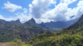
(1) Makes Aventures (treetop adventure park). Viewpoints at La Fenêtre and Le Bras Patates. The Bras Patates valley. Panoramic views of Les Makes and the surrounding area. Visit the Makes Astronomical Observatory after the hike.
To open this route on your smartphone, you must have the Visorando app installed. If not, got to the Apple Store (iPhone) or Google Play Store (Android) to download the app.



 Country:
 City:
City:


 Visorando Member

 Easy
Easy 
 Difficult