Country:
 City:


Park in the car park in front of Saint-Étienne Church on Rue des Awirs.
(S/E) Leave the car park and take Rue des Awirs to the right. Turn left into Rue Jules Beaumont, then immediately right onto the footpath after the bridge over the stream. At the end, follow Rue Sart d’Avette for about fifty metres.
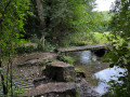
(1) Head right towards the far end of the large gravel courtyard lined with prefabricated buildings (school): walk between these buildings and the graffiti-covered building at the far end , taking care not to follow the path behind that building. The path passes through a copse and continues along Rue des Awirs. At the end of this street, turn immediately left onto the path running alongside the stream; this leads onto a grassy track which you follow until you reach the main road, after passing some old lime kilns.
(2) Take the road on the right and walk carefully along it for about a hundred metres. Cross at the car park, enter it and take the path running alongside it. Then take the path immediately on the left which begins the climb up the hillside; turn left at the junction. At the top, continue along Rue Thier Ardent until the next junction.
(3) Turn right onto Rue Trokay. After about a hundred metres, take the footpath on the right which leads to the wooded ridge.
(4) Where this path meets the concrete road (Rue des Fagnes), head downhill to the left for about twenty metres, then turn right into the woods. Follow this wooded ridge path for about 1.5 km, taking care to keep heading in the same direction: there are a few views of the Meuse valley.
(5) As the ridge path bends and joins a forest track, take this track to the right. It soon emerges into open fields, lined with trees and bushes, and leads onto a small road (Rue Noiset). Continue straight on along this road, passing a few houses, and carry on straight ahead until you reach Rue Tincelle. Keep going in the same direction until you reach the start of the left-hand bend.
(6) Turn right onto a tree-lined footpath (GR® 121). Follow this path along the rear of properties with gardens, rejoin Rue de Tincelle and cross it to take the path opposite, running alongside a farm. About 200 metres further on, turn left onto another path, which soon curves to the left and leads to a bend in the road near a fenced-off electrical installation. Walk down the road to the left for about twenty metres.
(7) Turn right onto the gravel path leading into the copse: an old hut is visible. Follow it to the end for about 1.5 km, then, after it curves to the left, you’ll come out onto Rue de Warfusée, near No. 12: a house with a coloured satellite dish.
(8) Turn right onto the street and, at the junction, first turn right then left to join Rue des Awirs: sign for ‘dead end’. At the end of this street, take the path that goes round the last house and enters the woodland.
(9) At the fork, ignore the path on the left, keep to the right, then shortly afterwards ignore the one on the right (GR®121) and head left. The path emerges into the fields and joins Rue du Cowâ.
(10) Walk down this street to the right until you reach the junction, then turn right to continue the descent along Rue du Palais. At number 5, turn left onto the path which leads to Rue des Awirs and the car park (S/E).
 Tourist office
 Easy

 Visorando Member

 Difficult