Country:
 City:


Car park: Rue Petit Rivage, Jehay, 4540 Amay (opposite the ‘Le Tambour’ café).
(S/E) With your back to the car park, turn left onto Rue du Petit Rivage, then left onto Rue du Parc. Walk alongside Jehay Castle. Turn left again onto the road opposite the castle entrance, Rue Trixhelette, and follow it for 500 metres, to the end of the woodland.
(1) Turn left onto the farm track running alongside the woodland and the field. The track continues as Rue El Motte. Go straight on at the first junction.
(2) Shortly afterwards, turn right into the narrow passage between numbers 12 (a long white house) and 10b to head uphill along the small road that leaves the village towards the fields.
The road, now called Rue Bois Léon, soon runs alongside some recently built houses. Ignore the farm tracks and Rue des Bacelles on the left.
(3) At an old building with a pediment bearing the inscription “1877 – École” and a more modern annexe, turn left towards the church and a farm entrance, which is visible at the end of the street. Turn left onto Rue de Bodegnée Village, which runs alongside the church, then right onto Rue Massy.
(4) At the end of this street (large farm), turn right onto Rue Gerbehaye towards the village of Fize-Fontaine until you reach the first junction.
(5) Turn left onto Rue Le Marais just after the ‘Forge de Spiers’ building, at the junction with a small roundabout, and follow it for 450 m.
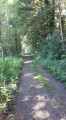
(6) Just before number 84, take the path on the right, between this building and the meadow. The path continues straight on as a track running between the meadows. It makes a slight bend and then leads into Rue Jules Pirotte, which you follow to the left until the next junction (passing in front of the cemetery).
At the junction, first turn left then right onto Rue du Cerf. At the end, turn left onto Rue Dabée. Cross a road and continue straight on towards the church along Rue de la Sablière.
(7) At the next junction, keep left into Rue Bas Pierremont (the street name is visible a little further on along the tall hedge). This street turns immediately left and then right. Follow it until you reach the next street (Rue Eau Morte) on the right; turn into it and follow it almost to the end.
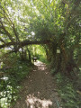
(8) Turn onto the path on the right, just after number 12, heading downhill. The path continues as a track, winding through the woodland alongside the Ruisseau de Châlet. Follow it to the end, past the two houses, until you reach the crossroads.
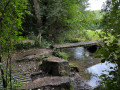
(9) At the junction, at the end of the path, take the dirt track on the left, which soon runs alongside a woodland before emerging onto a main road (N684). Walk along it on the left for 200 m (downhill) and take the first path on the left. This leads to the grounds of the Abbaye de la Paix-Dieu, which is well worth a look.
(10) Walk past the car parks and buildings until you reach the road (Rue Paix-Dieu). Follow it to the left for about 40 metres, then cross the road opposite the house (no. 1a).
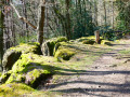
(11) Take the path that climbs diagonally to the left of the house and winds up the valley beneath the canopy of trees. At the top, it emerges into the fields and then joins a tarmac road.
(12) Cross the road and turn into Rue du Tambour opposite; follow it for 600 metres (many modern houses), then take the second street on the left (Rue Loumaye). Walk down this street for 200 m, then take the small, inconspicuous path on the right after house no. 8. The path comes out onto Rue Zénobe Gramme, which you follow uphill back to Rue du Tambour. Turn left onto this street and follow it to the end to reach the car park (S/E).

 Visorando Member
 Difficult

 Easy
 Tourist office