Country:
 City:
City:


The route starts at the small car park opposite the François Funeral Parlour.
(S/E) Set off to the right along Rue de Lexhy and ignore the two paths on your right.
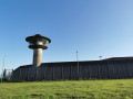
(1) Shortly after the second path on the right (Chemin des Rêts), turn left onto a small track between fields and meadows for about a hundred metres. When you reach a tarmac road (Rue du Postillon), carry on straight ahead until the next four-way junction (on the ridge, you may be able to see Liège Airport’s facilities straight ahead and, why not, a wide-body aircraft taking off with the approach radar in the foreground). At the junction, turn left onto the old Roman road, skirting the woodland of a beautiful estate, and continue to the next junction.
(2) Turn right and enter the hamlet of Goreux, passing the famous whisky distillery in Fexhe-le-Haut-Clocher, ‘The Owl Distillery’, and continue along the path, which slopes upwards and then downwards towards the next T-junction. Before starting the descent, take a look at the church at Voroux-Goreux on your left and the airport’s heavy goods vehicle car parks opposite you.
At the T-junction, turn right past an isolated house and carry on straight ahead through the fields towards the next T-junction; on your right is the airport’s approach radar. First turn left then right and follow the Chemin des Alouettes to the next four-way junction, with the village of Roloux on your right.
(3) At the junction, turn left and drive past the Bierset concrete plant (Rue du Traquet) and head down towards Rue des Blancs Bastons.
(4) At the junction, turn right and make sure to keep to the left-hand side of the road, as there is sometimes traffic heading towards the airport’s freight area. Continue to the first farm and the junction with Rue des Quatre fossés.
(5) Turn left and follow this slightly uphill road to a house, then downhill to the next junction (on the left and straight ahead of the runway threshold and the freight area car parks).
(6) At the junction, turn right onto Rue du Ferdou and head downhill towards the next junction; on the left, you’ll see Fontaine Castle. At the junction, carry straight on along Rue Brennée, then, on the right, head downhill along Rue des Rochers until you reach the T-junction. Head back up this road, turning right onto a gentle slope, until you reach the next four-way junction. Cross the road and continue along Rue de Hozémont.
(7) Opposite the old schools, turn right and head up Rue Péry to the next junction.
(8) Turn right and walk up Rue de la Station, passing the “Les Buissonnets” care home, then crossing Rue de Horion to the next T-junction (residential area).
(9) Turn right onto Rue de la Douainière and head towards the junction with Rue de la Ferme and its superb lime tree (which is very fragrant between August and September). Continue straight on along Rue des Cornus Champs until you reach the junction with Rue de l’Arbre à la Croix.
(10) Cross the road and carry on to the left via Rue du Saou, which curves to the right towards a large farm as it passes through a small, quiet residential area. Carry on across the fields towards the next junction. At the junction, turn left and keep well to the left, as the road has a fair amount of traffic but motorists drive far too fast; continue for about 200 metres, then, at the crest, turn right. Carry on straight ahead across the fields; at the next crossroads, turn left then right until you reach the N637; on your right is the hamlet of Roloux and its thousand-year-old Romanesque church.
(11) Cross the N637 and carry on straight ahead for 400 metres, still through the fields, towards Rue de Noville. Turn left, then immediately right onto a small path running alongside meadows and then the railway line towards Fexhe-le-Haut-Clocher station.
(12) When you reach the station, turn right and head back up towards the starting point via Rue de la Station and Rue de Roloux (S/E).


 .
. Tourist office
 Easy
Easy 
 Visorando Member
 Difficult