


Refine your search for walks in Haillicourt
Haillicourt walks


 Les falandes depuis Haillicourt
 Association / Club / Walk leader
 5.51 mi
 +476 ft
 -463 ft
 2h 55
2h 55
 Moderate
 Departure from Haillicourt (Pas-de-Calais)
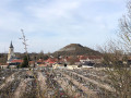
Cette randonnée vous conduiras sur les terrils, culminant a 180 m. Vous gravirez les 389 marches pour atteindre le sommet de l'un d'entre-eux sans compter que vous marcherez sur les divers terrils.
Sur le terril 9, 2000 pieds de vignes ont été planter en 2011 et donnent a ce jour du vin appelé charbonnay.
Slag heaps 2, 3 and 122 in the ‘Pays à part’ region
 Visorando Member
 6.26 mi
+446 ft
-420 ft
3h 15
Moderate
Departure from Haillicourt (Pas-de-Calais)
6.26 mi
+446 ft
-420 ft
3h 15
Moderate
Departure from Haillicourt (Pas-de-Calais)
A route that will take you to the foot of slag heap 122 (known as the ‘Volcan’ slag heap). You’ll walk up old ‘cavaliers’ (paths that linked the pits together), where flora and fauna have reclaimed their place, and climb one of the twin slag heaps of the ‘Pays à part’, rising to an altitude of 180 metres (offering a magnificent view).
Chès Noirs Monts à m’mote
 3.66 mi
+138 ft
-138 ft
1h 50
3.66 mi
+138 ft
-138 ft
1h 50
 Easy
Departure from Ruitz (Pas-de-Calais)
Easy
Departure from Ruitz (Pas-de-Calais)
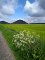
Les Noirs Monts, as I see it, or a reworking of a walk that has been around for a very long time.
The Bois des Dames starting from Labuissière
 6.51 mi
+243 ft
-240 ft
3h 10
Moderate
Departure from Bruay-la-Buissière (Pas-de-Calais)
6.51 mi
+243 ft
-240 ft
3h 10
Moderate
Departure from Bruay-la-Buissière (Pas-de-Calais)
This walk, starting from Labuissière, will take you to the Bois des Dames via the castle. You will then follow the Lawe river and cross part of the Bois des Dames with its centuries-old oak trees and rich biodiversity.
Circular walk around the keep and the La Buissière slag heap
 6.32 mi
+282 ft
-289 ft
3h 10
Moderate
Departure from Bruay-la-Buissière (Pas-de-Calais)
6.32 mi
+282 ft
-289 ft
3h 10
Moderate
Departure from Bruay-la-Buissière (Pas-de-Calais)
This walk, starting from Bruay-Labuissiere, will take you through the Bois des Dames and up the slag heap. You’ll follow the River Lawe, all along very good wooded paths with a few gentle climbs.
The two Haillicourt slag heaps and the Étang de la Fossette
 7.32 mi
+545 ft
-522 ft
3h 50
Moderate
Departure from Maisnil-lès-Ruitz (Pas-de-Calais)
7.32 mi
+545 ft
-522 ft
3h 50
Moderate
Departure from Maisnil-lès-Ruitz (Pas-de-Calais)
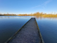
From the mine to angling on this walk. Climb the 389 steps of the first slag heap and walk round the second. A bare minimum of roads to reach the lovely Étang de la Fossette – another beautifully landscaped spot, and no tarmac!
La Buissière - Ourton loop following the Biette, then the Lawe
 13.84 mi
+535 ft
-512 ft
6h 50
13.84 mi
+535 ft
-512 ft
6h 50
 Difficult
Departure from Bruay-la-Buissière (Pas-de-Calais)
Difficult
Departure from Bruay-la-Buissière (Pas-de-Calais)
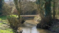
This is a long walk in an urban area, but 90% of it is on paths. Start at the old bridge and its steps, then follow the Biette (a beautiful footbridge restored last year) to Ourton. Next, climb back up (unfortunately on the road) before descending to Beugin. Follow another bridge to the Divion Viaduct. There, a slightly tricky descent takes you back to the banks of the Lawe. Follow it first on the left bank, then on the right bank before following the bus route. And to finish in style, the Bois de la Volville, with a nice climb at the end.
 Between woods and mining riders in Bruay-la-Buissière
8.15 mi
+243 ft
-233 ft
1 hr
Moderate
Departure from Bruay-la-Buissière (Pas-de-Calais)
This circular hike offers a superb hike that combines mining history, nature and redevelopment. You will take an old mining railway line (a former railway line used to transport coal) that crosses the Bois des Dames to take you to the Chartreuse des Dames in Gosnay.
Let’s go for a walk in the Maisnil-lès-Ruitz woods
 12.47 mi
+1,089 ft
-1,099 ft
6h 40
Difficult
Departure from Maisnil-lès-Ruitz (Pas-de-Calais)
12.47 mi
+1,089 ft
-1,099 ft
6h 40
Difficult
Departure from Maisnil-lès-Ruitz (Pas-de-Calais)
A long route that winds through the Bois d’Olhain. A difficult route, and even very difficult in wet weather.As with all routes through woodland, the route description isn’t very clear, so I recommend using the app.
The Houchin tour
 5.51 mi
+141 ft
-144 ft
2h 40
Easy
Departure from Houchin (Pas-de-Calais)
5.51 mi
+141 ft
-144 ft
2h 40
Easy
Departure from Houchin (Pas-de-Calais)
Short route on well-marked paths. Little tarmac, for a breath of fresh air.
La Houchinel from Houchin
 5.37 mi
+72 ft
-66 ft
2h 30
Easy
Departure from Houchin (Pas-de-Calais)
5.37 mi
+72 ft
-66 ft
2h 30
Easy
Departure from Houchin (Pas-de-Calais)
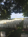
This hike from Houchin will allow you to discover another side of the mining basin without much difficulty along beautiful trails.
A bit of history: the pit, 12 mining companies from Noeux-les-Mines. Mining began in 1939 and was halted in 1940 with the German occupation and never resumed.
La Lawe in Bruay-la-Bruissière
 5.09 mi
+98 ft
-98 ft
2h 25
Easy
Departure from Bruay-la-Buissière (Pas-de-Calais)
5.09 mi
+98 ft
-98 ft
2h 25
Easy
Departure from Bruay-la-Buissière (Pas-de-Calais)
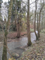
This walk will take you on a tour of Bruay-la-Buissière, starting from Parc de la Lawe and passing by the Miners' Memorial and the Corons.
This young commune owes its name to the merger of Bruay-en-Artois and La Buissière, which took place in 1987.
Circuit "Les fossés" à Barlin
 8.07 mi
+200 ft
-197 ft
3h 55
Moderate
Departure from Barlin (Pas-de-Calais)
8.07 mi
+200 ft
-197 ft
3h 55
Moderate
Departure from Barlin (Pas-de-Calais)
Belle randonnée entre bois, plaine et étang. En partie ombragée.
GR® et PR® du parc à Mesnil-lès-Ruitz
6.82 mi
+679 ft
-682 ft
3h 45
Moderate
Departure from Maisnil-lès-Ruitz (Pas-de-Calais)
Très belle randonnée dans le parc, en sous-bois et avec une belle vue sur le golf et le château.
Brette and Lawe
 7.62 mi
+312 ft
-312 ft
3h 45
Moderate
Departure from Houdain (Pas-de-Calais)
7.62 mi
+312 ft
-312 ft
3h 45
Moderate
Departure from Houdain (Pas-de-Calais)
Hike, without major difficulty, through woodland and countryside.
Trail along the little paths of Houdain via Mont de la Comté
 14.82 mi
+961 ft
-935 ft
7h 40
Difficult
Departure from Houdain (Pas-de-Calais)
14.82 mi
+961 ft
-935 ft
7h 40
Difficult
Departure from Houdain (Pas-de-Calais)
Admittedly, the trail may seem a little monotonous, but what a beautiful path! It takes you gently up to the heights before dropping back down into the valley to climb Mont de la Comté.And at the end of the trail, the church awaits you.
Circular route between Fouquereuil and Bruay
 13.31 mi
+495 ft
-499 ft
6h 35
Difficult
Departure from Fouquereuil (Pas-de-Calais)
13.31 mi
+495 ft
-499 ft
6h 35
Difficult
Departure from Fouquereuil (Pas-de-Calais)
Long route through the urban area. Follow the Lawe and then the Brette to reach the Miner's Monument in Bruay. To return, head to Cité 4 in Bruay before reaching the Bois des Dames by following the PR® du Bois des Dames. Crossing the woods takes you to the slag heap before leading you to Emmaüs. From there, the return journey is via the Bois de la Sablière. There are many paths and "bus lanes" for a route that is passable even in wet weather.
Le château depuis Rebreuve-Ranchicourt
 7.69 mi
+433 ft
-446 ft
3h 55
Moderate
Departure from Rebreuve-Ranchicourt (Pas-de-Calais)
7.69 mi
+433 ft
-446 ft
3h 55
Moderate
Departure from Rebreuve-Ranchicourt (Pas-de-Calais)
Cette randonnée vous permettra de découvrir de jolis paysages et, sur le retour, le Château de Ranchicourt
Around Cuvigny
 6.79 mi
+354 ft
-384 ft
3h 25
Moderate
Departure from Rebreuve-Ranchicourt (Pas-de-Calais)
6.79 mi
+354 ft
-384 ft
3h 25
Moderate
Departure from Rebreuve-Ranchicourt (Pas-de-Calais)
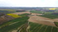
A short walk on good paths in the hills above La Comté. On a clear day, the panorama is superb, and if you're luckier than me, you'll spot a few deer.
Slag heaps 37 and 56 in Verquin
2.93 mi
+151 ft
-171 ft
1h 30
Easy
Departure from Verquin (Pas-de-Calais)
This route will take you past two slag heaps from the old Noeux mines. These are two very unspoilt slag heaps, hardly developed at all, either for tourism or for industrial purposes. So, let the adventure begin.
The Two Rivers Trail in Fouquières-lès-Béthune
 5.18 mi
+135 ft
-135 ft
2h 30
Easy
Departure from Fouquières-lès-Béthune (Pas-de-Calais)
5.18 mi
+135 ft
-135 ft
2h 30
Easy
Departure from Fouquières-lès-Béthune (Pas-de-Calais)
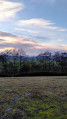
The two rivers trail from Fouquières-lès-Béthune to Fouquereuil takes you along the Blanche to the Annezin marsh, then along the Lawe before walking above the water under a railway line!
This route will take you to the Fouquereuil storage slag heap (the Terril de la Cuisse Maraune) where you can enjoy a superb 360° panorama from the top. The return journey is through the fields.
The two Chartreuses in Fouquières-lès-Béthune
 7.67 mi
+174 ft
-151 ft
3h 40
Moderate
Departure from Fouquières-lès-Béthune (Pas-de-Calais)
7.67 mi
+174 ft
-151 ft
3h 40
Moderate
Departure from Fouquières-lès-Béthune (Pas-de-Calais)
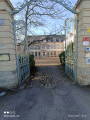
Belle randonnée sans difficulté. Elle vous fait découvrir des chartreuses dans la campagne et les bois environnants.
Route du Bois in the Olhain Forest
 6.22 mi
+400 ft
-404 ft
3h 15
Moderate
Departure from Fresnicourt-le-Dolmen (Pas-de-Calais)
6.22 mi
+400 ft
-404 ft
3h 15
Moderate
Departure from Fresnicourt-le-Dolmen (Pas-de-Calais)
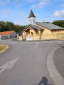
This walk through the Olhain State Forest takes you along good paths, which can be a bit muddy in winter. You can visit the arboretum right next to the starting car park and pop into Verdrel for a quick look.
Bernard’s walk from Lapugnoy
 6.86 mi
+407 ft
-427 ft
3h 30
Moderate
Departure from Lapugnoy (Pas-de-Calais)
6.86 mi
+407 ft
-427 ft
3h 30
Moderate
Departure from Lapugnoy (Pas-de-Calais)
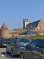
A lovely walk that takes you through the Bois des Dames State Forest, with its rich biodiversity and a good climb, returning via Labeuvrière and passing over the slag heap. A bit of mining history: in 1920, many Polish workers arrived in Lapugnoy, where they were forced to build the barracks to house themselves.
From one woodland to another, starting from Labeuvrière and passing by slag heap no. 12
 11.18 mi
+640 ft
-614 ft
5h 40
Moderate
Departure from Labeuvrière (Pas-de-Calais)
11.18 mi
+640 ft
-614 ft
5h 40
Moderate
Departure from Labeuvrière (Pas-de-Calais)
The route takes you through the two woods of Lapugnoy: Roquelaure with its easy paths, followed by the Bois des Dames where the trails can be very wet. I’ve tried to take the lesser-known paths, particularly in the Bois des Dames, which makes for a route that’s quite difficult to follow. I recommend using the Visorando app. Note: on OpenStreetMap, the paths are clearly marked.
The slag heap is very beautiful in spring when it’s covered in flax.
Two woods, a slag heap and a charterhouse to digest it all
14.94 mi
+738 ft
-735 ft
7h 30
Difficult
Departure from Labeuvrière (Pas-de-Calais)
Up to the entrance to the Bois des Dames, the route is much the same as this walk (there aren’t many options in the Bois de Roquelaure), but for the section through the Bois des Dames, I took different paths. The final stretch passes behind Emmaüs before reaching the Chartreuse des Dames and joining the Bois des Sablières.It’s a long, winding route, with hardly any tarmac and a significant elevation gain; whilst there are no major hills, there’s a succession of ascents and descents, which makes it more tiring . Very difficult in wet weather.Use ofthe Visorando app is strongly recommended.
Woods, footpaths and mining heritage around Lapugnoy
 13.71 mi
+505 ft
-509 ft
6h 45
Difficult
Departure from Lapugnoy (Pas-de-Calais)
13.71 mi
+505 ft
-509 ft
6h 45
Difficult
Departure from Lapugnoy (Pas-de-Calais)
Long route through the Bois de Roquelaure, the Poulouches d'Allouagne and the Vallée Carreau d'Auchel. Return via Lozinghem and Mont Éventé before finishing at the Terril de Lapugnoy and a beautiful path on the edge of the Bois des Dames.Relatively little tarmac (but we are still in an urban area), but in wet weather, some paths can become difficult.
Val de Clarence and Bois de Roquelaure
13.96 mi
+646 ft
-640 ft
7h 00
Difficult
Departure from Lapugnoy (Pas-de-Calais)
A patchwork of the various marked trails in the area for a long stroll, ending at the Bois de Roquelaure. It is a highly urbanised area, but you still feel as though you are in the countryside.