Thibessart Pond via the Mellier Forges, starting from Rulles

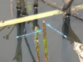
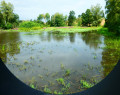
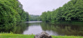
The magnificent Thibessart Pond, on the Mandebras Stream, features a bird and dragonfly observation point. An educational trail has been created there, focusing on dragonflies.

Details

103189238
Creation:
Last update:
Last review:
  • Walking
    Activity: Walking
  • ↔
    Distance: 11.98 mi
  • ◔
    Average duration: 6h 25 
  • ▲
    Difficulty: Moderate

  • ⚐
    Back to start: Yes
  • ↗
    Ascent: + 1,083 ft
  • ↘
    Descent: - 1,056 ft

  • ▲
    Highest point: 1,532 ft
  • ▼
    Lowest point: 1,119 ft

Photos

Description of the walk

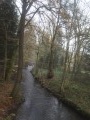
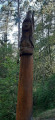
(1) This is where the ‘Chemin des Côtes’ begins. It follows the course of the Mandebras stream upstream. Numerous information boards, often accompanied by a work of art, explain the lives of the forest’s animals.

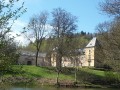
(5) The houses at Forges Basses and (6) those at Forges Hautes are private properties. The Forges Hautes site is of greater interest as visitors can observe the pond and its aquatic life, as well as the buildings or ruins of the former coal and ore sheds.

The south-eastern section of Thibessart Pond between (10) and (12) is private, and the path leading to the small, horseshoe-shaped fishing pond is blocked by a padlocked gate and several ‘Private Property’ signs. This is why the route for this walk turns left at (7) to reach the wetland to the north of the pond at (8) and, after going round the pond, the route returns to (7) and turns left there to reach the ford over the Mandebras stream at (12). Please note that this ford can be tricky after heavy rain or during the snowmelt. It is, of course, possible to continue straight on (7) and reach the pond directly, but you will then have to walk this section in the opposite direction on the way back.

Whilst the route is mainly through woodland, the start of the Chemin des Côtes – and particularly the end, after emerging from the woods on the heights of Rulles – offers a beautiful view of the surrounding countryside.

Waypoints

  1. S/E : mi 0 - alt. 1,119 ft - Chemin du Mont Carmel
  2. 1 : mi 0.4 - alt. 1,152 ft - Chemin des Côtes
  3. 2 : mi 1.88 - alt. 1,240 ft - Nobohan
  4. 3 : mi 2.3 - alt. 1,273 ft - Biseux
  5. 4 : mi 2.36 - alt. 1,257 ft - Footbridge
  6. 5 : mi 3.72 - alt. 1,230 ft - Forges Basses de Mellier
  7. 6 : mi 4.44 - alt. 1,243 ft - Forges Hautes de Mellier
  8. 7 : mi 5.68 - alt. 1,516 ft - Crossroads
  9. 8 : mi 6.23 - alt. 1,394 ft - Dragonfly Footbridge
  10. 9 : mi 6.5 - alt. 1,348 ft - Observation point
  11. 10 : mi 6.61 - alt. 1,325 ft - Picnic tables
  12. 11 : mi 6.66 - alt. 1,345 ft - Fish pass (trout)
  13. 12 : mi 7.93 - alt. 1,352 ft - Ford
  14. 13 : mi 9.61 - alt. 1,371 ft - Wez Stream
  15. 14 : mi 10.08 - alt. 1,266 ft - Ford with slats on the ground
  16. 15 : mi 11.25 - alt. 1,161 ft - Rulles Fishing Ground
  17. S/E : mi 11.98 - alt. 1,119 ft - Chemin du Mont Carmel

Notes

People with reduced mobility can access the pond via a vehicle access road leading off the N861, and two disabled parking spaces have been provided near the observation point.

Other walks in the area

For more walks, use our search engine .

The GPS track and description are the property of this route's author. Please do not copy them without permission.