


Grande Traversée des Alpes - De Saint Gingolph à Bourg-Saint-Maurice

Itinéraire reliant le lac Léman à Bourg Saint Maurice. Toutes les étapes font parties de la grande Traversée des Alpes reliant Saint Gingolph (Lac Léman) à Nice. Le balisage à suivre est le GR®5. Il permet de randonner en admirant les différents paysages sans toujours être concentré sur une carte IGN.
Les régions traversées dans cette partie sont le Chablais, le Giffre, le Massif du Mont Blanc, le Beaufortain.
Details
Creation:
Last update:
Last review:
–
–
-
 Activity: Walking
 -
 Distance: 88.05 mi
 -
 Average duration: 7 days
 -
 Difficulty: Difficult
 -
-
 Back to start: No
 -
 Ascent: + 28,251 ft
 -
 Descent: - 26,739 ft
 -
-
 Highest point: 8,225 ft
 -
 Lowest point: 1,266 ft
-
 Country:
France
Country:
France
-

-
 City:
Saint-Gingolph (74500)
City:
Saint-Gingolph (74500) -
 Start: N 46.393411° / E 6.803991°
 -
 End: N 45.696563° / E 6.734089°
 -


 Hour-by-hour weather


Stages of the route
This route needs several days, find the details below:
This route passes through multiple protected areas, which may be subject to special regulations:
Other walks in the area
Saint Gingolph - La Chapelle d'Abondance
 Visorando Member10.74 mi
+6,010 ft
-3,934 ft
10h 10
Difficult
Departure from Saint-Gingolph (Haute-Savoie)
Visorando Member10.74 mi
+6,010 ft
-3,934 ft
10h 10
Difficult
Departure from Saint-Gingolph (Haute-Savoie)
Itinéraire de la traversée des Alpes. Etape des rives du lac Léman au Val d'Abondance. Franchir les montagnes du Chablais par une longue grimpette de 1850m en traversant les alpages pour passer le Col de Bise puis redescendre à la station de ski de la Chapelle d'Abondance. Cet itinéraire offre de très beaux panoramas sur le plus grand lac d'Europe et sur le sommet des Cornettes de Bise.
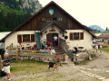
From Saint-Gingolph to the Chalets de Bise
 7.66 mi
+5,013 ft
-1,348 ft
7h 55
Difficult
Departure from Saint-Gingolph (Haute-Savoie)
7.66 mi
+5,013 ft
-1,348 ft
7h 55
Difficult
Departure from Saint-Gingolph (Haute-Savoie)
This first stage of the Grande Traversée des Alpes (GTA), from Lake Geneva to the Mediterranean, takes place in the Chablais massif. The path climbs up the Novel valley on the left bank of the Morge, below the hamlet of La Meurtaz, then follows the D30 road, which it overlooks after the hamlet of Jordy. On leaving Novel, the path winds its way above the hairpin bends of the D30 to La Planche. There, it leaves the main valley route to climb due south towards the chalets of Neuteu and on to the Col de Bise, before descending to the Chalets de Bise.
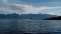
Along the shores of Lake Geneva from one Saint-Gingolph to the other
 1.61 mi
+102 ft
-102 ft
0h 50
1.61 mi
+102 ft
-102 ft
0h 50
 Easy
Departure from Saint-Gingolph (Haute-Savoie)
Easy
Departure from Saint-Gingolph (Haute-Savoie)
On the southern shore of Lake Geneva, two neighbouring municipalities are both called Saint-Gingolph; one is in Switzerland, the other in France. This short walk takes you from one to the other, first along the lake and then through the streets higher up. You’ll be treated to some stunning views and a rich heritage.
La Dent d'Oche from Novel
 Association / Club / Walk leader
 8.89 mi
+4,478 ft
-4,475 ft
8 hrs
8.89 mi
+4,478 ft
-4,475 ft
8 hrs
 Very difficult
Departure from Novel (Haute-Savoie)
Very difficult
Departure from Novel (Haute-Savoie)
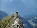
La Dent d'Oche is accessible via various routes. This one starts from a place called "La Planche" above Novel. It passes through "les chalets de Neuteu", the Pavis pass, the portes d'Oche, the lac de la case, the planchamp pass, the dent d'Oche and returns via the Rebollion pass, the Neuve pass, the Neuva dessous, the enclos, and finally "la Planche".
This route allowed us to see many ibex in different places and the local flora.
Pointe de Pétalouse
 5.80 mi
+2,175 ft
-2,175 ft
4h 35
5.80 mi
+2,175 ft
-2,175 ft
4h 35
 Moderate
Departure from Novel (Haute-Savoie)
Moderate
Departure from Novel (Haute-Savoie)
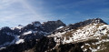
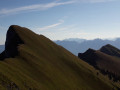
A little-visited peak, more accessible than the neighbouring Pic de Borée and offering a beautiful panorama. The walk takes place in superb surroundings.
Pic de Borée from Novel
 5.61 mi
+2,510 ft
-2,510 ft
4h 45
Difficult
Departure from Novel (Haute-Savoie)
5.61 mi
+2,510 ft
-2,510 ft
4h 45
Difficult
Departure from Novel (Haute-Savoie)
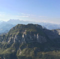
A summit offering superb views of both Lake Geneva and the Chablais massif. This route via the south face offers a walk in a beautiful natural setting. It also avoids the hassle of the ski lifts at the Thollon ski resort (north face, more crowded).
La Grande Jumelle from Novel
 8.00 mi
+3,967 ft
-3,960 ft
7 hrs
Very difficult
Departure from Novel (Haute-Savoie)
8.00 mi
+3,967 ft
-3,960 ft
7 hrs
Very difficult
Departure from Novel (Haute-Savoie)
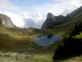
An original route to climb a little-visited summit from which you can enjoy sweeping views. A relatively demanding route, with exposed sections along the summit ridge, set in a very beautiful landscape.
Lac et Pas de Lovenex
 4.81 mi
+2,497 ft
-2,490 ft
4h 25
Difficult
Departure from Novel (Haute-Savoie)
4.81 mi
+2,497 ft
-2,490 ft
4h 25
Difficult
Departure from Novel (Haute-Savoie)
Niché dans un cadre sauvage, le Lac de Lovenex constitue le but de cette randonnée franco-suisse. On passe d'abord au Pas de Lovenex, afin de bénéficier d'une vue unique sur ce petit lac qui apparaît comme suspendu au-dessus du Lac Léman visible à l'arrière-plan.
For more walks, use our search engine .
The GPS track and description are the property of this route's author. Please do not copy them without permission.

