Country:

 City:
City:


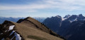
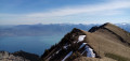
Park in a fairly large car park located past the hamlet of La Planche, at the end of the road leading up from Novel (end of authorised access; sign indicating ‘altitude 1,205 m’). Access from Saint-Gingolph (French-Swiss border).
Signposts are provided at all major junctions.
(S/E) Continue along the road you arrived on, towards the Col de Neuvaz. The road soon gives way to a track through the forest. At the first fork, take the right-hand track. Cross a stream and take a sharp right-hand bend. Follow the track, known locally as the Route de la Planche, and ignore a turn-off to the right followed by one to the left (ignore the signposting).
(1) Take a hairpin bend to the left (rock on the outer edge). The track, known as Route de Neuvaz, then heads broadly westwards. Several signs indicate that you are on a private road and that traffic is prohibited, but this only applies to motor vehicles. Ignore several junctions on the left and follow the signs for the Col de Neuvaz each time. Reach the Neuvaz chalet below.
(2) The track then becomes very steep and makes a wide right-hand bend to go round a sort of grassy outcrop.
(3) At the top of the steep section, the track turns left and the gradient levels out. Continue westwards.
(4) At a fork in the road, take the path on the right, which is better marked. At the next fork, about a hundred metres further on, turn right. Head north-east along a stony track that winds its way up, running directly below some very steep grassy slopes. Cross an area with a few scattered spruce trees, then turn sharply left towards the Col de Parchet, which is very close by.
(5) There are two options here:
- As shown on the map, turn right before reaching the pass and follow an alpine fence on your left.
- Head for the pass, go through the turnstile and turn right to follow the fence on your right. Take care: the path is narrow and there are sheer drops on the left-hand side.
In both cases, climb a steep slope to reach a secondary summit.
(6) Continue along the grassy ridge, following the fence, and you’ll easily reach the summit where a simple wooden cross stands (if you’ve chosen the first option, climb over the fence to reach the cross).
(7) The descent follows the same route. Please note: after the hairpin bend (1), do not turn left, as a yellow arrow suggests, but continue along the track taken on the way up to return to the starting point (S/E).

 Association / Club / Walk leader
 Very difficult
 Visorando Member
 Difficult