La Grande Jumelle from Novel

An original route to climb a little-visited summit from which you can enjoy sweeping views. A relatively demanding route, with exposed sections along the summit ridge, set in a very beautiful landscape.

Details

25268787
Creation:
Last update:
Last review:
  • Walking
    Activity: Walking
  • ↔
    Distance: 8.00 mi
  • ◔
    Duration according to the author: 7 hrs 
  • ▲
    Difficulty: Very difficult

  • ⚐
    Back to start: Yes
  • ↗
    Ascent: + 3,967 ft
  • ↘
    Descent: - 3,960 ft

  • ▲
    Highest point: 7,146 ft
  • ▼
    Lowest point: 3,957 ft

Photos

Description of the walk

Park in the fairly large car park located past the hamlet of La Planche, at the end of the road leading up from Novel (end of authorised access; signpost ‘La Planche à Brousoz, altitude 1,205 m’). Access from Saint-Gingolph (French-Swiss border).

Signposts are in place at major junctions

Red and white + blue markings

(S/E) Set off southwards following theGR®5, cross a stream and continue through the forest. Cross a pasture until you reach a signpost.

(1) Then turn right onto a gravel track. At the next signpost, ignore the track branching off to the right and take a path to the left. At the next signpost, veer left onto a path that starts in a meadow and continues through the woodland.

Blue markings

(2) At an altitude of 1,330 m, turn left towards the Col de la Croix and Lac de Lovenex (let theGR®5continue straight on). Cross the bed of a dry stream (in summer), follow its right bank uphill, then veer left (you are now in Switzerland).

(3) At a signpost, continue towards the Col de la Croix, situated near the Grande Miette, a distinctive peak clearly visible high up to the south-east. The slope becomes steeper. Follow the left bank of another stream, then veer away from it to make a wide loop to the right. You’ll emerge at the bottom of a small valley and climb up it to reach the pass.

Markings: Yellow Diamond framed in black

(4) Turn right towards Pas de Lovenex (signposted), following a path that begins to descend slightly (do not take the first path on the right, which climbs up to the foot of the Grande Miette). Walk along the hillside, cross the dry bed of a torrent, then traverse an area of scree. Then follow a few steep hairpin bends along a path through the grass to reach the Pas de Lovenex.

Unmarked

(5) Descend on the other side (south-east) towards the Chalets de Loz (also known as ‘de l’Au de Taney’). Go round the chalets on the right.

(6) Continue eastwards and keep descending along an alpine track. At a fork in the road, keep left on the alpine track and head north-east towards the rocky foothills. You’ll come to a junction where the track turns east-south-east (directional signs with partially faded markings).

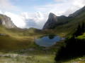
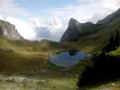
(7) Then turn left and head uphill (do not follow the signs for Taney). After a hairpin bend to the left, you’ll reach a chalet at a place called La Combe, at the bottom of a small, ancient glacial cirque. Walk past a chalet and continue for about fifty metres towards a small lake (or pond, depending on the season).

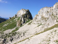
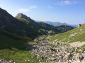
(8) Then turn right onto a faintly marked path. Follow a few switchbacks eastwards and go round a rocky outcrop on the right. Continue climbing east-north-east up a slope of short grass dotted with small limestone boulders. Finally, head north to reach the summit ridge.

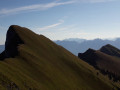
(9) Follow the rocky ridge to the right (east) to the summit (be careful, watch out for the north-facing cliffs).

(10) The return journey follows the same route as the ascent, in the opposite direction, to the La Planche car park in Brousoz (S/E).

Waypoints

  1. S/E : mi 0 - alt. 3,976 ft - Car park – La Planche in Brousoz
  2. 1 : mi 0.19 - alt. 3,973 ft - T-junction
  3. 2 : mi 0.67 - alt. 4,462 ft - Signpost
  4. 3 : mi 0.72 - alt. 4,531 ft - Signpost
  5. 4 : mi 1.4 - alt. 5,751 ft - Col de la Croix (Chablais)
  6. 5 : mi 1.92 - alt. 6,070 ft - Pas de Lovenex
  7. 6 : mi 2.45 - alt. 6,007 ft - Chalets de Loz
  8. 7 : mi 2.97 - alt. 5,771 ft - Fork in the path
  9. 8 : mi 3.51 - alt. 6,306 ft - La Combe
  10. 9 : mi 3.91 - alt. 7,133 ft - Summit ridge – View of the - Lac Léman
  11. 10 : mi 4 - alt. 7,133 ft - Grande Jumelle (la)
  12. S/E : mi 8 - alt. 3,976 ft - Car park – La Planche in Brousoz

Notes

Hiking kit and footwear are essential.

No water sources have been identified along the route.

For the ascent to the summit, allow between 3 and 4 hours’ walking, excluding stops.

Between (8) and (9), a good sense of the route and direction-finding skills are required. A detailed map is essential (at the very least, the one accompanying this description). La Grande Jumelle is also known as “Grande Séreu”: this place name is rarely used nowadays but can be found in some documents.

Worth a visit

- Lake Lovenex.
- Beautiful views of Lake Geneva along the way.
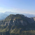
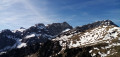
- From the summit, a sweeping panorama of Lake Geneva, the peaks of the Chablais, the Dents du Midi and the Mont Blanc massif.

Always be cautious and plan ahead when you're outdoors. Visorando and the author of this route cannot be held responsible for any accidents occurring on this route.

The GR® and PR® markings are the intellectual property of the Fédération Française de Randonnée Pédestre.

Reviews and comments

5 / 5
Based on 2 reviews

Reliability of the description
5 / 5
Ease of following the route
5 / 5
Route interest
5 / 5
User 25863395

Overall rating : 5 / 5

Date of your route : Sep 07, 2026
Reliability of the description : ★★★★★ Very good
Ease of following the route : ★★★★★ Very good
Route interest : ★★★★★ Very good
Very busy route : No

A lovely hike – you have to work for the summit!

Machine-translated

Le mato
Le mato

Overall rating : 5 / 5

Date of your route : Nov 01, 2024
Reliability of the description : ★★★★★ Very good
Ease of following the route : ★★★★★ Very good
Route interest : ★★★★★ Very good
Very busy route : No

A really lovely walk that starts in the forest and ends at the top of the Grande Jumelle. The scenery is superb and the paths are varied. There weren’t many people on the route, so we had it pretty much to ourselves.
The walk gets quite steep quite early on, and you need to be in good shape to complete the whole thing in a day. There’s the option of camping near La Combe if you fancy taking a tent.

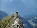
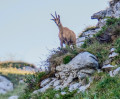
Our main company was that of the chamois, which we came across several times.

Machine-translated

Other walks in the area

For more walks, use our search engine .

The GPS track and description are the property of this route's author. Please do not copy them without permission.