Grand Veymont direct routes on the west and east faces

Ascent and descent of the highest point in the Vercors, via an off-trail route that is steep and wild. A beautiful hike, largely off unmarked trails, over steep to very steep slopes. You’ll need sure-footedness and a head for heights. A great way to escape the crowds and spot ibex.
Caution: steep off-trail ascent, scree. A short climbing section. The descent is even steeper and very exposed: falling is not an option.

Details

14898835
Creation:
Last update:
Last review:
  • Walking
    Activity: Walking
  • ↔
    Distance: 11.70 mi
  • ◔
    Duration according to the author: 10 hrs 
  • ▲
    Difficulty: Very difficult

  • ⚐
    Back to start: Yes
  • ↗
    Ascent: + 3,360 ft
  • ↘
    Descent: - 3,350 ft

  • ▲
    Highest point: 7,618 ft
  • ▼
    Lowest point: 4,432 ft

Photos

Description of the walk

Park in the Coche car park.

(S/E) Continue straight on along the road to the Maison Forestière de Pré Grandu.

(1) Turn left onto the Route Forestière de Combeau until you reach a Fork in the road.

(2) Keep left onto the Route Forestière de Combeau; further on, pass the Fontaine du Pichet on your right before reaching a clearing at an elevation of 1,480 metres.

(3) Leave the track and head straight on towards the far end of the grassy plain. Continue on to reach the junction withthe GR®91(elevation 1,672) near the Fontaine des Serrons.

(4) Head straight ahead to find the small Fontaine des Serrons, marked by large cairns. Continue uphill through the forest, then over scree and easy rocky terraces. Cross a small, stony valley to the left. Then head slightly back to the right, whilst climbing steeply. You’ll arrive beneath a steep scree slope about 50 m wide, with a small rocky ridge 4 to 6 m high above it. Cross the scree to the right whilst ascending and locate the small chimney. Then make an easy climbing move (Grade III) of about 3 m high, in the enclosed but not vertiginous chimney (use of hands essential). Animal tracks may help you find this passage. GPS track recommended.

(5) After this climbing section, which takes you over the only large rocky outcrop on the ascent, the route is steep but obvious. Take a short detour to the right between the trees to easily cross asecond small rocky outcrop 1 metre high.

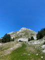
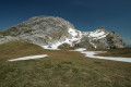
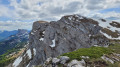
(6) After this small rocky outcrop, head straight up, veering slightly to the right. You’ll emerge at the top of the southern couloir. Beautiful views of the west face of the Grand Veymont.

(7) The rest of the route is obvious: head straight up the slope. Continue the steep climb through the meadows. There are a few rocks, but you no longer need to use your hands. It’s steep and long, but technically easy.

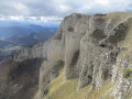
(8) Start the descent down the east face at around 2,300 m. From the summit, descend along the southern ridge path for about 100 m. Look for a small scree-filled gully. Head into this gully and make your way back down the east face of the Grand Veymont: the entire descent down the east face is then visible.
Caution: the descent down the east face is steeper than the ascent up the west face. Off the track. Unmarked. No trail. Impressive, as there are vertical cliffs below. Falling is not an option. You must have sure-footedness and not be afraid of heights. Do not attempt this if the ground is wet.
Easy alternative route: descend via the standard Pas des Chatons path, on the southern slope of the Grand Veymont.
Then descend 10 m to the right to pass beneath and round thefirst rocky spur. Then continue to the left of the face. Very faint track. Then navigate as best you can, staying on the grassy terraces and avoiding steep rocks and slippery scree or loose earth. You’ll reach the foot of the face at the pass between the Petit and the Grand Veymont. Turn round and admire the cliffs and the descent – the scenery is truly spectacular.

(9) From here on, the difficult sections are over. It is advisable to make a round trip up to the Petit Veymont. Allow 10 minutes for the ascent.

(10) A stunning view of Mont Aiguille and the Vercors… Turn back.

(9) Then head down to the left, through the mountain pastures towards the Col des Chatons. There’s a very short climb of 20 metres below the Pas des Chatons.

(11) Continue straight ahead along the easy, signposted paths. Head for the Bergerie de la Grande Cabane.

(12) Follow the marked and cairn-marked path straight ahead. Go round the Grande Cabane on the right, following the signs to avoid flocks of sheep and any mountain dogs guarding them. Then join the Rachier Forest Road. Further on, you’ll reach the original junction you passed on the way there.

(2) Turn left at the next Fork in the road; then take the right-hand path to rejoin the road and follow it to the right towards the Maison Forestière de la Coche to return to the Coche car park (S/E).


Waypoints

  1. S/E : mi 0 - alt. 4,432 ft - La Coche car park
  2. 1 : mi 0.32 - alt. 4,475 ft - Pré Grandu Forest House
  3. 2 : mi 0.71 - alt. 4,511 ft - Crossroads of the circular loop
  4. 3 : mi 2.18 - alt. 4,856 ft - After the Fontaine du Pichet
  5. 4 : mi 3.81 - alt. 5,479 ft - Fontaine des Serrons
  6. 5 : mi 4.27 - alt. 6,106 ft - Short climbing section.
  7. 6 : mi 4.39 - alt. 6,457 ft - Summit of the southern couloir
  8. 7 : mi 4.91 - alt. 7,612 ft - Le Grand Veymont
  9. 8 : mi 5.01 - alt. 7,533 ft - Start of the descent on the east-facing slope
  10. 9 : mi 5.37 - alt. 6,729 ft - Unnamed Pass – Access to the - Le Petit Veymont
  11. 10 : mi 5.49 - alt. 6,844 ft - Le Petit Veymont
  12. 11 : mi 6.4 - alt. 5,991 ft - Pas des Chattons
  13. 12 : mi 7.97 - alt. 5,125 ft - Grande Cabane - Bergerie
  14. S/E : mi 11.7 - alt. 4,432 ft - La Coche car park

Notes

- Water: do not rely too heavily on fountains and springs. They often run dry. This is a limestone massif and is very dry in summer. You can find out more on the website.
(4) Fontaine des Serrons: very, very low flow; water supply not guaranteed.
- Limestone massif, so the rock is very slippery in wet weather. This hike should be undertaken in dry weather, given the steepness of the slopes. Ideally from late May to November. So, no snow or black ice.

This route passes through a protected area, which may be subject to special regulations:

Worth a visit

The Vercors highlands are wild, vast and magnificent. A local must-see.

Always be cautious and plan ahead when you're outdoors. Visorando and the author of this route cannot be held responsible for any accidents occurring on this route.

The GR® and PR® markings are the intellectual property of the Fédération Française de Randonnée Pédestre.

Reviews and comments

4.7 / 5
Based on 2 reviews

Reliability of the description
5 / 5
Ease of following the route
4 / 5
Route interest
5 / 5
oponcin
oponcin
• Edited:

Overall rating : 5 / 5

Date of your route : Sep 18, 2022
Reliability of the description : ★★★★★ Very good
Ease of following the route : ★★★★★ Very good
Route interest : ★★★★★ Very good
Very busy route : No

A video of the hike – excluding the ascent of the Grand Veymont – exploring the high plateau

Machine-translated

microd
microd

Overall rating : 4.3 / 5

Date of your route : Jul 08, 2019
Reliability of the description : ★★★★★ Very good
Ease of following the route : ★★★☆☆ Average
Route interest : ★★★★★ Very good
Very busy route : Yes

Hello,
I’ve done this trail dozens of times. Just to let you know that you can find water at two other spots, depending on the time of year. If you stick to the route, you’ll need water on the way back. So, at the Pas des Chattons junction, extend your route (go straight on to the Fontaine des Hollowed-Out Tree Trunks, which flows all year round, 1 km away. This will make it a round trip, but your water bottles will be full.) The second water source will be to the right of the Grande Cabane (in summer, this one flows very little, and you’ll need a water filter). It’s located in a karstic cave (without a name). On the straight path leading to the sheepfold, turn right towards the woods; a narrow track will take you to the karstic cave, which is just 300 metres from the sheepfold (please note, the path is a bit steep to reach it). Even if you don’t need water, it’s a remarkable spot to see and offers a refreshing break.
Kind regards,
Microdrome

Machine-translated

Other walks in the area

For more walks, use our search engine .

The GPS track and description are the property of this route's author. Please do not copy them without permission.