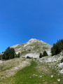
The But Sapiau from Rousset-en-Vercors

This walk takes you to But Sapiau via a circular route from Rousset-en-Vercors. It’s an alternative to the return walk from the Col de Rousset to Pré Peyret via theGR®93. This way, you can walk across the Vercors plateau and follow the entire ridge of the But Sapiau, with the option of taking the lovely descent via the Pas de Chabrinel, before reaching the But Sapiau itself.

Details

1617249
Creation:
Last update:
Last review:
  • Walking
    Activity: Walking
  • ↔
    Distance: 15.78 mi
  • ◔
    Duration according to the author: 8 hrs 
  • ▲
    Difficulty: Very difficult

  • ⚐
    Back to start: Yes
  • ↗
    Ascent: + 3,392 ft
  • ↘
    Descent: - 3,386 ft

  • ▲
    Highest point: 5,381 ft
  • ▼
    Lowest point: 3,084 ft

Photos

Description of the walk

The route starts on the D518 at the Pont des Oules, just after Rousset-en-Vercors at the junction with the Route des Liotards.
There’s no designated parking area, but you can park at the side of the road: on either side of the bridge or along the Route des Liotards, there are spots with enough space so as not to obstruct traffic.

(S/E) Head east and follow the Route des Liotards for 500m.

(1) After a left-hand bend and before the stopover lodge, leave the road and turn sharply right onto a good path towards Les Rancs de Charles (the route is signposted).

(2) A little further on, at a water intake, carry on straight ahead (still signposted) without taking the path that leads down to the right. The path then winds its way uphill to reach the summit of the Rancs de Charles. After crossing eastwards, you’ll join a wide track.

(3) Follow this track to the right (leaving the signposted route which heads off to the left). After about 400 metres, ignore the Route forestière du Pas du Bœuf on the right and continue east-northeast. Carry on along the track, ignoring a few faint forest paths on either side. You’ll come to a junction with another wide, well-marked track.

(4) Turn right here and follow the Route Forestière du Petit Bois until it fades away at a large clearing.

N.B. Between points (5) and (7), the base map contains inaccuracies and the track becomes poorly marked and easy to lose. Follow the route and the description.

(5) Cross the clearing; a track branches off to the left. Follow it until you reach an elevated observation hut at the entrance to a second clearing.

(6) Cross this clearing, veering slightly to the right (south-south-west). At the end of the clearing, you will find two cairns on either side of a path.

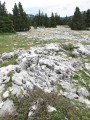
(7) Then follow a better-marked path southwards. After a short descent, rejoin the previous track and follow it to the left. You will then begin a long stretch across the plateau, heading generally south-east whilst keeping a escarpment on your left at all times. The path is virtually non-existent; there are only a few visible sections here and there, but the terrain is open and makes it easy to find your way.

(8) When the escarpment disappears, continue across the plateau, veering slightly to the right. There is no longer a path, but the terrain is undulating with meadows dotted with trees, and you can cross anywhere. Simply continue in a general easterly direction until you come across aPR® path coming from the Gerland hut. This path is very clearly marked; you can’t miss it when you come across it.

(9) Follow thePR® to the right (yellow markings) and you’ll come out onto theGR®91.

(10) Follow theGR® to the right towards the Pré Peyret hut (red and white markings).

(11) When theGR® takes a sharp bend to the left, leave it and continue straight on (south-south-west) via an off-trail shortcut.

(12) Rejoin theGR® and follow it to the left to reach the Pré Peyret hut.

(13) Then turn right (south) onto aPR® path (yellow markings) which descends below the hut and passes the Pas de Chabrinel.

(14) After the pass, the descent is steep and leads to the Gravelles junction.

(15) Take the path on the right (still signposted) which leads uphill. At a Fork in the road, continue straight on (ignore the path leading down to the left). Further on, at another Fork in the road, turn right and climb up to the Pas des Écondus.

(16) Follow theGR®93to the left as far as But Sapiau. At a junction (elevation 1641), carry on straight ahead on the GR®. Pass under a ski lift cable and reach the ridge at Pas de l’Échelette.

(17) Continue along the ridge westwards to But Sapiau.

(18) Continue onthe GR® along the ridge, which runs north-north-west. Reach a hillock with an orientation table. From there, descend to the top of the Bergerie ski lift, clearly visible to the north.

(19) Take a wide path branching off to the right (PR® signposted).

(20) After 400m, stay on the path on the left alongside the Berger ski lift.

(21) At the bottom, follow a road to the left.

(22) After about 300m, take a track (unmarked) that branches off sharply to the right. Immediately (50m on), turn onto a path on the left. Head down Combe Mouron (this shortcut avoids a good bit of the tarmac road followed by the signposted route).

(23) Join a wide track (bench, fountain) and follow it to the right. Stay on the track, ignoring the vague paths branching off to either side.

(24) When you reach the Pont des Scies, turn left along the track (north-west; do not cross the bridge).

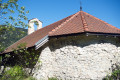
(25) After about 300m, take a short detour to the right to visit the Chapelle Saint-Alexis, situated amongst some ruins.

(25) Continue north-west along the track. Join the D518 and follow it to the right to return to the Pont des Oules (S/E).


Waypoints

  1. S/E : mi 0 - alt. 3,091 ft - Pont des Oules - Vernaison (rivière)
  2. 1 : mi 0.35 - alt. 3,228 ft - Crossroads
  3. 2 : mi 0.81 - alt. 3,455 ft - Captage – Fork in the road
  4. 3 : mi 1.94 - alt. 4,423 ft - Rancs de Charles – Track
  5. 4 : mi 2.47 - alt. 4,636 ft - Petit Bois Route
  6. 5 : mi 3.02 - alt. 4,829 ft - End of the trail
  7. 6 : mi 3.18 - alt. 4,843 ft - Observation hut
  8. 7 : mi 3.25 - alt. 4,846 ft - Cairns
  9. 8 : mi 4.66 - alt. 5,141 ft - End of the escarpment
  10. 9 : mi 5.38 - alt. 5,121 ft - Junction with the PR
  11. 10 : mi 5.64 - alt. 5,184 ft - Junction with the GR91
  12. 11 : mi 6.54 - alt. 5,312 ft - Shortcut (off the trail)
  13. 12 : mi 6.7 - alt. 5,302 ft - End of the shortcut
  14. 13 : mi 6.91 - alt. 5,253 ft - Cabane de Pré Peyret
  15. 14 : mi 7.22 - alt. 5,118 ft - Pas de Chabrinel
  16. 15 : mi 7.66 - alt. 4,508 ft - Les Gravelles
  17. 16 : mi 9.16 - alt. 5,072 ft - Pas des Econduis (1546m)
  18. 17 : mi 10.62 - alt. 5,236 ft - Pas de l'Échelette (1620m)
  19. 18 : mi 11.19 - alt. 5,253 ft - But Sapiau (1619m)
  20. 19 : mi 11.87 - alt. 4,948 ft - La Bergerie ski lift
  21. 20 : mi 12.18 - alt. 4,783 ft - Le Berger ski lift
  22. 21 : mi 12.6 - alt. 4,501 ft - Route
  23. 22 : mi 12.87 - alt. 4,439 ft - Junction (unmarked)
  24. 23 : mi 13.57 - alt. 3,950 ft - Fountain
  25. 24 : mi 15.04 - alt. 3,346 ft - Pont des Scies
  26. 25 : mi 15.23 - alt. 3,301 ft - Access to the - Chapelle Saint-Alexis (Rousset-en-Vercors)
  27. S/E : mi 15.78 - alt. 3,091 ft - Pont des Oules (Rousset-en-Vercors)

Notes

Avoid this route in snowy or foggy conditions, to ensure the paths on the plateau remain visible! Otherwise, it’s difficult to find your way.

Apart from the (optional) descent from the Pas de Chabrinel, there are no particularly steep sections, and the terrain is fairly easy (though walking boots are still required). The main difficulty lies in its relative length, combined with a significant elevation gain, but the ascent is gradual.

There is an alternative route to shorten the walk slightly: at the Pré Peyret hut, instead of descending the Pas de Chabrinel and climbing back up the Pas des Écondus, you can stay on the plateau by simply following theGR®93. This saves you a 200m descent and a 150m climb, but it’s a bit of a shame as the descent via the Pas de Chabrinel is lovely…

This route passes through a protected area, which may be subject to special regulations:

Worth a visit

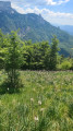
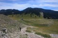
The walk allows you to explore the Vercors plateau, with the Grand Veymont as a backdrop.

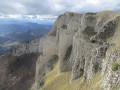
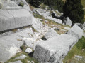
There are stunning views at But Sapiau and all along the ridge. The cliffs at But Sapiau are quite unique: the rocks are extremely fragmented – it looks just like a mountain of bricks!

Stop for a moment at the Pont des Oules (starting point): it looks quite unremarkable when you drive past it – it could be any old little stream. And yet, look down below: it hides a gorge of impressive depth!

Always be cautious and plan ahead when you're outdoors. Visorando and the author of this route cannot be held responsible for any accidents occurring on this route.

The GR® and PR® markings are the intellectual property of the Fédération Française de Randonnée Pédestre.

Reviews and comments

4.7 / 5
Based on 2 reviews

Reliability of the description
4.5 / 5
Ease of following the route
4.5 / 5
Route interest
5 / 5
Alison54
Alison54

Overall rating : 4.3 / 5

Date of your route : Jul 28, 2026
Reliability of the description : ★★★★☆ Good
Ease of following the route : ★★★★☆ Good
Route interest : ★★★★★ Very good
Very busy route : No

A magnificent hike, with landscapes of incredible beauty and variety. At times, the off-trail sections (unmarked paths or off-trail) aren’t easy to follow, and I would have got lost without a GPS. Lots of birds (griffon vulture, bearded vulture, red-billed chough, yellow-billed chough, raven…) and marmots. The descent, described as tricky, certainly is – technical and rugged – but it’s short and you can manage it; you just need to stay focused. This hike was a real treat.

Machine-translated

Romain L42
Romain L42

Overall rating : 5 / 5

Date of your route : Aug 30, 2024
Reliability of the description : ★★★★★ Very good
Ease of following the route : ★★★★★ Very good
Route interest : ★★★★★ Very good
Very busy route : No

Route taken on a Saturday in August.
A very pleasant, varied and rather off-the-beaten-track route. Very few people, even at this time of year (apart from the ridge sections on the GR93).
The route presents no significant difficulties, with the elevation gain fairly evenly distributed. The GPX track is very accurate.
There’s no water along the route apart from at the ‘Fontaine des Endettés’.
The wild crossing through the high plateaus is absolutely stunning.

Be careful with the shortcut after point 22 via the Combe Mouron: whilst the path is easy to find, it disappears very quickly and doesn’t seem to be used much anymore. It is almost entirely overgrown with vegetation, including a lot of stinging nettles.

Thanks for the route!

Machine-translated

Other walks in the area

For more walks, use our search engine .

The GPS track and description are the property of this route's author. Please do not copy them without permission.