The Ratier Circuit via Mont Julien

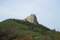
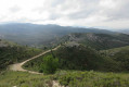
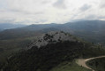
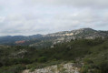
A circular route on either side of the Ratier valleys along beautiful DFCI tracks. Shortcuts through the valleys, heaths and forest allow you to shorten the route by bypassing many hairpin bends. They also lend a wild and challenging character to this route, right up to the ascent of Mont Julien (see also the practical information).

Details

17394514
Creation:
Last update:
Last review:
  • Walking
    Activity: Walking
  • ↔
    Distance: 6.21 mi
  • ◔
    Average duration: 4h 15 
  • ▲
    Difficulty: Moderate

  • ⚐
    Back to start: Yes
  • ↗
    Ascent: + 1,621 ft
  • ↘
    Descent: - 1,601 ft

  • ▲
    Highest point: 2,116 ft
  • ▼
    Lowest point: 732 ft

Photos

Description of the walk

Coming from Allauch, pass through the village of La Fève towards the D908. The walk starts at a large green gate next to underground cistern no. 141. Please note that there is only one parking space at this location. Alternatively, park 300 metres further down the road in an open area at the side of the road which can accommodate 3 to 4 vehicles.

(S/E) Set off along the DFCI track, heading north-east, and turn right onto thefirst track which, after a left-hand bend, climbs north-eastwards. Continue to the next hairpin bend.

(1) Halfway round the bend, turn left onto the path which descends steeply to reach the bottom of the valley. Turn right into the valley, then at a fork in the road keep to the right.

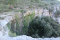
(2) After about 200 m, continue to the right onto the path which climbs through the vegetation (marked with purple dots). About a hundred metres further up, look out for a karstic cave on the right. When you reach a DFCI track, take it to the left. Pass two fire cisterns, nos. 523 and 522, in succession.
Turn left towards the north-east at a track junction, heading towards the electricity pylons. Keep to the left as the track descends; further on, the track passes under high-voltage power lines twice and climbs back up towards a junction.

(3) Turn left onto the wide track, heading north for about 200 m.

(4) At the junction, keep to the right and follow the FFC mountain bike signposts, in line with the electricity pylons. The track heads north and reaches a crossroads.

(5) Turn right towards a pylon and pass to its left. Pass another pylon and follow the path as it climbs, becoming increasingly overgrown. The path gradually turns north, then north-west, and reaches a T-junction.

(6) Turn left; further on, rejoin the DFCI track and turn right onto it. After a right-hand bend, in the left-hand bend that follows, a path branches off to the left.

(7) Turn left onto this stony path, which climbs between the summit of Ratier and Mont Julien. Join the DFCI track and turn right, following it for about 40 metres.

(8) Take the path on the right which climbs steeply towards Mont Julien, marked with yellow signposts.

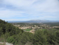
(9) At the summit, take in the 360° panorama. Then continue along the path which descends steeply, heading north towards the Tête du Grand Puech.

(10) Turn sharply left towards La Fève, signposted on a rock and marked with blue markings. You’ll reach a junction where a track meets several paths (elevation 571). Head south-west for a few dozen metres, keeping Marseille in your sights.

(11) Keep to the left as you leave the track to climb a small hill, following the blue markings, then rejoin the DFCI track further down.
Still following the blue markings, cross the track several times in the following order:
- Turn left to pass by an electricity pylon.
- Turn right at the cairn (500-metre contour). Then cross the track and continue straight ahead.
- Then immediately turn left (elevation 437) and head into the forest.
You’ll reach a junction at right angles to the DFCI track. Turn left onto this track. Keep to the left. After three very sharp bends in the track, a path branches off to the left heading south-east.

(12) Take this path and keep to the left (watch out for beehives) to follow the narrow track which joins the DFCI track at a bend.
Turn left onto the track and return to the starting point of the walk (S/E)


Waypoints

  1. S/E : mi 0 - alt. 732 ft - Underground cistern no. 141 and DFCI track - Jarret (rivière)
  2. 1 : mi 0.16 - alt. 797 ft - Hairpin bend
  3. 2 : mi 0.29 - alt. 801 ft - Marked with purple dots
  4. 3 : mi 2.09 - alt. 1,142 ft - Crossroads
  5. 4 : mi 2.2 - alt. 1,161 ft - Crossroads
  6. 5 : mi 2.45 - alt. 1,345 ft - Crossroads – Electricity pylon
  7. 6 : mi 2.75 - alt. 1,401 ft - T-junction
  8. 7 : mi 2.89 - alt. 1,453 ft - Stony path
  9. 8 : mi 3.13 - alt. 1,765 ft - Path towards Mont Julien and towards my - Grotte des Voleurs
  10. 9 : mi 3.41 - alt. 2,113 ft - Mont Julien (645 m)
  11. 10 : mi 3.52 - alt. 2,005 ft - Heading towards La Fève
  12. 11 : mi 3.82 - alt. 1,857 ft - Towards the hill
  13. 12 : mi 5.68 - alt. 1,115 ft - Towards the beehives
  14. S/E : mi 6.21 - alt. 732 ft - DFCI track and underground cistern no. 141

Notes

For guidance: the author’s estimated time for this route is 3 hours (excluding a lunch break).

Nordic walking enthusiasts can stay on the DFCI trails, passing at the foot of Mont Julien. The length of the route is then 12.4 km.

Please note: in the Ratier area (from (5) to (12)), wild boar drives are organised every Tuesday and Friday from September to March. Do not venture into this area.

Worth a visit

The Grotte des Voleurs at the foot of Mont Julien. The Grotte des Fées further north.

Reviews and comments

4.4 / 5
Based on 3 reviews

Reliability of the description
4.5 / 5
Ease of following the route
4 / 5
Route interest
4.7 / 5
Gijean
Gijean

Overall rating : 4.7 / 5

Date of your route : Nov 13, 2024
Reliability of the description : ★★★★★ Very good
Ease of following the route : ★★★★☆ Good
Route interest : ★★★★★ Very good
Very busy route : No

A lovely walk
A tough climb to reach the summit of Mont Julien, but it’s well worth the effort.
Thanks to whoever described this walk.

Machine-translated

LIONEL13118
LIONEL13118

Overall rating : 5 / 5

Date of your route : Mar 18, 2023
Reliability of the description : Not used / Not applicable
Ease of following the route : Not used / Not applicable
Route interest : ★★★★★ Very good
Very busy route : No

Thank you so much for sharing this; thanks to you, we had a wonderful day. It’s easy, and absolutely lovely!

Machine-translated

phildaix
phildaix

Overall rating : 4 / 5

Date of your route : May 18, 2022
Reliability of the description : ★★★★☆ Good
Ease of following the route : ★★★★☆ Good
Route interest : ★★★★☆ Good
Very busy route : No

Absolutely stunning scenery, especially on the way back, and at the moment there are flowerbeds all along the trails; but the views of Marseille were completely obscured. All in all, it was well worth it!
I gave it a good rating for the reliability of the route on the map, but as is often the case, the map isn’t up to date – some footpaths are missing and, more seriously, some tracks are; it would be good to have maps that are a bit more accurate...

Machine-translated

Other walks in the area

For more walks, use our search engine .

The GPS track and description are the property of this route's author. Please do not copy them without permission.