Around Grancourt via the Forest of Eu

A walk taking in various spots in the Forêt d’Eu, steeped in history. This is a well-maintained part of the forest where you can spot various animals and enjoy a rich variety of flora. You’ll leave the poplar grove on the outskirts of Le Tréport behind.

Details

54515
Creation:
Last update:
Last review:
  • Walking
    Activity: Walking
  • ↔
    Distance: 7.06 mi
  • ◔
    Average duration: 3h 50 
  • ▲
    Difficulty: Moderate

  • ⚐
    Back to start: Yes
  • ↗
    Ascent: + 633 ft
  • ↘
    Descent: - 614 ft

  • ▲
    Highest point: 666 ft
  • ▼
    Lowest point: 226 ft

Photos

Description of the walk

Place du Maréchal Leclerc.

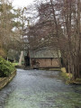
(S/E) Leave the town hall on your left and head towards the cul-de-sac slightly to the right, where there are a few half-timbered houses (a place known as L’Abreuvoir).
Cross the footbridge.

(1) Turn left, then right towards La Baronnie.
Follow the road to the left, cross the footbridge over the Yères and take the path that runs alongside the D14, rejoining the road as you head towards the Manoir de la Baronnie.

(2) Take the road that climbs up to the right almost to the edge of the forest.
Take the path that enters the forest on the right.
At the entrance to the forest, ignore thefirst path on the left and take the one a few steps further on, almost in line with the path you’ve been following, which is the ‘steepest’ (there’s a Yellow Circle on a tree). Carry on straight ahead.
Pass between plots 304 and 308.
Walk past the La Baronnie signpost.
Carry on straight ahead, cross the looping road, and continue to the Mont Huguet signpost.

(3) Turn right just as you reach the post.
Carry on straight ahead to the Père André signpost.

(4) Turn right, cross the roundabout.
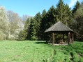
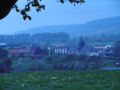
Follow the path, passing the Sainte Catherine kiosk and the Grancourt viewpoint, until you reach the road.
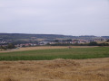
Take the path that leads down through the fields opposite.
Walk down to a three-way junction (before the first houses).

(5) Turn right, continue straight on until you reach the D149.
Turn left onto the Route de Dieppe.
Return to the starting point.

Waypoints

  1. S/E : mi 0 - alt. 246 ft - Place du Maréchal Leclerc
  2. 1 : mi 0.07 - alt. 236 ft - On the left. Cross the footbridge over the - moulin sur l'Yères
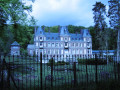
  3. 2 : mi 0.73 - alt. 226 ft - On the right at the Manoir de la Baronnie
  4. 3 : mi 2.59 - alt. 591 ft - Mont Huguet signpost
  5. 4 : mi 3.62 - alt. 620 ft - Father André’s signpost
  6. 5 : mi 6.11 - alt. 253 ft - On the right
  7. S/E : mi 7.06 - alt. 246 ft - Place du Maréchal Leclerc

Reviews and comments

4.7 / 5
Based on 2 reviews

Reliability of the description
5 / 5
Ease of following the route
4.5 / 5
Route interest
4.5 / 5
edechezelles
edechezelles

Overall rating : 5 / 5

Date of your route : Aug 16, 2022
Reliability of the description : ★★★★★ Very good
Ease of following the route : ★★★★★ Very good
Route interest : ★★★★★ Very good
Very busy route : No

A lovely walk through the valley and the forest. A breathtaking view of Saint Catherine.
Thank you

Machine-translated

ninijules
ninijules

Overall rating : 4.3 / 5

Date of your route : Jun 12, 2017
Reliability of the description : ★★★★★ Very good
Ease of following the route : ★★★★☆ Good
Route interest : ★★★★☆ Good

Please make sure you do this in dry weather because of the uphill and downhill sections – stunning views over the Yères Valley –

Machine-translated

Other walks in the area

For more walks, use our search engine .

The GPS track and description are the property of this route's author. Please do not copy them without permission.